National Register of Historic Places listings in Quincy, Massachusetts
The following properties located in Quincy, Massachusetts are listed on the National Register of Historic Places.
- This National Park Service list is complete through NPS recent listings posted January 29, 2021.[1]
Current listings
| [2] | Name on the Register | Image | Date listed[3] | Location | City or town | Description |
|---|---|---|---|---|---|---|
| 1 | Adams Academy |  Adams Academy |
September 6, 1974 (#74000379) |
8 Adams St. 42°15′13″N 71°00′23″W |
||
| 2 | Adams Building | Adams Building |
June 23, 1983 (#83000593) |
1342–1368 Hancock St.; 1–9 Temple St. 42°15′01″N 71°00′11″W |
||
| 3 | Adams National Historic Site |  Adams National Historic Site |
October 15, 1966 (#66000051) |
135 Adams St. 42°15′47″N 71°00′42″W |
||
| 4 | John Quincy Adams Birthplace | 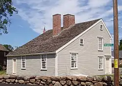 John Quincy Adams Birthplace |
October 15, 1966 (#66000128) |
141 Franklin St. 42°14′21″N 71°00′15″W |
||
| 5 | John Adams Birthplace | 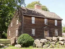 John Adams Birthplace |
October 15, 1966 (#66000129) |
133 Franklin St. 42°14′22″N 71°00′15″W |
||
| 6 | Arthur Alden House | 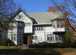 Arthur Alden House |
September 20, 1989 (#89001382) |
24 Whitney Rd. 42°15′15″N 71°00′18″W |
||
| 7 | Randolph Bainbridge House | 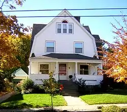 Randolph Bainbridge House |
September 20, 1989 (#89001340) |
133 Grandview Ave. 42°15′40″N 71°01′05″W |
||
| 8 | George A. Barker House |  George A. Barker House |
September 20, 1989 (#89001345) |
74 Greenleaf St. 42°15′24″N 71°00′16″W |
||
| 9 | Henry F. Barker House |  Henry F. Barker House |
September 20, 1989 (#89001346) |
103 Greenleaf St. 42°15′23″N 71°00′15″W |
||
| 10 | Barnes House |  Barnes House |
September 20, 1989 (#89001362) |
183 Pine St. 42°15′40″N 71°01′45″W |
||
| 11 | S. H. Barnicoat Monuments |  S. H. Barnicoat Monuments |
September 20, 1989 (#89001325) |
114 Columbia St. 42°14′06″N 71°00′44″W |
Demolished for commercial development. | |
| 12 | William R. Bateman House |  William R. Bateman House |
September 20, 1989 (#89001359) |
148 Monroe Rd. 42°15′06″N 71°00′32″W |
||
| 13 | Baxter Street Historic District |  Baxter Street Historic District |
September 20, 1989 (#89001309) |
Roughly 19-34 Baxter St. 42°14′58″N 70°59′57″W |
||
| 14 | Baxter-King House |  Baxter-King House |
November 13, 1989 (#89001953) |
270 Adams St. 42°15′12″N 71°01′00″W |
||
| 15 | Bethany Congregational Church | 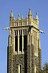 Bethany Congregational Church |
September 20, 1989 (#89001374) |
8 Spear St. 42°15′06″N 71°00′04″W |
||
| 16 | Blue Hills Reservation Parkways-Metropolitan Park System of Greater Boston |  Blue Hills Reservation Parkways-Metropolitan Park System of Greater Boston |
August 11, 2003 (#03000746) |
Parts of Blue Hill Rd., Chickatawbut Rd., Hillside St., Uniquity Rd., Wampatuck Rd., and Green St. 42°13′34″N 71°04′20″W |
Extends into Milton and into Braintree and Canton, elsewhere in Norfolk County | |
| 17 | Boston Harbor Islands Archeological District | 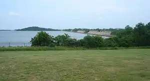 Boston Harbor Islands Archeological District |
December 21, 1985 (#85003323) |
Address Restricted |
Extends into Hingham in Plymouth County and Boston in Suffolk County | |
| 18 | Brown-Hodgkinson House | 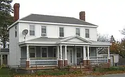 Brown-Hodgkinson House |
September 20, 1989 (#89001319) |
42 Bicknell St. 42°15′07″N 70°57′54″W |
||
| 19 | Building at 1–7 Moscow Street | 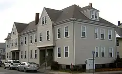 Building at 1–7 Moscow Street |
September 20, 1989 (#89001360) |
1–7 Moscow St. 42°16′29″N 71°01′40″W |
||
| 20 | Building at 51 Hunt Street |  Building at 51 Hunt Street |
September 20, 1989 (#89001355) |
51 Hunt St. 42°16′39″N 71°01′42″W |
||
| 21 | Charles H. Burgess House |  Charles H. Burgess House |
September 20, 1989 (#89001381) |
17 Whitney Rd. 42°15′13″N 71°00′18″W |
||
| 22 | Frank Burgess House |  Frank Burgess House |
September 20, 1989 (#89001354) |
355 Highland Ave. 42°15′36″N 71°01′23″W |
||
| 23 | Clarence Burgin House |  Clarence Burgin House |
September 20, 1989 (#89001364) |
95 President's Ln. 42°15′11″N 71°00′31″W |
||
| 24 | Central Fire Station | 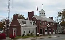 Central Fire Station |
September 20, 1989 (#89001371) |
26 Quincy Ave. 42°14′40″N 70°59′57″W |
||
| 25 | Chickatawbut Observation Tower | 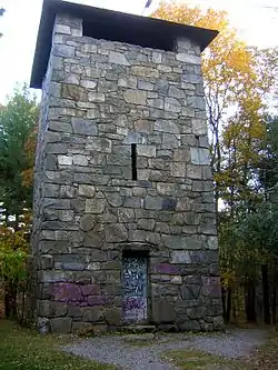 Chickatawbut Observation Tower |
September 25, 1980 (#80000652) |
Chickatawbut Rd. 42°13′30″N 71°03′41″W |
||
| 26 | Christ Church |  Christ Church |
September 20, 1989 (#89001369) |
14 Quincy St. 42°14′43″N 70°59′59″W |
||
| 27 | Christ Church Burial Ground | 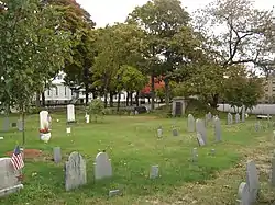 Christ Church Burial Ground |
September 20, 1989 (#89001372) |
54–60 School St. 42°14′39″N 71°00′09″W |
||
| 28 | Coddington School | 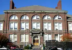 Coddington School |
September 20, 1989 (#89001323) |
26–44 Coddington St. 42°15′08″N 71°00′09″W |
||
| 29 | Cranch School |  Cranch School |
July 5, 1984 (#84002872) |
270 Whitwell St. 42°14′57″N 71°00′36″W |
||
| 30 | Frank W. Crane House | 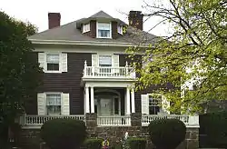 Frank W. Crane House |
September 20, 1989 (#89001312) |
11 Avon Way 42°15′03″N 71°00′29″W |
||
| 31 | Thomas Crane Public Library | .JPG.webp) Thomas Crane Public Library |
October 18, 1972 (#72000143) |
40 Washington St. 42°15′06″N 71°00′05″W |
||
| 32 | Noah Curtis House |  Noah Curtis House |
September 20, 1989 (#89001335) |
313 Franklin St. 42°14′02″N 71°00′01″W |
||
| 33 | Thomas Curtis House |  Thomas Curtis House |
September 20, 1989 (#89001334) |
279 Franklin St. 42°14′06″N 71°00′01″W |
||
| 34 | Dr. Frank Davis House |  Dr. Frank Davis House |
September 20, 1989 (#89001330) |
25 Elm St. 42°14′48″N 70°59′57″W |
||
| 35 | Russell M. Dicey House |  Russell M. Dicey House |
September 20, 1989 (#89001363) |
56 Pope St. 42°16′12″N 71°02′14″W |
||
| 36 | Solon Dogget House |  Solon Dogget House |
September 20, 1989 (#89001379) |
50 Union St. 42°14′56″N 70°59′52″W |
||
| 37 | Dorothy Q Apartments |  Dorothy Q Apartments |
September 20, 1989 (#89001322) |
36 Butler Rd. 42°15′29″N 71°00′26″W |
||
| 38 | Elks Building | 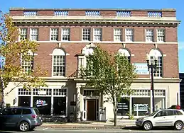 Elks Building |
September 20, 1989 (#89001348) |
1218–1222 Hancock St. 42°15′09″N 71°00′17″W |
||
| 39 | Faxon House |  Faxon House |
September 20, 1989 (#89001310) |
310 Adams St. 42°15′11″N 71°01′02″W |
||
| 40 | First Baptist Church of Wollaston |  First Baptist Church of Wollaston |
September 20, 1989 (#89001380) |
187 Warren Ave. 42°15′37″N 71°01′15″W |
||
| 41 | Forbes Hill Standpipe | 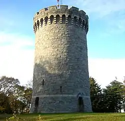 Forbes Hill Standpipe |
January 18, 1990 (#89002252) |
Reservoir Rd. 42°15′27″N 71°01′42″W |
||
| 42 | Fore River Club House | Fore River Club House |
September 20, 1989 (#89001333) |
Follett and Beechwood Sts. 42°15′01″N 70°58′44″W |
||
| 43 | Furnace Brook Parkway |  Furnace Brook Parkway |
March 18, 2004 (#04000248) |
Furnace Brook Parkway 42°14′59″N 71°01′18″W |
||
| 44 | Glover House | 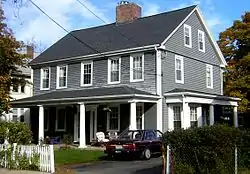 Glover House |
September 20, 1989 (#89001328) |
249 E. Squantum St. 42°17′00″N 71°01′29″W |
||
| 45 | Granite Trust Company | 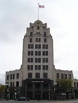 Granite Trust Company |
September 20, 1989 (#89001351) |
1400 Hancock St. 42°14′58″N 71°00′10″W |
||
| 46 | John Halloran House |  John Halloran House |
September 20, 1989 (#89001327) |
99 E. Squantum St. 42°16′44″N 71°01′36″W |
||
| 47 | Hancock Cemetery |  Hancock Cemetery |
January 28, 1982 (#82004421) |
Hancock St. in Quincy Sq. 42°15′02″N 70°59′46″W |
||
| 48 | Hardwick House |  Hardwick House |
September 20, 1989 (#89001376) |
59–61 Spear St. 42°15′06″N 71°00′04″W |
||
| 49 | House at 105 President's Lane |  House at 105 President's Lane |
September 20, 1989 (#89001365) |
105 President's Ln. 42°15′11″N 71°00′30″W |
||
| 50 | House at 15 Gilmore Street |  House at 15 Gilmore Street |
September 20, 1989 (#89001336) |
15 Gilmore St. 42°15′32″N 71°00′38″W |
||
| 51 | House at 20 Sterling Street |  House at 20 Sterling Street |
September 20, 1989 (#89001377) |
20 Sterling St. 42°16′18″N 71°02′12″W |
||
| 52 | House at 23–25 Prout Street |  House at 23–25 Prout Street |
September 20, 1989 (#89001367) |
23–25 Prout St. 42°14′37″N 71°00′56″W |
||
| 53 | House at 25 High School Avenue |  House at 25 High School Avenue |
September 20, 1989 (#89001352) |
25 High School Ave. 42°14′43″N 70°59′58″W |
||
| 54 | House at 32 Bayview Avenue |  House at 32 Bayview Avenue |
September 20, 1989 (#89001314) |
32 Bayview Ave. 42°16′17″N 70°57′02″W |
||
| 55 | House at 92 Willard Street |  House at 92 Willard Street |
September 20, 1989 (#89001383) |
92 Willard St. 42°15′07″N 71°02′13″W |
||
| 56 | House at 94 Grandview Avenue |  House at 94 Grandview Avenue |
September 20, 1989 (#89001339) |
94 Grandview Ave. 42°15′46″N 71°01′08″W |
||
| 57 | David L. Jewell House |  David L. Jewell House |
September 20, 1989 (#89001338) |
48 Grandview Ave. 42°15′50″N 71°01′11″W |
||
| 58 | Edward J. Lennon House |  Edward J. Lennon House |
September 20, 1989 (#89001378) |
53 Taber St. 42°14′12″N 71°00′41″W |
||
| 59 | Lyon's Turning Mill |  Lyon's Turning Mill |
September 25, 1980 (#80000656) |
Ricciuti Dr.[4] 42°14′37″N 71°02′52″W |
||
| 60 | Charles Marsh House |  Charles Marsh House |
September 20, 1989 (#89001366) |
248 President's Ln. 42°14′55″N 71°00′18″W |
Torn down for new development. | |
| 61 | Edwin W. Marsh House |  Edwin W. Marsh House |
September 20, 1989 (#89001356) |
17 Marsh St. 42°14′35″N 71°00′22″W |
||
| 62 | Masonic Temple | 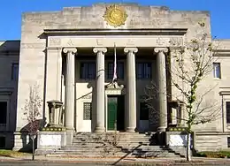 Masonic Temple |
November 13, 1989 (#89001952) |
1156 Hancock St. 42°15′12″N 71°00′18″W |
||
| 63 | Massachusetts Fields School |  Massachusetts Fields School |
November 13, 1990 (#88000960) |
Rawson Rd. and Beach St. 42°16′19″N 71°01′00″W |
||
| 64 | Massachusetts Hornfels-Braintree Slate Quarry | 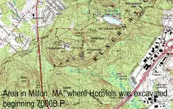 Massachusetts Hornfels-Braintree Slate Quarry |
September 25, 1980 (#80000653) |
Address Restricted |
Extends into Milton. | |
| 65 | Herman McIntire House |  Herman McIntire House |
September 20, 1989 (#89001326) |
55 Dixwell Ave. 42°15′01″N 71°00′33″W |
||
| 66 | Edward Miller House |  Edward Miller House |
March 8, 1990 (#89001358) |
36 Miller Stile Rd. 42°14′59″N 70°59′59″W |
||
| 67 | Moswetuset Hummock |  Moswetuset Hummock |
July 1, 1970 (#70000094) |
Squantum St. near its junction with Morrissey Rd. 42°17′22″N 71°01′18″W |
||
| 68 | Mount Wollaston Cemetery |  Mount Wollaston Cemetery |
February 18, 1994 (#94000035) |
20 Sea St. 42°15′31″N 70°59′56″W |
||
| 69 | Munroe Building |  Munroe Building |
September 20, 1989 (#89001349) |
1227–1259 Hancock St. 42°15′08″N 71°00′18″W |
||
| 70 | John R. Nelson House |  John R. Nelson House |
September 20, 1989 (#89001321) |
4 Brunswick St. 42°17′52″N 71°00′32″W |
||
| 71 | New England Telephone Building |  New England Telephone Building |
September 20, 1989 (#89001357) |
10 Merrymount Rd. 42°15′23″N 71°00′26″W |
||
| 72 | Newcomb Place |  Newcomb Place |
September 20, 1989 (#89001368) |
109 Putnam St. 42°15′25″N 71°00′19″W |
||
| 73 | Nightengale House |  Nightengale House |
September 20, 1989 (#89001370) |
24 Quincy St. 42°14′32″N 71°00′23″W |
||
| 74 | Solomon Nightengale House |  Solomon Nightengale House |
September 20, 1989 (#89001342) |
429 Granite St. 42°14′43″N 71°00′19″W |
House torn down (more likely) or rebuilt beyond recognition. | |
| 75 | J. Martin Nowland House |  J. Martin Nowland House |
September 20, 1989 (#89001329) |
31 Edgemere Rd. 42°15′22″N 71°00′13″W |
||
| 76 | C. F. Pettengill House |  C. F. Pettengill House |
November 13, 1989 (#89001951) |
53 Revere Rd. 42°14′52″N 71°00′02″W |
||
| 77 | Pinkham House |  Pinkham House |
September 20, 1989 (#89001384) |
79 Winthrop Ave. 42°15′40″N 71°01′11″W |
||
| 78 | Pratt-Faxon House |  Pratt-Faxon House |
September 20, 1989 (#89001331) |
75 Faxon Ln. 42°14′30″N 70°59′51″W |
||
| 79 | Quincy Electric Light and Power Company Station | 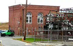 Quincy Electric Light and Power Company Station |
September 20, 1989 (#89001332) |
76 Field St. 42°15′16″N 70°59′31″W |
||
| 80 | Quincy Granite Railway |  Quincy Granite Railway |
October 15, 1973 (#73000309) |
Bunker Hill Lane 42°14′23″N 71°01′57″W |
Encompasses a surviving section of railroad bed | |
| 81 | Quincy Granite Railway Incline |  Quincy Granite Railway Incline |
June 19, 1973 (#73000310) |
Mullin Ave. 42°14′43″N 71°02′14″W |
||
| 82 | Quincy Homestead |  Quincy Homestead |
July 1, 1970 (#70000095) |
34 Butler Road 42°15′28″N 71°00′28″W |
||
| 83 | Quincy Point Fire Station | 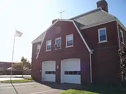 Quincy Point Fire Station |
February 18, 1994 (#93000347) |
615 Washington St. 42°14′46″N 70°58′37″W |
||
| 84 | Quincy Police Station | 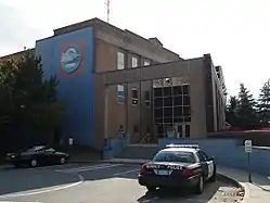 Quincy Police Station |
March 8, 1990 (#89001373) |
442 Southern Artery 42°15′21″N 70°59′47″W |
||
| 85 | Quincy Savings Bank | 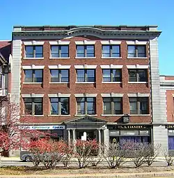 Quincy Savings Bank |
September 20, 1989 (#89001350) |
1370 Hancock St. 42°15′00″N 71°00′09″W |
||
| 86 | Quincy School |  Quincy School |
June 23, 1983 (#83000599) |
94 Newbury Ave. 42°16′50″N 71°01′44″W |
||
| 87 | Quincy Shore Drive |  Quincy Shore Drive |
June 23, 2003 (#03000575) |
Quincy Shore Drive 42°16′35″N 71°01′04″W |
||
| 88 | Quincy Town Hall | 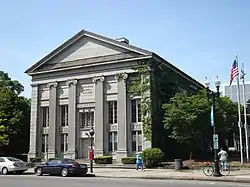 Quincy Town Hall |
January 11, 1980 (#80000649) |
1305 Hancock St. 42°15′03″N 71°00′15″W |
||
| 89 | Quincy Water Company Pumping Station | Quincy Water Company Pumping Station |
September 20, 1989 (#89001361) |
106 Penn St. 42°14′09″N 71°00′27″W |
Demolished, now a largely vacant lot. | |
| 90 | Josiah Quincy House |  Josiah Quincy House |
May 28, 1976 (#76000285) |
20 Muirhead St. 42°16′18″N 71°00′56″W |
||
| 91 | Jonathan Dexter Record House |  Jonathan Dexter Record House |
September 20, 1989 (#89001337) |
39–41 Grandview Ave. 42°15′50″N 71°01′13″W |
||
| 92 | Timothy Reed House |  Timothy Reed House |
September 20, 1989 (#89001311) |
284 Adams St. 42°15′13″N 71°01′01″W |
||
| 93 | Alfred H. Richards House |  Alfred H. Richards House |
September 20, 1989 (#89001353) |
354 Highland Ave. 42°15′37″N 71°01′17″W |
||
| 94 | Salem Lutheran Church |  Salem Lutheran Church |
September 20, 1989 (#89001341) |
199 Granite St. 42°14′41″N 71°00′31″W |
Now named "Faith Lutheran Church" | |
| 95 | George A. Sidelinger House |  George A. Sidelinger House |
September 20, 1989 (#89001313) |
19 Avon Way 42°15′02″N 71°00′30″W |
||
| 96 | A. C. Smith & Co. Gas Station | 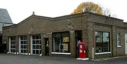 A. C. Smith & Co. Gas Station |
February 23, 1994 (#94000036) |
117 Beale St. 42°15′54″N 71°01′16″W |
||
| 97 | South Junior High School | 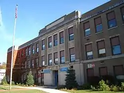 South Junior High School |
September 20, 1989 (#89001343) |
444 Granite St. 42°14′24″N 71°00′59″W |
||
| 98 | Seth Spear Homestead |  Seth Spear Homestead |
September 20, 1989 (#89001375) |
47–49 Spear St. 42°15′06″N 71°00′05″W |
||
| 99 | United First Parish Church (Unitarian) of Quincy | %252C_Quincy%252C_Massachusetts.JPG.webp) United First Parish Church (Unitarian) of Quincy |
December 30, 1970 (#70000734) |
1266 Hancock St. 42°15′04″N 71°00′13″W |
||
| 100 | US Post Office-Quincy Main | 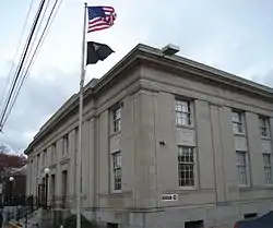 US Post Office-Quincy Main |
May 23, 1986 (#86001217) |
47 Washington St. 42°15′03″N 71°00′08″W |
||
| 101 | Charles E. White House | 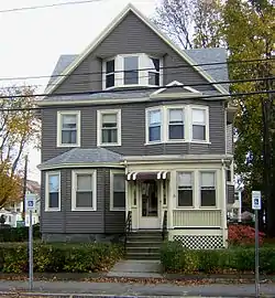 Charles E. White House |
September 20, 1989 (#89001320) |
101 Billings Rd. 42°16′28″N 71°01′24″W |
||
| 102 | Winfield House | 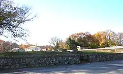 Winfield House |
September 20, 1989 (#89001347) |
853 Hancock St. 42°15′43″N 71°00′47″W |
Stairway leading up to vacant house lot. Burned some time ago. | |
| 103 | John Winthrop, Jr. Iron Furnace Site | 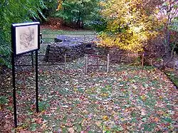 John Winthrop, Jr. Iron Furnace Site |
September 20, 1977 (#77000192) |
61 Crescent St. 42°14′45″N 71°01′37″W |
Although NRIS shows this as "Address Restricted", it is a public site, on the Quincy Historical Trail | |
| 104 | Wollaston Branch, Thomas Crane Public Library | 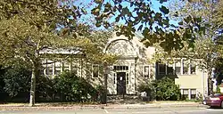 Wollaston Branch, Thomas Crane Public Library |
September 20, 1989 (#89001316) |
41 Beale St. 42°16′00″N 71°01′06″W |
||
| 105 | Wollaston Congregational Church | 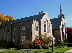 Wollaston Congregational Church |
December 5, 2008 (#08001128) |
47–57 Lincoln Ave. 42°15′46″N 71°01′12″W |
||
| 106 | Wollaston Fire Station | 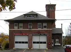 Wollaston Fire Station |
September 20, 1989 (#89001317) |
111 Beale St. 42°15′34″N 71°00′45″W |
||
| 107 | Wollaston Theatre | 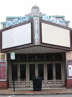 Wollaston Theatre |
September 20, 1989 (#89001315) |
14 Beale St. 42°16′03″N 71°01′00″W |
Demolished in 2016 | |
| 108 | Wollaston Unitarian Church |  Wollaston Unitarian Church |
September 20, 1989 (#89001318) |
155 Beale St. 42°15′51″N 71°01′20″W |
||
| 109 | Woodward Institute |  Woodward Institute |
November 13, 1989 (#89001954) |
1098 Hancock St. 42°15′17″N 71°00′23″W |
References
| Wikimedia Commons has media related to National Register of Historic Places in Quincy, Massachusetts. |
- "National Register of Historic Places: Weekly List Actions". National Park Service, United States Department of the Interior. Retrieved on January 29, 2021.
- Numbers represent an alphabetical ordering by significant words. Various colorings, defined here, differentiate National Historic Landmarks and historic districts from other NRHP buildings, structures, sites or objects.
- The eight-digit number below each date is the number assigned to each location in the National Register Information System database, which can be viewed by clicking the number.
- Location derived from this Quincy Quarry and Granite Workers Museum webpage; the NRIS lists the site as "Address Restricted"
| Topics |  | ||||||||||||||||
|---|---|---|---|---|---|---|---|---|---|---|---|---|---|---|---|---|---|
| Lists by county | |||||||||||||||||
| Lists by city |
| ||||||||||||||||
| Other lists | |||||||||||||||||
| |||||||||||||||||
This article is issued from Wikipedia. The text is licensed under Creative Commons - Attribution - Sharealike. Additional terms may apply for the media files.