National Register of Historic Places listings in Gloucester, Massachusetts
This is a list of the National Register of Historic Places listings in Gloucester, Massachusetts.
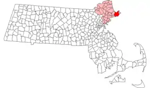
Location of Gloucester in Massachusetts
This is intended to be a complete list of the properties and districts on the National Register of Historic Places in Gloucester, Massachusetts, United States. The locations of National Register properties and districts for which the latitude and longitude coordinates are included below, may be seen in an online map.[1]
Essex County, of which Gloucester is a part, is the location of more than 450 properties and districts listed on the National Register. Gloucester itself is the location of 34 of these properties and districts.[2]
- This National Park Service list is complete through NPS recent listings posted February 5, 2021.[3]
Current listings
| [4] | Name on the Register[2] | Image | Date listed[5] | Location | Neighborhood | Description |
|---|---|---|---|---|---|---|
| 1 | ADVENTURE (schooner) |  ADVENTURE (schooner) |
December 11, 1989 (#89002054) |
State Fish Pier, Gloucester Inner Harbor 42°36′53″N 70°39′06″W |
||
| 2 | Annisquam Bridge | Annisquam Bridge |
June 23, 1983 (#83000572) |
Carries foot traffic over Lobster Cove between Washington St. and River Rd. 42°39′18″N 70°40′32″W |
||
| 3 | Annisquam Harbor Light Station | 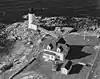 Annisquam Harbor Light Station |
June 15, 1987 (#87001526) |
Wigwam Pt. 42°39′49″N 70°40′31″W |
||
| 4 | Babson-Alling House | 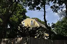 Babson-Alling House |
April 26, 1996 (#96000472) |
245 Washington St. 42°37′23″N 70°40′33″W |
The house was listed on the National Register of Historic Places in 1996. | |
| 5 | Beauport | 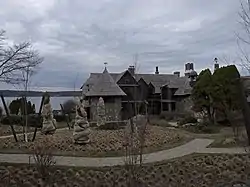 Beauport |
April 26, 1976 (#76000246) |
75 Eastern Point Boulevard 42°35′28″N 70°39′38″W |
Designated a National Historic Landmark on May 27, 2003. | |
| 6 | Central Gloucester Historic District |  Central Gloucester Historic District |
July 8, 1982 (#82001881) |
Roughly bounded by Middle, Main, Center, Hancock, Short, Prospect, and Pleasant Sts. 42°36′46″N 70°39′55″W |
||
| 7 | Davis-Freeman House |  Davis-Freeman House |
March 9, 1990 (#90000214) |
302 Essex St. 42°36′38″N 70°42′32″W |
||
| 8 | Dyke-Wheeler House | 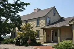 Dyke-Wheeler House |
March 9, 1990 (#90000215) |
144 Wheeler St. 42°38′36″N 70°40′51″W |
||
| 9 | East Gloucester Square Historic District | 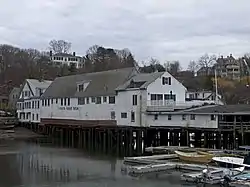 East Gloucester Square Historic District |
April 26, 1996 (#96000471) |
E. Main St., roughly bounded by Inner Harbor, Smith Cove, Woonson Cove, and Mt. Pleasant Ave. 42°36′28″N 70°39′07″W |
||
| 10 | Eastern Point Light Station | 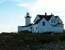 Eastern Point Light Station |
September 30, 1987 (#87002027) |
Eastern Pt. 42°34′38″N 70°39′52″W |
||
| 11 | First Parish Burial Ground | 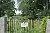 First Parish Burial Ground |
February 26, 2010 (#10000040) |
122-R Centennial Ave. 42°37′03″N 70°40′23″W |
||
| 12 | FRANK A. PALMER AND LOUIS B. CRARY (Shipwreck) | 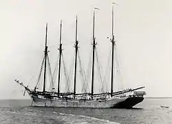 FRANK A. PALMER AND LOUIS B. CRARY (Shipwreck) |
March 8, 2006 (#06000107) |
Stellwagen Bank National Marine Sanctuary |
||
| 13 | Front Street Block | 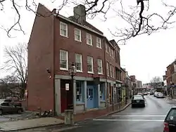 Front Street Block |
May 8, 1974 (#74000369) |
West End, 55-71 Main St. 42°36′45″N 70°39′55″W |
||
| 14 | Gloucester City Hall | 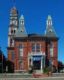 Gloucester City Hall |
May 8, 1973 (#73000297) |
Dale Ave. 42°36′50″N 70°39′47″W |
||
| 15 | Gloucester Fisherman's Memorial |  Gloucester Fisherman's Memorial |
May 7, 1996 (#96000473) |
S. Stacy Boulevard near the entrance to Stacy Esplanade 42°36′36″N 70°40′17″W |
||
| 16 | Gloucester Net and Twine Company |  Gloucester Net and Twine Company |
April 26, 1996 (#96000474) |
Maplewood Ave. at the southeastern junction of Maplewood Ave. and Grove St. 42°37′15″N 70°40′07″W |
||
| 17 | Hammond Castle |  Hammond Castle |
May 8, 1973 (#73000298) |
80 Hesperus Ave. 42°35′06″N 70°41′35″W |
||
| 18 | Edward Harraden House |  Edward Harraden House |
March 9, 1990 (#90000212) |
12-14 Leonard St. 42°39′13″N 70°40′47″W |
||
| 19 | William Haskell House | 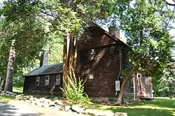 William Haskell House |
March 9, 1990 (#90000217) |
11 Lincoln St. 42°37′38″N 70°44′18″W |
||
| 20 | Ella Proctor Herrick House |  Ella Proctor Herrick House |
March 9, 1990 (#90000213) |
257 Concord St.[6] 42°38′33″N 70°43′26″W |
Listed at 189 Concord Street. | |
| 21 | JOFFRE (shipwreck) |  JOFFRE (shipwreck) |
January 16, 2009 (#08000887) |
Stellwagen Bank National Marine Sanctuary[7] |
||
| 22 | LAMARTINE (shipwreck) | 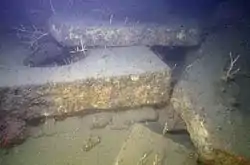 LAMARTINE (shipwreck) |
March 7, 2012 (#12000067) |
Stellwagen Bank National Marine Sanctuary |
Granite Vessel Shipwrecks in the Stellwagen Bank National Marine Sanctuary Multiple Property Submission | |
| 23 | Fitz Henry Lane House | 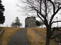 Fitz Henry Lane House |
July 1, 1970 (#70000837) |
Harbor side of Rogers St. 42°36′41″N 70°39′36″W |
||
| 24 | Norwood-Hyatt House | 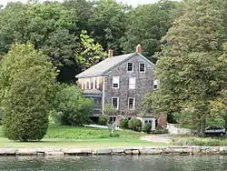 Norwood-Hyatt House |
October 26, 2000 (#00001272) |
704 Washington St. 42°39′04″N 70°40′26″W |
||
| 25 | Oak Grove Cemetery | 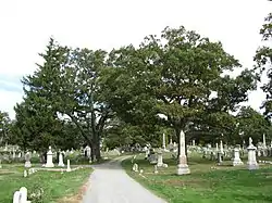 Oak Grove Cemetery |
April 3, 1975 (#75000263) |
Bounded by Derby, Washington, and Grove Sts., and Maplewood Ave. 42°37′10″N 70°40′14″W |
||
| 26 | Our Lady of Good Voyage Church | 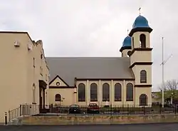 Our Lady of Good Voyage Church |
May 10, 1990 (#90000706) |
136-144 Prospect St. and 2-4 Taylor St. 42°37′01″N 70°39′28″W |
||
| 27 | PORTLAND (Shipwreck and Remains) | .jpg.webp) PORTLAND (Shipwreck and Remains) |
January 13, 2005 (#04001473) |
Stellwagen Bank National Marine Sanctuary |
||
| 28 | Puritan House | 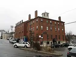 Puritan House |
May 28, 1976 (#76000244) |
3 Washington St. and 2 Main St. 42°36′41″N 70°40′00″W |
||
| 29 | Rocky Neck Historic District |  Rocky Neck Historic District |
August 24, 2017 (#100001502) |
1-5 Eastern Point Rd., 285 E. Main St., Bickford Way, Clarendon, Fremont, Horton, Rackliffe Wiley & Wonson Sts. 42°36′17″N 70°39′25″W |
||
| 30 | Sargent-Robinson House | 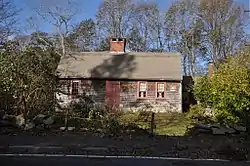 Sargent-Robinson House |
December 20, 2016 (#16000870) |
972 & 974 Washington St. 42°40′16″N 70°39′54″W |
||
| 31 | George O. Stacy House |  George O. Stacy House |
July 8, 1982 (#82004963) |
107 Atlantic Rd. 42°36′30″N 70°38′03″W |
Now the Bass Rocks Inn. | |
| 32 | Ten Pound Island Light |  Ten Pound Island Light |
August 4, 1988 (#88001179) |
Gloucester Harbor 42°36′07″N 70°39′56″W |
||
| 33 | Webster-Lane House | 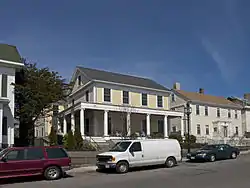 Webster-Lane House |
April 26, 1996 (#96000475) |
304 Main St. 42°36′57″N 70°39′24″W |
||
| 34 | White-Ellery House |  White-Ellery House |
March 9, 1990 (#90000216) |
247 Washington St.[8] 42°37′23″N 70°40′34″W |
Listed on the register at 244 Washington Street. | |
| 35 | Whittemore House | 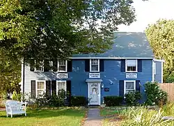 Whittemore House |
March 9, 1990 (#90000218) |
179 Washington St. 42°37′07″N 70°40′28″W |
See also
| Wikimedia Commons has media related to National Register of Historic Places in Gloucester, Massachusetts. |
References
- The latitude and longitude information provided in this table was derived originally from the National Register Information System, which has been found to be fairly accurate for about 99% of listings. Some locations in this table may have been corrected to current GPS standards.
- "National Register Information System". National Register of Historic Places. National Park Service. April 24, 2008.
- "National Register of Historic Places: Weekly List Actions". National Park Service, United States Department of the Interior. Retrieved on February 5, 2021.
- Numbers represent an alphabetical ordering by significant words. Various colorings, defined here, differentiate National Historic Landmarks and historic districts from other NRHP buildings, structures, sites or objects.
- The eight-digit number below each date is the number assigned to each location in the National Register Information System database, which can be viewed by clicking the number.
- MACRIS record for Ella Proctor Herrick House
- Location is derived from this NOAA website; the NRIS lists it as "Address Restricted"
- "MACRIS inventory record for White-Ellery House". Commonwealth of Massachusetts. Archived from the original on 2014-01-17. Retrieved 2014-01-17.
| Topics |  | ||||||||||||||||
|---|---|---|---|---|---|---|---|---|---|---|---|---|---|---|---|---|---|
| Lists by county | |||||||||||||||||
| Lists by city |
| ||||||||||||||||
| Other lists | |||||||||||||||||
| |||||||||||||||||
This article is issued from Wikipedia. The text is licensed under Creative Commons - Attribution - Sharealike. Additional terms may apply for the media files.