National Register of Historic Places listings in Arlington, Massachusetts
The following properties are listed on the National Register of Historic Places in Arlington, Massachusetts.
- This National Park Service list is complete through NPS recent listings posted February 5, 2021.[1]
Listings
| [2] | Name on the Register[3] | Image | Date listed[4] | Location | City or town | Description |
|---|---|---|---|---|---|---|
| 1 | Allyn House | 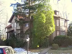 Allyn House |
September 27, 1985 (#85002680) |
94 Oakland Ave. 42°25′08″N 71°10′44″W |
||
| 2 | Arlington Center Historic District | 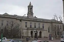 Arlington Center Historic District |
July 18, 1974 (#74000361) |
Bounded by Massachusetts Ave. and Academy, Pleasant, and Maple Sts.; also roughly bounded by Jason St., Massachusetts Ave., and Pleasant and Gray Sts. 42°24′53″N 71°09′21″W |
Second set of addresses represents a boundary increase | |
| 3 | Arlington Coal & Lumber | 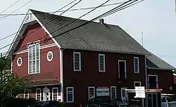 Arlington Coal & Lumber |
April 18, 1985 (#85001020) |
41 Park Ave. 42°25′29″N 71°11′00″W |
||
| 4 | Arlington Gaslight Company |  Arlington Gaslight Company |
April 18, 1985 (#85001021) |
51 Grove St. (Town Yard) 42°25′13″N 71°09′48″W |
||
| 5 | Arlington Pumping Station | 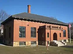 Arlington Pumping Station |
April 18, 1985 (#85001022) |
Brattle Court off Brattle St. 42°25′19″N 71°10′13″W |
||
| 6 | Arlington Reservoir | 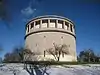 Arlington Reservoir |
September 27, 1985 (#85002676) |
Park Circle 42°24′53″N 71°10′49″W |
||
| 7 | Baptist Society Meeting House |  Baptist Society Meeting House |
April 18, 1985 (#85001023) |
3–5 Brattle St. 42°25′15″N 71°10′11″W |
||
| 8 | Maria Bassett House | 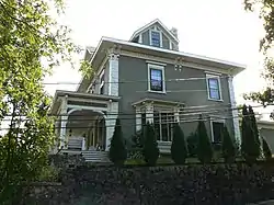 Maria Bassett House |
September 27, 1985 (#85002681) |
8 College Ave. 42°25′40″N 71°09′14″W |
||
| 9 | Butterfield-Whittemore House |  Butterfield-Whittemore House |
March 30, 1978 (#78000429) |
54 Massachusetts Ave. 42°24′06″N 71°08′18″W |
||
| 10 | Call-Bartlett House |  Call-Bartlett House |
April 18, 1985 (#85001024) |
216 Pleasant St. 42°24′28″N 71°09′37″W |
||
| 11 | Calvary Methodist Church | _-_Arlington%252C_MA.jpg.webp) Calvary Methodist Church |
June 23, 1983 (#83003433) |
300 Massachusetts Ave. 42°24′32″N 71°08′52″W |
||
| 12 | Capitol Theater Building | 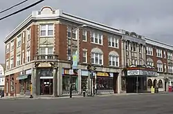 Capitol Theater Building |
April 18, 1985 (#85001025) |
202–208 Massachusetts Ave. 42°24′20″N 71°08′35″W |
||
| 13 | Chapel of St. Anne |  Chapel of St. Anne |
April 18, 1985 (#85001026) |
approximately 30 Claremont Ave. 42°25′16″N 71°11′07″W |
The chapel is on (or only accessible through) the grounds of the Germaine Lawrence School, but is visible from the street. | |
| 14 | Cushman House | 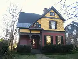 Cushman House |
April 18, 1985 (#85001027) |
104 Bartlett Ave. 42°24′42″N 71°09′48″W |
||
| 15 | Ephraim Cutter House | 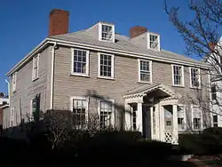 Ephraim Cutter House |
March 29, 1978 (#78000430) |
4 Water St. 42°24′59″N 71°09′17″W |
||
| 16 | Gershom Cutter House |  Gershom Cutter House |
November 12, 1999 (#99001306) |
1146 Massachusetts Ave. 42°25′21″N 71°10′26″W |
||
| 17 | Jefferson Cutter House |  Jefferson Cutter House |
January 23, 1992 (#85001028) |
1 Whittemore Park 42°24′55″N 71°09′12″W |
||
| 18 | Second A. P. Cutter House |  Second A. P. Cutter House |
April 18, 1985 (#85001029) |
89 Summer St. 42°25′08″N 71°09′29″W |
||
| 19 | Damon House | 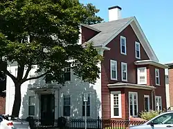 Damon House |
April 18, 1985 (#85001030) |
275 Broadway 42°24′49″N 71°08′55″W |
||
| 20 | Edmund Dwight House |  Edmund Dwight House |
July 5, 1989 (#89000633) |
5 Cambridge St., Winchester 42°26′10″N 71°09′15″W |
Property straddles the Arlington-Winchester line | |
| 21 | Kimball Farmer House | 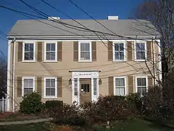 Kimball Farmer House |
April 18, 1985 (#85001031) |
1173 Massachusetts Ave. 42°25′24″N 71°10′30″W |
||
| 22 | First Parish Church Parsonage | 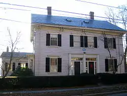 First Parish Church Parsonage |
April 18, 1985 (#85001032) |
232–234 Pleasant St. 42°24′24″N 71°09′46″W |
||
| 23 | Fowle-Reed-Wyman House |  Fowle-Reed-Wyman House |
April 14, 1975 (#75000244) |
64 Old Mystic St. 42°25′54″N 71°09′25″W |
||
| 24 | Greek Orthodox Church | 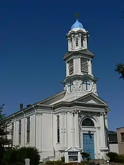 Greek Orthodox Church |
June 23, 1983 (#83000805) |
735 Massachusetts Ave. 42°24′59″N 71°09′27″W |
||
| 25 | Edward Hall House |  Edward Hall House |
April 18, 1985 (#85001033) |
187 Pleasant St. 42°24′32″N 71°09′36″W |
||
| 26 | Highland Hose House |  Highland Hose House |
April 18, 1985 (#85001034) |
1007 Massachusetts Ave. 42°25′11″N 71°10′08″W |
This is a fire station. | |
| 27 | Addison Hill House |  Addison Hill House |
September 27, 1985 (#85002682) |
83 Appleton St. 42°25′22″N 71°10′52″W |
||
| 28 | Edward Hornblower House and Barn |  Edward Hornblower House and Barn |
April 18, 1985 (#85001035) |
200 Pleasant St. 42°24′30″N 71°09′36″W |
||
| 29 | House at 45 Claremont Avenue |  House at 45 Claremont Avenue |
April 18, 1985 (#85001036) |
45 Claremont Ave. 42°25′13″N 71°11′07″W |
||
| 30 | House at 5 Willow Court |  House at 5 Willow Court |
April 18, 1985 (#85001038) |
5 Willow Ct. 42°25′01″N 71°09′33″W |
||
| 31 | House at 5–7 Winter Street | 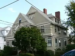 House at 5–7 Winter Street |
April 18, 1985 (#85001037) |
5–7 Winter St. 42°24′22″N 71°08′32″W |
||
| 32 | Kensington Park Historic District |  Kensington Park Historic District |
September 27, 1985 (#85002679) |
Roughly bounded by Kensington Park, Brantwood, and Kensington Rds. 42°24′36″N 71°09′39″W |
||
| 33 | W.W. Kimball House | 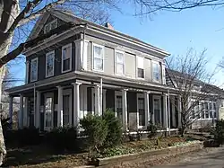 W.W. Kimball House |
April 18, 1985 (#85001039) |
13 Winter St. 42°24′23″N 71°08′30″W |
||
| 34 | Locke School | 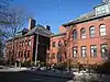 Locke School |
September 27, 1985 (#85002684) |
88 Park Ave. 42°24′52″N 71°10′58″W |
||
| 35 | Capt. Benjamin Locke House |  Capt. Benjamin Locke House |
July 21, 1978 (#78000432) |
21 Appleton St. 42°25′24″N 71°10′39″W |
||
| 36 | Lt. Benjamin Locke Store | 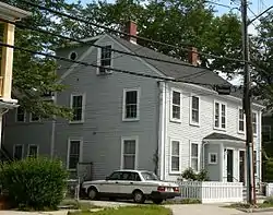 Lt. Benjamin Locke Store |
April 18, 1985 (#85001068) |
11–13 Lowell St. 42°25′26″N 71°10′40″W |
This structure is currently a two-family house. | |
| 37 | Milestone |  Milestone |
September 27, 1985 (#85002683) |
Appleton St. and Paul Revere Rd. 42°25′22″N 71°10′53″W |
The stone is located in a small triangular island in the intersection. | |
| 38 | Mystic Dam | Mystic Dam |
January 18, 1990 (#89002282) |
Between Lower and Upper Mystic Lakes 42°25′50″N 71°08′56″W |
Extends between Medford and Arlington; incorrectly listed as being in Winchester | |
| 39 | Mystic Valley Parkway, Metropolitan Park System of Greater Boston MPS | 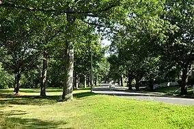 Mystic Valley Parkway, Metropolitan Park System of Greater Boston MPS |
January 18, 2006 (#05001529) |
Mystic Valley Parkway 42°25′07″N 71°08′33″W |
The Arlington section of the Mystic Valley Parkway runs from the intersection of Summer St. and Mystic Ave. (Route 2A and Route 3) north and then roughly ESE along the Mystic River to the junction with Alewife Brook Parkway in Somerville, thence back into Medford. | |
| 40 | Old Schwamb Mill | 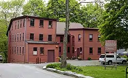 Old Schwamb Mill |
October 7, 1971 (#71000081) |
17 Mill Lane and 29 Lowell St. 42°25′30″N 71°10′42″W |
||
| 41 | Orvis Road Historic District |  Orvis Road Historic District |
September 27, 1985 (#85002677) |
Roughly bounded by Massachusetts Ave. and Freeman, Randolph, and Newcomb Sts. on Orvis Rd. 42°24′21″N 71°08′45″W |
||
| 42 | Pierce Farm Historic District | 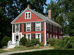 Pierce Farm Historic District |
September 27, 1985 (#85002678) |
Roughly bounded by Claremont and Oakland Aves. 42°25′00″N 71°11′01″W |
||
| 43 | Pleasant Street Congregational Church | 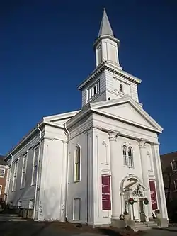 Pleasant Street Congregational Church |
June 23, 1983 (#83000823) |
75 Pleasant St. 42°24′50″N 71°09′23″W |
Built in 1844[5] | |
| 44 | William Prentiss House | 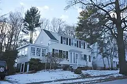 William Prentiss House |
September 27, 1985 (#85002685) |
252 Gray St. 42°24′59″N 71°10′21″W |
||
| 45 | Prentiss-Payson House | 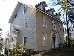 Prentiss-Payson House |
April 18, 1985 (#85001040) |
224–226 Pleasant St. 42°24′25″N 71°09′43″W |
||
| 46 | Prince Hall Mystic Cemetery | 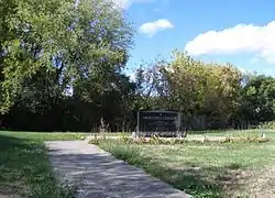 Prince Hall Mystic Cemetery |
November 25, 1998 (#97001473) |
Gardner St.[6] 42°24′37″N 71°08′07″W |
||
| 47 | William Proctor House | 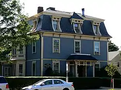 William Proctor House |
April 18, 1985 (#85001041) |
390 Massachusetts Ave. 42°24′45″N 71°09′44″W |
||
| 48 | Warren Rawson Building | 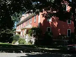 Warren Rawson Building |
September 27, 1985 (#85002686) |
68–74 Franklin St. 42°24′57″N 71°08′49″W |
||
| 49 | Warren Rawson House | 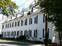 Warren Rawson House |
April 18, 1985 (#85001042) |
37–49 Park St. 42°24′52″N 71°08′35″W |
||
| 50 | Alfred E. Robindreau House |  Alfred E. Robindreau House |
April 18, 1985 (#85001043) |
28 Lafayette St. 42°24′03″N 71°08′20″W |
||
| 51 | Robinson House |  Robinson House |
April 18, 1985 (#85001044) |
19 Winter St. 42°24′25″N 71°08′28″W |
||
| 52 | Robinson-Lewis-G. F. Fessenden House | 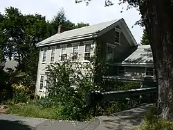 Robinson-Lewis-G. F. Fessenden House |
April 18, 1985 (#85001045) |
40 Westminster Ave. 42°25′38″N 71°11′06″W |
||
| 53 | Russell Common | 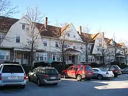 Russell Common |
April 18, 1985 (#85001046) |
2–10 Park Terrace 42°24′56″N 71°09′09″W |
This is a row house located just northeast of the center of town, behind the retail stores on Massachusetts Ave. It is accessible from the municipal lot behind the Jefferson Cutter House (entries from Mystic St. and Medford St.) | |
| 54 | Jason Russell House | 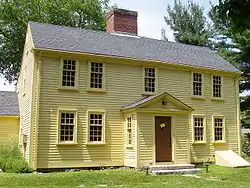 Jason Russell House |
October 9, 1974 (#74000363) |
7 Jason St. 42°24′58″N 71°09′31″W |
||
| 55 | Ralph W. Shattuck House | 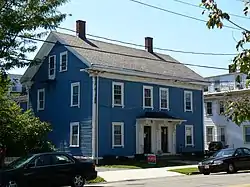 Ralph W. Shattuck House |
September 27, 1985 (#85002687) |
274–276 Broadway 42°24′48″N 71°08′56″W |
||
| 56 | Ella Mahalla Cutter Sterling House |  Ella Mahalla Cutter Sterling House |
April 18, 1985 (#85001047) |
93 Summer St. 42°25′08″N 71°09′28″W |
||
| 57 | Thomas Swadkins House | 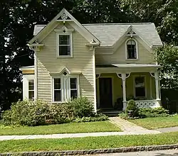 Thomas Swadkins House |
April 18, 1985 (#85001048) |
160 Westminster Ave. 42°25′48″N 71°11′13″W |
||
| 58 | Henry Swan House | 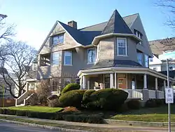 Henry Swan House |
September 27, 1985 (#85002688) |
418 Massachusetts Ave. 42°24′49″N 71°09′03″W |
||
| 59 | Stephen Symmes Jr. House |  Stephen Symmes Jr. House |
April 18, 1985 (#85001049) |
215 Crosby St. 42°25′49″N 71°09′23″W |
||
| 60 | Taylor-Dallin House |  Taylor-Dallin House |
September 27, 1985 (#85002689) |
69 Oakland Ave. 42°25′11″N 71°10′45″W |
||
| 61 | US Post Office-Arlington Main | 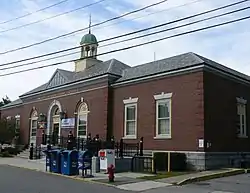 US Post Office-Arlington Main |
June 18, 1986 (#86001351) |
10 Court St. 42°25′00″N 71°09′22″W |
||
| 62 | Wayside Inn |  Wayside Inn |
September 27, 1985 (#85002690) |
393 Massachusetts Ave. 42°24′46″N 71°08′59″W |
||
| 63 | Whittemore House |  Whittemore House |
April 18, 1985 (#85001050) |
267 Broadway 42°24′48″N 71°08′54″W |
||
| 64 | Winn Farm | 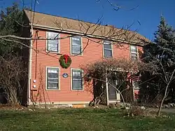 Winn Farm |
April 18, 1985 (#85001051) |
57 Summer St. 42°25′08″N 71°09′22″W |
This is only a farmhouse, not an actual farm. |
See also
- National Register of Historic Places listings in Middlesex County, Massachusetts for listings in neighboring Belmont and Lexington
- National Register of Historic Places listings in Winchester, Massachusetts
- National Register of Historic Places listings in Cambridge, Massachusetts
- National Register of Historic Places listings in Medford, Massachusetts
References
| Wikimedia Commons has media related to National Register of Historic Places in Arlington, Massachusetts. |
- "National Register of Historic Places: Weekly List Actions". National Park Service, United States Department of the Interior. Retrieved on February 5, 2021.
- Numbers represent an alphabetical ordering by significant words. Various colorings, defined here, differentiate National Historic Landmarks and historic districts from other NRHP buildings, structures, sites or objects.
- "National Register Information System". National Register of Historic Places. National Park Service. April 24, 2008.
- The eight-digit number below each date is the number assigned to each location in the National Register Information System database, which can be viewed by clicking the number.
- Parker, Brock (January 23, 2011). "Members, community to say farewell to Arlington church". The Boston Globe. Retrieved January 26, 2011.
- The NRIS lists the property as "Address Restricted"; the Gardner St. location comes from this Archived 2008-01-09 at the Wayback Machine Arlington town website
- "NRHP Document for Arlington, Massachusetts MRA". National Park Service. 1985. Retrieved 2008-09-29.
| Topics |  | ||||||||||||||||
|---|---|---|---|---|---|---|---|---|---|---|---|---|---|---|---|---|---|
| Lists by county | |||||||||||||||||
| Lists by city |
| ||||||||||||||||
| Other lists | |||||||||||||||||
| |||||||||||||||||
This article is issued from Wikipedia. The text is licensed under Creative Commons - Attribution - Sharealike. Additional terms may apply for the media files.