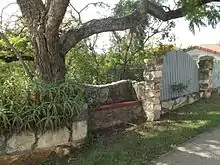
Taringa, Queensland
Taringa is a suburb in the City of Brisbane, Queensland, Australia.[3] In the 2016 census, Taringa had a population of 8,376 people.[1]
| Taringa Brisbane, Queensland | |||||||||||||||
|---|---|---|---|---|---|---|---|---|---|---|---|---|---|---|---|
 Taringa | |||||||||||||||
| Coordinates | 27.4927°S 152.9844°E | ||||||||||||||
| Population | 8,376 (2016 census)[1] | ||||||||||||||
| • Density | 3,990/km2 (10,330/sq mi) | ||||||||||||||
| Postcode(s) | 4068 | ||||||||||||||
| Area | 2.1 km2 (0.8 sq mi) | ||||||||||||||
| Time zone | AEST (UTC+10:00) | ||||||||||||||
| Location | 6.8 km (4 mi) SW of Brisbane GPO | ||||||||||||||
| LGA(s) | City of Brisbane (Walter Taylor Ward)[2] | ||||||||||||||
| State electorate(s) | Maiwar | ||||||||||||||
| Federal Division(s) | Ryan | ||||||||||||||
| |||||||||||||||
Geography
Taringa is 6.8 kilometres (4.2 mi) by road south-west of the Brisbane GPO.
Taringa is dominated by a ridge that runs the length of Swann Road, with steep slopes on either side of the ridge.[4]
Taringa is mostly residential, except for a small number of commercial buildings mostly clustered along Moggill Road.[4] It is a popular neighbourhood among the students of the University of Queensland and the Queensland University of Technology because of its proximity to the universities and to Brisbane CBD.
History
The name Taringa is a combination of two Aboriginal words: tarau (stones) and nga (made up of). Together, they mean "place of stones".[3]
The Main Line railway from Roma Street railway station to Indooroopilly railway station opened on 14 June 1875 with the area being served by West Milton railway station (as it was initially known) before being renamed Taringa later that year.[5]
On 15 December 1883 auctioneer John W. Todd offered 176 suburban lots, mostly of 25.3 perches (640 m2) in the Abbotsford Estate, bounded by Stanley Terrace to the north, Mt Cootha Road (now Moorak Street) to the east, Moggill Road to the south-east, Waverley Road to the south, and Sarah Street (now Manchester Terrace) and Woodstock Avenue to the west.[6][7]
On 16 August 1884 auctioneer John W. Todd offered 173 suburban sites, mostly between 16 to 20 perches (400 to 510 m2) in the South Toowong Estate, which is bounded by Wilson Street (now Whitmore Street) to the west, Alpha Street to the north, Indooroopilly Road to the north and east and the southern side of Oxford Street, including Ellerslie Crescent and Bellevue Parade.[8] The sale include the house Ellerslie on 1 acre (0.40 ha) of land.[9]
On 14 February 1885 auctioneer John W. Todd offered 79 suburban sites in the Taringa Township, immediately north of the Taringa railway station.[10] 58 of the lots were sold for a total of £1012/15/0.[11]
In August 1886 auctioneer John W. Todd offered 32 buildings sites (all 0.75-acre (0.30 ha) or larger) in the Belgrave and Riverview Estate in "South Toowong". The estate was bounded by Swan Road to the north, Indooroopilly Road to the east, Todd Street to the south, and Kobada Street to the west.[12][13]
On 19 March 1887 auctioneer R.J. Cottell offered suburban lots in the Taringa Township, which was along Harrys Road between Stanley Terrace and present-day Moggill Road. The lots ranged from 16.15 to 27.8 perches (408 to 703 m2).[14]
Taringa State School opened on 8 October 1900 and closed on 14 December 1996.[15] The school was located between Moggill Road and Morrow Street (27.4921°S 152.9810°E).[16]
On Saturday 20 June 1908, Venerable H.F Le Fanu, Anglican Archdeacon of Brisbane laid the foundation stone and performed a stump capping ceremony for St Paul's Anglican Church.[17] It was at 165 (approx) Moggill Road (on the present site of Taringa Central complex, 27.4924°S 152.9803°E).[18][19] It closed circa 1982-1986 and was removed.[20][21]
On 30 April 1921 auctioneer Cameron Bros offered 27 suburban allotments ranging from 20 to 33 perches (510 to 830 m2) in the Coomoola Park Estate on the north side of Stanley Terrace near the junction with Hillsdon Road.[22][23]
The Lionel Brand of Worcestershire sauce was manufactured in Taringa.[24]
Gailey Road, Taringa is named after Richard Gailey an Irish-Australian architect.
In the 2011 census, the population of Taringa was 7,176.[25]
In the 2016 census, Taringa had a population of 8,376 people.[1]
Heritage listings

Taringa has a number of heritage-listed sites, including:
- 103 Stanley Terrace (27.4892°S 152.9803°E): Pilot Officer Geoffrey Lloyd Wells Memorial Seat[26]
- 209 Indooroopilly Road (27.5011°S 152.991°E): Fulton Residence[27]
Education
There are no government schools in Taringa. The nearest primary schools are Toowong State School in neighbouring Toowong to the north, Ironside State School in neighbouring St Lucia to the east, and Indooroopilly State School in neighbouring Indooroopilly to the south-west. The nearest government secondary school is Indooroopilly State High School in Indooroopilly.[4]
The Japanese Language Supplementary School of Queensland Japanese School of Brisbane (ブリスベン校 Burisuben Kō), a weekend Japanese school, maintains its school office in Taringa. It holds its classes at Indooroopilly State High School in Indooroopilly.[28]
Community groups
The Taringa Scout Den is the home of the Taringa-Milton-Toowong Scout Group. It is also used as a GoJu Karate training facility and for Yoga.
Sport
Taringa is the home of the Taringa Rovers Soccer Football Club, who play in the Brisbane Premier League.
Transport

By Train, Taringa railway station (27.4931°S 152.9822°E) is part of the Queensland Rail City network, on the Ipswich, Rosewood and Springfield railway lines providing travel to the Brisbane CBD, Ipswich, Rosewood and Springfield.[5]
By Bus, Taringa is serviced by Brisbane Transport buses to the Brisbane CBD, Chancellor's Place at UQ St Lucia, Indooroopilly, Long Pocket, Chapel Hill and Kenmore.
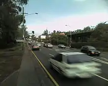
By Road, Taringa's main thoroughfares are Swann Road and Moggill Road.
Notable people
- Gwen Harwood, an Australian poet, was born in Taringa.
- Dorothy Hill, geologist and palaeontologist, the first female professor at an Australian university, and the first female president of the Australian Academy of Science was born in Taringa in 1907.
- Frank William Moorhouse, born in Taringa, Chief Inspector of the Fisheries and Game Department of South Australia from 1936 to 1959.
- Clement Lindley Wragge, a meteorologist, lived in Taringa in a house named Capemba in the 1890s.
Demographics
In the 2011 census, the population of Taringa was 7,176, 50.4% female and 49.6% male.[25] The median age of the Taringa population was 29 years, 8 years below the Australian median. 63.8% of people living in Taringa were born in Australia, compared to the national average of 69.8%; the next most common countries of birth were England 3.8%, China 3%, New Zealand 2.4%, Malaysia 2.1%, India 2%. 75.9% of people spoke only English at home; the next most common languages were 3.6% Mandarin, 1.6% Cantonese, 1.3% Malay, 1.1% Spanish, 0.9% Persian (excluding Dari).[25]
References
- Australian Bureau of Statistics (27 June 2017). "Taringa (SSC)". 2016 Census QuickStats. Retrieved 20 October 2018.

- "Walter Taylor Ward". Brisbane City Council. Brisbane City Council. Archived from the original on 12 March 2017. Retrieved 12 March 2017.
- "Taringa – suburb in City of Brisbane (entry 50317)". Queensland Place Names. Queensland Government. Retrieved 17 September 2020.
- "Queensland Globe". State of Queensland. Retrieved 10 October 2020.
- "Taringa – railway station in the City of Brisbane (entry 33361)". Queensland Place Names. Queensland Government. Retrieved 11 October 2020.
- "Plan of Abbotsford Estate". 1883. hdl:10462/deriv/451596. Cite journal requires
|journal=(help) - "Classified Advertising". The Brisbane Courier. XXXVIII (8, 091). Queensland, Australia. 15 December 1883. p. 8. Archived from the original on 11 October 2020. Retrieved 29 October 2019 – via National Library of Australia.
- "South Toowong". hdl:10462/deriv/459789. Cite journal requires
|journal=(help) - "Classified Advertising". The Brisbane Courier. XXXIX (8, 299). Queensland, Australia. 15 August 1884. p. 8. Archived from the original on 11 October 2020. Retrieved 29 October 2019 – via National Library of Australia.
- "Classified Advertising". The Brisbane Courier. XXXIX (8, 455). Queensland, Australia. 14 February 1885. p. 7. Archived from the original on 11 October 2020. Retrieved 29 October 2019 – via National Library of Australia.
- "Commercial". The Telegraph (3, 875). Queensland, Australia. 16 February 1885. p. 5. Archived from the original on 11 October 2020. Retrieved 29 October 2019 – via National Library of Australia.
- "Bellgrave and Riverview Estate". State Library of Queensland. hdl:10462/deriv/251851. Cite journal requires
|journal=(help) - "Advertising". The Telegraph (4, 338). Queensland, Australia. 2 August 1886. p. 8. Archived from the original on 11 October 2020. Retrieved 29 October 2019 – via National Library of Australia.
- "Taringa Township". hdl:10462/deriv/280869. Cite journal requires
|journal=(help) - Queensland Family History Society (2010), Queensland schools past and present (Version 1.01 ed.), Queensland Family History Society, ISBN 978-1-921171-26-0
- "Mount Coot-tha" (Map). Queensland Government. 1981. Archived from the original on 11 October 2020. Retrieved 11 October 2020.
- "Taringa Anglicans". The Telegraph (11, 106). Queensland, Australia. 22 June 1908. p. 2. Archived from the original on 11 October 2020. Retrieved 29 August 2020 – via National Library of Australia.
- "Brisbane and Suburbs Street and Road Map". Queensland Government. 1927. Archived from the original on 29 August 2020. Retrieved 29 August 2020.
- Greater Brisbane area atlas directory of residents & streets : including Wynnum, Manly-lota & Sandgate, G.R. Bartlett, 1931, p. 316, archived from the original on 11 October 2020, retrieved 30 August 2020
- "Closed Churches". Anglican Records and Archives Centre, Anglican Church of Southern Queensland. Archived from the original on 3 April 2019. Retrieved 27 February 2019.
- "St Paul's Anglican Church". Mapping Brisbane History. Archived from the original on 29 August 2020. Retrieved 29 August 2020.
- "Coomoola Park, Taringa". 1921. hdl:10462/deriv/410761. Cite journal requires
|journal=(help) - "Advertising". The Brisbane Courier (19, 742). Queensland, Australia. 30 April 1921. p. 8. Archived from the original on 11 October 2020. Retrieved 29 October 2019 – via National Library of Australia.
- Unidentified, Lionel Brand Worcestershire Sauce label, John Oxley Library, State Library of Queensland, retrieved 29 October 2019
- Australian Bureau of Statistics (31 October 2012). "Taringa". 2011 Census QuickStats. Retrieved 24 October 2013.

- "Pilot Officer Geoffrey Lloyd Wells Memorial Seat (entry 600338)". Queensland Heritage Register. Queensland Heritage Council. Retrieved 6 July 2013.
- "Fulton Residence (entry 602208)". Queensland Heritage Register. Queensland Heritage Council. Retrieved 6 July 2013.
- "平成 26(2014)年度" (Archive). The Japanese Language Supplementary School of Queensland. Retrieved on April 1, 2015. p. 4. "借用校舎:インドロピリー州立高校(Indooroopilly State High School) Ward Street, Indooroopilly, QLD4068, AUSTRALIA 事務所:The Japanese Club of Brisbane/The Japanese School of Brisbane Suite 17, Taringa Professional Centre, 180 Moggill Road, Taringa, QLD4068"
External links
| Wikimedia Commons has media related to Taringa, Queensland. |
- "Taringa". Queensland Places. Centre for the Government of Queensland, University of Queensland.
- Taringa Neighbourhood Group