Sinnamon Park, Queensland
Sinnamon Park is a suburb in the City of Brisbane, Queensland, Australia.[3] In the 2016 census, Sinnamon Park had a population of 6,419 people.[1]
| Sinnamon Park Brisbane, Queensland | |||||||||||||||
|---|---|---|---|---|---|---|---|---|---|---|---|---|---|---|---|
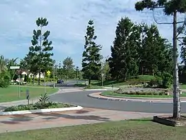
 Sinnamon Road and roundabout | |||||||||||||||
 Sinnamon Park | |||||||||||||||
| Coordinates | 27.5452°S 152.9480°E | ||||||||||||||
| Population | 6,419 (2016 census)[1] | ||||||||||||||
| • Density | 2,140/km2 (5,540/sq mi) | ||||||||||||||
| Postcode(s) | 4073 | ||||||||||||||
| Area | 3.0 km2 (1.2 sq mi) | ||||||||||||||
| Time zone | AEST (UTC+10:00) | ||||||||||||||
| Location | 14.0 km (9 mi) SW of Brisbane GPO | ||||||||||||||
| LGA(s) | City of Brisbane (Jamboree Ward)[2] | ||||||||||||||
| State electorate(s) | Mount Ommaney | ||||||||||||||
| Federal Division(s) | Oxley | ||||||||||||||
| |||||||||||||||
Geography
Sinnamon Park is 14 kilometres (8.7 mi) by road south-west of the Brisbane CBD.[4]
The suburb is bounded to the north by the median of the Brisbane River.[5] It is partly bounded to the east by the Jindalee Creek riparian zone and mostly to the west by the Western Freeway.[6]
The land use is residential.[6]
History
In 1879, the local government area of Yeerongpilly Division was created. In 1891, parts of Yeerongpilly Division were excised to create Sherwood Division becoming a Shire in 1903 which contained the area of Wolston Estate. In 1925, the Shire of Sherwood was amalgamated into the City of Brisbane.[7]
A portion of Sinnamon Park was formerly part of the Wolston Estate, consisting of 54 farms on an area of 3,000 acres, offered for auction at Centennial Hall, Brisbane, on 16 October 1901.[8] Wolston Estate was the property of M. B. Goggs, whose father obtained the land forty years previously in the 1860s and after whom Goggs Road is named.[9] Only three of the farms sold at the original auction.[10]
The suburb of Sinnamon Park was officially named and bounded on 13 May 1989, with the land excised from the suburb of Seventeen Mile Rocks. Sinnamon Park is named for the pioneering Sinnamon family headed by James and Margaret Sinnamon.[3] The land occupied by Sinnamon Village retirement complex and the river flats east of the Centenary Freeway were formerly their family farm.
At the 2011 census Sinnamon Park had a population of 6,362 people.[11]
In the 2016 census, Sinnamon Park had a population of 6,419 people.[1]
Heritage listings
Sinnamon Park has a number of heritage-listed sites, including:
- 645 & 693 Seventeen Mile Rocks Road: Sinnamon Farm (including the houses "Avondale", "Beechwood" and "Glen Ross" and Seventeen Mile Rocks School) [12][13][14][15][16]
- 675 Seventeen Mile Rocks Road: Sinnamon Memorial Uniting Church [17][18]
Education
There are no schools in Sinnamon Park. The nearest primary schools are Jindalee State School in neighbouring Jindalee to the north-west, Jamboree Heights State School in neighbouring Jamborie Heights to the south-west, and Darra State School in neighbouring Darra to the south. The nearest secondary school is Centenary State High School in Jindalee.[6]
Demographics
In the 2011 census, the population of Sinnamon Park was 6,362, 53.4% female and 46.6% male.
The median age of the Sinnamon Park population was 39 years, 2 years above the Australian median.
61.1% of people living in Sinnamon Park were born in Australia, compared to the national average of 69.8%; the next most common countries of birth were England 5.3%, New Zealand 3%, India 2.7%, South Africa 2.5%, Vietnam 2.5%.
72.2% of people spoke only English at home; the next most common languages were 3.7% Vietnamese, 3% Mandarin, 2% Cantonese, 1.7% Hindi, 1.1% Persian (excluding Dari).
Politics
The people of Sinnamon Park are represented in the Queensland Parliament by Jess Pugh, the ALP Member for Mount Ommaney.
References
- Australian Bureau of Statistics (27 June 2017). "Sinnamon Park (SSC)". 2016 Census QuickStats. Retrieved 20 October 2018.

- "Jamboree Ward". Brisbane City Council. Brisbane City Council. Archived from the original on 12 March 2017. Retrieved 12 March 2017.
- "Sinnamon Park – suburb in City of Brisbane (entry 44369)". Queensland Place Names. Queensland Government. Retrieved 7 July 2020.
- "Brisbane GPO to Sinnamon Park". Google Maps. Archived from the original on 20 July 2020. Retrieved 20 July 2020.
- "Queensland Globe; Layer:Boundaries".
- "Queensland Globe". State of Queensland. Retrieved 20 July 2020.
- Fones, Ralph (1 January 1993). "Suburban conservatism in the Sherwood Shire 1891-1920". UQ eSpace. Archived from the original on 2 March 2020. Retrieved 2 March 2020.
- "Plan of the Wolston Estate". 1901. hdl:10462/deriv/252490. Cite journal requires
|journal=(help) - "SALE OF WOLSTON ESTATE". The Brisbane Courier. LVIII (13, 651). Queensland, Australia. 12 October 1901. p. 4. Retrieved 21 May 2019 – via National Library of Australia.
- "LATEST NEWS IN BRIEF". The Queenslander. LXI (1353). Queensland, Australia. 26 October 1901. p. 780. Retrieved 21 May 2019 – via National Library of Australia.
- Australian Bureau of Statistics (31 October 2012). "Sinnamon Park (State Suburb)". 2011 Census QuickStats. Retrieved 2 February 2013.

- "Sinnamon Farm (entry 600233)". Queensland Heritage Register. Queensland Heritage Council. Retrieved 6 July 2013.
- "Avondale". Brisbane Heritage Register. Brisbane City Council. Retrieved 20 July 2020.
- "Beechwood". Brisbane Heritage Register. Brisbane City Council. Retrieved 20 July 2020.
- "Glen Ross". Brisbane Heritage Register. Brisbane City Council. Retrieved 20 July 2020.
- "Seventeen Mile Rocks School". Brisbane Heritage Register. Brisbane City Council. Retrieved 20 July 2020.
- "Sinnamon Memorial Uniting Church (entry 600235)". Queensland Heritage Register. Queensland Heritage Council. Retrieved 6 July 2013.
- "Sinnamon Memorial Uniting Church". Brisbane Heritage Register. Brisbane City Council. Retrieved 20 July 2020.
External links
| Wikimedia Commons has media related to Sinnamon Park, Queensland. |
- "Sinnamon Park". Queensland Places. Centre for the Government of Queensland, University of Queensland.