National Register of Historic Places listings in Lancaster County, Pennsylvania
This is a list of the National Register of Historic Places listings in Lancaster County, Pennsylvania.

This is intended to be a complete list of the properties and districts on the National Register of Historic Places in Lancaster County, Pennsylvania, United States. The locations of National Register properties and districts for which the latitude and longitude coordinates are included below, may be seen in a map.[1]
There are 209 properties and districts listed on the National Register in the county. The city of Lancaster is the location of 57 of these properties and districts; they are listed separately, while the 153 properties and districts in the other parts of the county are listed here. One property straddles the Lancaster city limits and appears on both lists. Another three sites are further designated as National Historic Landmarks. Yet another property was once listed but has been removed.
- This National Park Service list is complete through NPS recent listings posted January 29, 2021.[2]
Current listings
Lancaster
Exclusive of Lancaster
| [3] | Name on the Register | Image | Date listed[4] | Location | Municipality | Description |
|---|---|---|---|---|---|---|
| 1 | Abbeville | 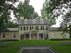 Abbeville |
December 14, 1978 (#78002414) |
1140 Columbia Avenue 40°02′16″N 76°20′07″W |
Lancaster Township | |
| 2 | Andrews Bridge Historic District |  Andrews Bridge Historic District |
December 22, 1988 (#88003046) |
Junction of Pennsylvania Route 896 and Sproul and Creek Roads 39°52′15″N 76°00′20″W |
Colerain Township | |
| 3 | Ashley and Bailey Silk Mill |  Ashley and Bailey Silk Mill |
June 27, 1980 (#80003533) |
East Walnut and Pine Streets 40°03′33″N 76°32′51″W |
Marietta | |
| 4 | Bachman and Forry Tobacco Warehouse | 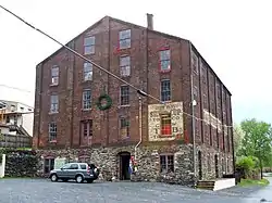 Bachman and Forry Tobacco Warehouse |
March 29, 1979 (#79002252) |
125 Bank Alley 40°01′45″N 76°30′10″W |
Columbia | |
| 5 | Bangor Episcopal Church |  Bangor Episcopal Church |
April 30, 1987 (#87000664) |
Northwestern corner of Main and Water Streets, Churchtown 40°08′01″N 75°57′42″W |
Caernarvon Township | |
| 6 | Baumgardner's Mill Covered Bridge | 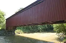 Baumgardner's Mill Covered Bridge |
December 11, 1980 (#80003541) |
Southwest of Willow Street on Township 425 39°55′50″N 76°17′44″W |
Martic and Pequea Townships | |
| 7 | Bausman Farmstead | 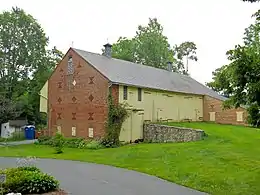 Bausman Farmstead |
August 30, 1994 (#94001061) |
1630 and 1631 Pennsylvania Route 999 (Millersville Pike) 40°01′18″N 76°20′00″W |
Lancaster Township | |
| 8 | John Berger & Son Company Tobacco Warehouse |  John Berger & Son Company Tobacco Warehouse |
August 1, 2014 (#14000468) |
191 Broad St. 40°05′52″N 76°24′48″W |
East Hempfield Township | |
| 9 | Big and Little Indian Rock Petroglyphs | April 3, 1978 (#78002421) |
In the Susquehanna River, south of Safe Harbor[5] 39°55′15″N 76°23′05″W |
Conestoga Township | ||
| 10 | Bird-in-Hand Hotel |  Bird-in-Hand Hotel |
July 24, 1992 (#92000950) |
2695 Old Philadelphia Pike (Pennsylvania Route 340), Bird-in-Hand 40°02′19″N 76°10′48″W |
East Lampeter Township | |
| 11 | Bitzer's Mill Covered Bridge |  Bitzer's Mill Covered Bridge |
December 11, 1980 (#80003516) |
Southeast of Ephrata on Legislative Route 36122 40°08′25″N 76°09′08″W |
West Earl Township | |
| 12 | Bowmansville Roller Mill |  Bowmansville Roller Mill |
January 19, 1990 (#89001821) |
Junction of Pennsylvania Route 625 and Von Nieda Street, Bowmansville 40°11′24″N 76°00′43″W |
Brecknock Township | |
| 13 | Bridge in West Earl Township |  Bridge in West Earl Township |
June 22, 1988 (#88000875) |
Legislative Route 36032 over Conestoga Creek, Brownstown 40°07′42″N 76°12′01″W |
West Earl Township | |
| 14 | George Brown's Sons Cotton and Woolen Mill |  George Brown's Sons Cotton and Woolen Mill |
July 21, 1995 (#95000881) |
324–360 East Main Street 40°06′32″N 76°29′47″W |
Mount Joy | |
| 15 | Bucher Thal Historic District | 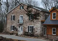 Bucher Thal Historic District |
December 31, 1987 (#87002207) |
Weaver Road 40°13′33″N 76°07′57″W |
East Cocalico Township | |
| 16 | James Buchanan House | 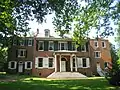 James Buchanan House |
October 15, 1966 (#66000669) |
1120 Marietta Avenue 40°02′36″N 76°19′49″W |
Lancaster Township | |
| 17 | Joseph Bucher House | 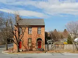 Joseph Bucher House |
September 7, 1979 (#79002260) |
104 East Front St 40°03′19″N 76°33′17″W |
Marietta | |
| 18 | Buck Hill Farm Covered Bridge |  Buck Hill Farm Covered Bridge |
December 10, 1980 (#80003528) |
South of Lititz, east of Pennsylvania Route 501, near Lititz 40°07′55″N 76°18′03″W |
Warwick Township | |
| 19 | Butcher's Mill Covered Bridge | 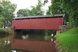 Butcher's Mill Covered Bridge |
December 11, 1980 (#80003514) |
South of Denver on Township 955, East Cocalico Township 40°12′28″N 76°08′05″W |
Denver | |
| 20 | Byers-Muma House |  Byers-Muma House |
February 22, 2002 (#02000070) |
1402 Trout Run Road 40°05′12″N 76°33′04″W |
East Donegal Township | |
| 21 | Caernarvon Presbyterian Church |  Caernarvon Presbyterian Church |
August 18, 2015 (#15000534) |
2148 Main St. 40°08′02″N 75°57′28″W |
Caernarvon Township | |
| 22 | Cameron Estate | 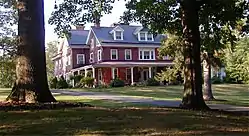 Cameron Estate |
November 3, 1975 (#75001646) |
2 miles (3.2 km) west of Mount Joy on Donegal Springs Road 40°06′10″N 76°34′00″W |
East Donegal Township | |
| 23 | Central Hotel | 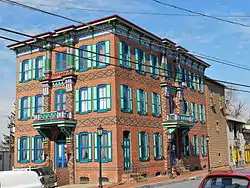 Central Hotel |
June 4, 1973 (#73001637) |
102 North Market Street 40°06′41″N 76°30′12″W |
Mount Joy | |
| 24 | Chickies Historic District |  Chickies Historic District |
December 28, 2005 (#05001488) |
Roughly bounded by the Susquehanna River, Chickies Creek, Bank Street and Long Lane 40°03′27″N 76°31′35″W |
East Donegal Township, West Hempfield Township, and Marietta | |
| 25 | Colemanville Covered Bridge |  Colemanville Covered Bridge |
December 11, 1980 (#80003534) |
Northeast of Pequea on Township 408 39°53′55″N 76°20′32″W |
Conestoga and Martic Townships | |
| 26 | Columbia Historic District | 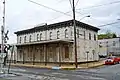 Columbia Historic District |
May 6, 1983 (#83002249) |
Roughly bounded by the Susquehanna River, Union, Cedar, 4th, and 5th Streets, Chestnut to 9th Street 40°02′02″N 76°30′12″W |
Columbia | |
| 27 | Columbia Wagon Works |  Columbia Wagon Works |
February 2, 2001 (#01000057) |
920 Plane Street 40°01′29″N 76°29′35″W |
Columbia | |
| 28 | Combination Baggage and Mail Car No. 5403 |  Combination Baggage and Mail Car No. 5403 |
December 17, 1979 (#79002261) |
Railroad Museum of Pennsylvania 39°58′56″N 76°09′40″W |
Strasburg Township | |
| 29 | Conestoga Town |  Conestoga Town |
June 18, 1973 (#73001636) |
Junction of Safe Harbor and Indian Marker Roads[6] 39°57′35″N 76°24′01″W |
Manor Township | |
| 30 | Congregational Store | 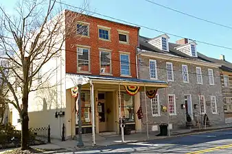 Congregational Store |
January 6, 1983 (#83002250) |
120–122 East Main Street 40°09′23″N 76°18′14″W |
Lititz | |
| 31 | Connell Mansion |  Connell Mansion |
January 19, 1979 (#79002254) |
249 West Main Street 40°10′51″N 76°10′53″W |
Ephrata | |
| 32 | Consolidation Freight Locomotive No. 1187 |  Consolidation Freight Locomotive No. 1187 |
December 17, 1979 (#79002262) |
Railroad Museum of Pennsylvania 39°58′56″N 76°09′40″W |
Strasburg Township | |
| 33 | Consolidation Freight Locomotive No. 2846 |  Consolidation Freight Locomotive No. 2846 |
December 17, 1979 (#79002263) |
Railroad Museum of Pennsylvania 39°58′56″N 76°09′40″W |
Strasburg Township | |
| 34 | Consolidation Freight Locomotive No. 7688 |  Consolidation Freight Locomotive No. 7688 |
December 17, 1979 (#79002264) |
Railroad Museum of Pennsylvania 39°58′56″N 76°09′40″W |
Strasburg Township | |
| 35 | Cumberland Valley Car |  Cumberland Valley Car |
December 17, 1979 (#79002265) |
Railroad Museum of Pennsylvania 39°58′56″N 76°09′40″W |
Strasburg Township | |
| 36 | Edward Davies House |  Edward Davies House |
September 6, 1991 (#91001122) |
West of Water Street on the southern side of Pennsylvania Route 23, Churchtown 40°08′01″N 75°57′38″W |
Caernarvon Township | |
| 37 | David Davis Farm |  David Davis Farm |
August 30, 1994 (#94001060) |
737 Spruce Road 40°07′23″N 76°04′46″W |
Earl Township | |
| 38 | DDI Electric Locomotive No. 36 |  DDI Electric Locomotive No. 36 |
December 17, 1979 (#79002266) |
Railroad Museum of Pennsylvania 39°58′56″N 76°09′40″W |
Strasburg Township | |
| 39 | Michael Dohner Farmhouse |  Michael Dohner Farmhouse |
June 27, 1980 (#80003523) |
South of U.S. Route 30, east of the intersection with Pennsylvania Route 896 40°01′39″N 76°13′49″W |
East Lampeter Township | |
| 40 | Donegal Mills Plantation |  Donegal Mills Plantation |
January 20, 1978 (#78002418) |
Southwest of Mount Joy on Trout Run Road 40°05′06″N 76°32′26″W |
East Donegal Township | |
| 41 | Donegal Presbyterian Church Complex | 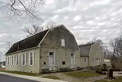 Donegal Presbyterian Church Complex |
July 2, 1985 (#85001482) |
Donegal Springs Road 40°06′04″N 76°34′00″W |
East Donegal Township | |
| 42 | John Douglass House |  John Douglass House |
September 5, 1990 (#90001411) |
Sproul Road, south of Pennsylvania Route 896, Kirkwood 39°51′55″N 76°00′30″W |
Colerain Township | |
| 43 | Duncan Island (36LA60,61) | 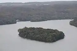 Duncan Island (36LA60,61) |
May 10, 1984 (#84003428) |
In the Susquehanna River[7] 39°51′41″N 76°21′49″W |
Martic Township | |
| 44 | Eby Shoe Corporation |  Eby Shoe Corporation |
August 18, 1989 (#89001050) |
136 North State Street 40°10′50″N 76°10′29″W |
Ephrata | |
| 45 | Ephrata Cloister |  Ephrata Cloister |
December 24, 1967 (#67000026) |
Junction of U.S. Routes 222 and 322 40°10′59″N 76°11′21″W |
Ephrata | |
| 46 | Ephrata Commercial Historic District | 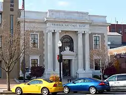 Ephrata Commercial Historic District |
November 8, 2006 (#06001005) |
Portions of West Main, East Main, North State, South State Streets, and Washington Avenue 40°10′41″N 76°10′39″W |
Ephrata | |
| 47 | Erb's Covered Bridge | 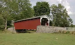 Erb's Covered Bridge |
December 10, 1980 (#80003536) |
North of Rothsville on Township 634 40°10′03″N 76°14′39″W |
Ephrata and Warwick Township | |
| 48 | Ann Cunningham Evans House |  Ann Cunningham Evans House |
May 9, 2002 (#02000475) |
6132 Twenty-eighth Division Highway 40°06′44″N 75°59′00″W |
Caernarvon Township | |
| 49 | Flat Car No. 473567 | 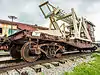 Flat Car No. 473567 |
December 17, 1979 (#79002267) |
Railroad Museum of Pennsylvania 39°58′56″N 76°09′40″W |
Strasburg Township | This flat car is outside the main train yard; the numbers on the side are extremely weathered and barely legible. |
| 50 | Forry's Mill Covered Bridge |  Forry's Mill Covered Bridge |
December 11, 1980 (#80003512) |
Northeast of Columbia on Township 362, Rapho/West Hempfield Townships 40°03′59″N 76°28′42″W |
Rapho and West Hempfield Townships | |
| 51 | Freight Locomotive No. 5741 | 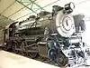 Freight Locomotive No. 5741 |
December 17, 1979 (#79002268) |
Railroad Museum of Pennsylvania 39°58′56″N 76°09′40″W |
Strasburg Township | |
| 52 | Frey-Haverstick Site (36LA6) | 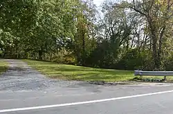 Frey-Haverstick Site (36LA6) |
January 15, 1986 (#86000819) |
Eastern side of the Susquehanna River, north of Staman's Run[8] 39°59′42″N 76°28′14″W |
Washington Boro | |
| 53 | Robert Fulton Birthplace | DSC00966-Edit.jpg.webp) Robert Fulton Birthplace |
October 15, 1966 (#66000670) |
8 miles (13 km) south of Quarryville on U.S. Route 222 39°48′17″N 76°09′37″W |
Fulton Township | |
| 54 | Furnace Hills Tenant House |  Furnace Hills Tenant House |
May 20, 2005 (#05000451) |
Unpaved road approximately 500 feet (150 m) east of Project Drive 40°15′55″N 76°12′21″W |
West Cocalico Township | |
| 55 | John B. Good House | 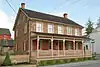 John B. Good House |
February 8, 1980 (#80003507) |
Pennsylvania Route 625 in Bowmansville 40°11′48″N 76°01′03″W |
Brecknock Township | |
| 56 | Grove Mansion | .jpg.webp) Grove Mansion |
April 21, 1983 (#83002251) |
133 River Road, Maytown 40°04′21″N 76°34′49″W |
East Donegal Township | |
| 57 | Christian Habeck Farm | 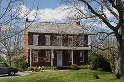 Christian Habeck Farm |
August 30, 1994 (#94001063) |
2301 Spring Valley Road 40°03′41″N 76°21′52″W |
East Hempfield Township | |
| 58 | Hammer Creek Bridge | 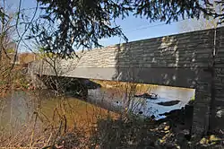 Hammer Creek Bridge |
June 22, 1988 (#88000872) |
Legislative Route 36011 over Hammer Creek 40°11′48″N 76°16′45″W |
Elizabeth and Warwick Townships | |
| 59 | Gen. Edward Hand House | 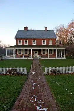 Gen. Edward Hand House |
November 21, 1976 (#76001646) |
881 Rock Ford Road 40°01′12″N 76°17′17″W |
West Lampeter Township | |
| 60 | Johannes Harnish Farmstead | 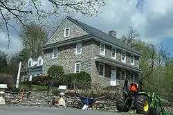 Johannes Harnish Farmstead |
March 12, 1999 (#99000327) |
202 Woodfield Crossing 40°00′05″N 76°17′11″W |
West Lampeter Township | |
| 61 | Christian and Emma Herr Farm |  Christian and Emma Herr Farm |
August 30, 1994 (#94001059) |
2131 and 2133 South View Road 39°58′16″N 76°14′20″W |
West Lampeter Township | |
| 62 | Hans Herr House |  Hans Herr House |
May 3, 1971 (#71000708) |
1851 Hans Herr Drive 39°58′48″N 76°15′43″W |
West Lampeter Township | |
| 63 | Herr's Mill Covered Bridge |  Herr's Mill Covered Bridge |
December 10, 1980 (#80003537) |
Southwest of Soundersburg on Township 696 40°00′35″N 76°09′44″W |
East Lampeter and Paradise Townships | |
| 64 | Hibshman Farm |  Hibshman Farm |
June 27, 1980 (#80003517) |
Springville Road 40°12′18″N 76°10′33″W |
Ephrata Township | |
| 65 | Kagerise Store and House |  Kagerise Store and House |
November 3, 1988 (#88002174) |
84–86 West Main Street 40°14′33″N 76°03′30″W |
Adamstown | |
| 66 | Kauffman's Distillery Covered Bridge |  Kauffman's Distillery Covered Bridge |
December 11, 1980 (#80003529) |
Southwest of Manheim on Township 889 40°08′53″N 76°24′37″W |
Penn and Rapho Townships | |
| 67 | Keller's Covered Bridge |  Keller's Covered Bridge |
December 10, 1980 (#80003518) |
Middle Creek Road (TR 660) over Cocalico Creek 40°09′51″N 76°13′57″W |
Ephrata Township | |
| 68 | Jacob Keller Farm |  Jacob Keller Farm |
July 17, 1986 (#86001679) |
900 Rettew Mill Road 40°10′13″N 76°12′21″W |
Ephrata Township | |
| 69 | Kirks Mills Historic District |  Kirks Mills Historic District |
July 17, 1978 (#78002420) |
West of Nottingham, Chester County off Pennsylvania Route 272 39°45′11″N 76°06′27″W |
Little Britain Township | |
| 70 | Kreider Shoe Manufacturing Company |  Kreider Shoe Manufacturing Company |
June 27, 1980 (#80003515) |
155 South Poplar Street 40°08′56″N 76°36′21″W |
Elizabethtown | |
| 71 | Lancaster City Historic District | 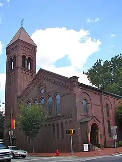 Lancaster City Historic District |
September 7, 2001 (#01000956) |
Roughly bounded by Liberty Street, Broad Street, Greenwood Avenue, Race Avenue, 40°02′29″N 76°18′25″W |
All neighborhoods | Extends into Lancaster |
| 72 | Lancaster County House of Employment |  Lancaster County House of Employment |
April 17, 1980 (#80003525) |
900 East King Street 40°02′17″N 76°17′08″W |
Lancaster Township | |
| 73 | Landis Mill Covered Bridge | 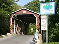 Landis Mill Covered Bridge |
December 10, 1980 (#80003526) |
Shreiner Station Road near the Park City Center 40°04′07″N 76°20′42″W |
East Hempfield and Manheim Townships | |
| 74 | Landis Valley Museum |  Landis Valley Museum |
January 3, 2000 (#99001578) |
2451 Kissel Hill Road 40°05′36″N 76°16′48″W |
Manheim Township | |
| 75 | Leaman Place Covered Bridge | 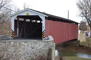 Leaman Place Covered Bridge |
December 11, 1980 (#80003519) |
South of Intercourse on Township 684 40°00′44″N 76°06′30″W |
Leacock and Paradise Townships | |
| 76 | Lime Valley Covered Bridge | 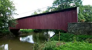 Lime Valley Covered Bridge |
December 10, 1980 (#80003535) |
North of Refton on Township 498 39°57′38″N 76°14′06″W |
Strasburg and West Lampeter Townships | |
| 77 | Linden House |  Linden House |
January 6, 1983 (#83002254) |
606 East Market Street 40°03′35″N 76°32′30″W |
Marietta | |
| 78 | Lititz Moravian Historic District |  Lititz Moravian Historic District |
May 9, 1986 (#86001030) |
Roughly bounded by East Main, Willow and Locust, Marion and Orange, and South Cedar and South and North Broad Streets 40°09′17″N 76°18′06″W |
Lititz | |
| 79 | Locomotive No. 6755 |  Locomotive No. 6755 |
December 17, 1979 (#01000519) |
Railroad Museum of Pennsylvania 39°58′56″N 76°09′40″W |
Strasburg Township | |
| 80 | Locust Grove |  Locust Grove |
August 3, 1977 (#77001171) |
South of Bainbridge off Pennsylvania Route 441 40°04′44″N 76°39′38″W |
Conoy Township | |
| 81 | Locust Grove Archaeological District | May 28, 2020 (#100003391) |
Address Restricted |
Bainbridge vicinity | ||
| 82 | Manheim Borough Historic District |  Manheim Borough Historic District |
February 4, 2000 (#00000058) |
Roughly bounded by Colebrook, Laurel, Fuller Dr., And Fulton Streets 40°09′45″N 76°23′45″W |
Manheim | |
| 83 | Manor Street Elementary School |  Manor Street Elementary School |
April 2, 1987 (#87000572) |
Tenth and Manor Streets 40°01′40″N 76°29′23″W |
Columbia | |
| 84 | Marietta Historic District |  Marietta Historic District |
July 18, 1978 (#78002417) |
Roughly bounded by Market, Front, Biddle, and Waterford Streets 40°03′22″N 76°33′28″W |
Marietta | |
| 85 | Mascot Roller Mills |  Mascot Roller Mills |
September 29, 1983 (#83002255) |
Newport and Stumptown Roads, Mascot 40°03′46″N 76°09′26″W |
Upper Leacock Township | |
| 86 | David M. Mayer House |  David M. Mayer House |
August 31, 2017 (#100001571) |
1580 Fruitville Pike 40°03′54″N 76°18′55″W |
Manheim Township | |
| 87 | Mentzer Building |  Mentzer Building |
March 7, 1985 (#85000466) |
3 West Main Street 40°10′47″N 76°10′44″W |
Ephrata | |
| 88 | Mercer's Mill Covered Bridge |  Mercer's Mill Covered Bridge |
December 11, 1980 (#80003509) |
South of Christiana 39°55′53″N 75°58′54″W |
Sadsbury Township | Extends into Chester County |
| 89 | Mikado Freight Locomotive No. 520 | 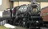 Mikado Freight Locomotive No. 520 |
December 17, 1979 (#79002269) |
Railroad Museum of Pennsylvania 39°58′56″N 76°09′40″W |
Strasburg Township | |
| 90 | Mount Hope Estate | 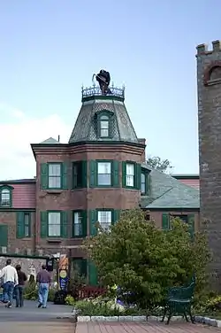 Mount Hope Estate |
December 1, 1980 (#80003530) |
Northwest of Manheim on Pennsylvania Route 72; also roughly along Shearer's Creek, east of Mansion House Road and north of the Pennsylvania Turnpike 40°13′37″N 76°25′47″W |
Penn and Rapho Townships | Second set of boundaries represents a boundary increase of September 6, 1991 |
| 91 | Mountain Springs Hotel | 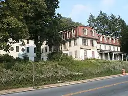 Mountain Springs Hotel |
March 2, 1982 (#82003791) |
320 East Main Street 40°10′31″N 76°10′21″W |
Ephrata | |
| 92 | Samuel N. Mumma Tobacco Warehouse |  Samuel N. Mumma Tobacco Warehouse |
May 30, 1997 (#97000517) |
Elizabeth Street junction with Emily Avenue 40°05′46″N 76°25′08″W |
East Hempfield Township | |
| 93 | Murry Site |  Murry Site |
December 10, 1980 (#80003540) |
2 miles (3.2 km) south of Washington Boro[9] 39°58′44″N 76°27′11″W |
Manor Township | |
| 94 | Neff's Mill Covered Bridge | 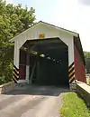 Neff's Mill Covered Bridge |
December 11, 1980 (#80003538) |
West of Strasburg on Township 559 39°58′43″N 76°13′33″W |
Strasburg and West Lampeter Townships | |
| 95 | New Holland Machine Company | 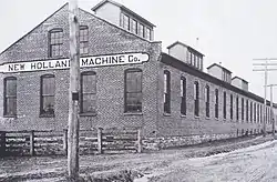 New Holland Machine Company |
August 9, 2000 (#00000846) |
146 East Franklin Street 40°06′03″N 76°05′19″W |
New Holland | |
| 96 | Nissly Swiss Chocolate Company |  Nissly Swiss Chocolate Company |
June 28, 1996 (#96000709) |
951 Wood Street 40°06′48″N 76°31′38″W |
Mount Joy | |
| 97 | Northeast Lancaster Township Historic District |  Northeast Lancaster Township Historic District |
March 20, 1986 (#86000464) |
Roughly bounded by Marietta, Race, and Wheatland Avenues and Wilson Drive 40°02′32″N 76°19′56″W |
Lancaster Township | |
| 98 | Old Columbia-Wrightsville Bridge | 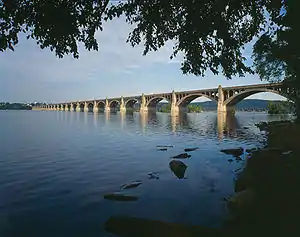 Old Columbia-Wrightsville Bridge |
June 22, 1988 (#88000764) |
Legislative Route 128 over the Susquehanna River and a railroad 40°01′50″N 76°30′41″W |
Columbia | Extends into York County |
| 99 | Oregon Mill Complex |  Oregon Mill Complex |
June 27, 1985 (#85001389) |
1415 Oregon Road 40°06′48″N 76°15′00″W |
Manheim Township | |
| 100 | Park Site 36La96 |  Park Site 36La96 |
April 4, 1985 (#85000698) |
On a knoll in Central Park, midway between the Conestoga River and Mill Creek[10] 40°01′07″N 76°17′04″W |
West Lampeter Township | |
| 101 | Passenger and Baggage Car No. 4639 | 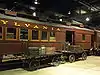 Passenger and Baggage Car No. 4639 |
December 17, 1979 (#79002276) |
Railroad Museum of Pennsylvania 39°58′56″N 76°09′40″W |
Strasburg Township | |
| 102 | Passenger Coach No. 3556 | 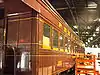 Passenger Coach No. 3556 |
December 17, 1979 (#79002270) |
Railroad Museum of Pennsylvania 39°58′56″N 76°09′40″W |
Strasburg Township | |
| 103 | Passenger Day Coach No. 8177 |  Passenger Day Coach No. 8177 |
December 17, 1979 (#79002271) |
Railroad Museum of Pennsylvania 39°58′56″N 76°09′40″W |
Strasburg Township | |
| 104 | Passenger Locomotive No. 1223 | 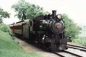 Passenger Locomotive No. 1223 |
December 17, 1979 (#79002272) |
Railroad Museum of Pennsylvania 39°58′56″N 76°09′40″W |
Strasburg Township | |
| 105 | Passenger Locomotive No. 1737 | 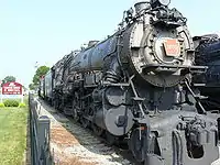 Passenger Locomotive No. 1737 |
December 17, 1979 (#79002273) |
Railroad Museum of Pennsylvania 39°58′56″N 76°09′40″W |
Strasburg Township | |
| 106 | Passenger Locomotive No. 460 | 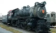 Passenger Locomotive No. 460 |
December 17, 1979 (#79002274) |
Railroad Museum of Pennsylvania 39°58′56″N 76°09′40″W |
Strasburg Township | |
| 107 | Passenger Locomotive No. 7002 | 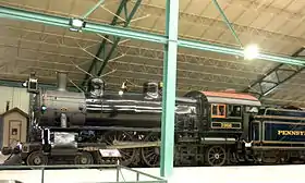 Passenger Locomotive No. 7002 |
December 17, 1979 (#79002275) |
Railroad Museum of Pennsylvania 39°58′56″N 76°09′40″W |
Strasburg Township | |
| 108 | Pine Grove Covered Bridge |  Pine Grove Covered Bridge |
December 11, 1980 (#80003521) |
Southeast of Kirkwood on Legislative Route 36018 39°47′37″N 76°02′41″W |
Little Britain Township | Extends into Chester County |
| 109 | Pinetown Covered Bridge | 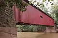 Pinetown Covered Bridge |
December 11, 1980 (#80003527) |
East of Lancaster on Township 620 40°06′20″N 76°14′55″W |
Upper Leacock and Manheim Townships | |
| 110 | Pool Forge Covered Bridge | 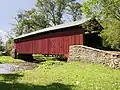 Pool Forge Covered Bridge |
December 11, 1980 (#80003510) |
Northwest of Churchtown on Township 773 40°08′27″N 76°00′00″W |
Caernarvon Township | |
| 111 | Poole Forge | 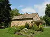 Poole Forge |
April 29, 1993 (#93000351) |
1936, 1938, 1940 and 1942 Main Street, Narvon 40°07′50″N 75°58′35″W |
Caernarvon Township | |
| 112 | Red Run Covered Bridge | 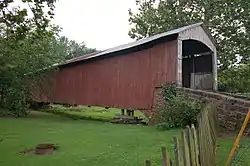 Red Run Covered Bridge |
December 11, 1980 (#80003539) |
Northwest of Terre Hill west of Township 816 40°10′32″N 76°04′55″W |
Brecknock Township | |
| 113 | Reinholds Station Trinity Chapel | 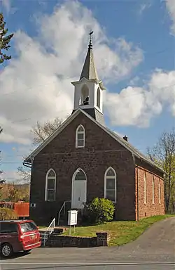 Reinholds Station Trinity Chapel |
September 5, 1990 (#90001412) |
114 East Main Street 40°15′57″N 76°06′45″W |
Reinholds | |
| 114 | Peter and Catherine Reyer Farmhouse | 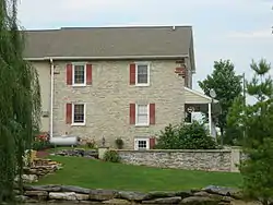 Peter and Catherine Reyer Farmhouse |
November 7, 1996 (#96001314) |
Trout Run Road, west of junction with Pennsylvania Route 272 40°11′39″N 76°10′45″W |
Ephrata Township | |
| 115 | Roberts Farm Site (36LA1) | April 3, 1986 (#86000830) |
On a knoll above the Conestoga River, just before its confluence with the Susquehanna River[11] 39°56′42″N 76°22′27″W |
Manor Township | ||
| 116 | Siegrist's Mill Covered Bridge | 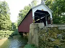 Siegrist's Mill Covered Bridge |
December 10, 1980 (#80003513) |
Northeast of Columbia on Township 360 40°04′33″N 76°28′17″W |
Rapho and West Hempfield Townships | Damaged by Tropical Storm Lee in 2011 |
| 117 | Shearer's Covered Bridge | 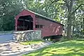 Shearer's Covered Bridge |
December 10, 1980 (#80003532) |
High School Memorial Park 40°10′19″N 76°23′25″W |
Manheim | |
| 118 | Shenk's Mill Covered Bridge | 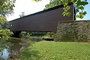 Shenk's Mill Covered Bridge |
December 10, 1980 (#80003531) |
South of Manheim on Township 372, East Hempfield/Rapho Townships 40°06′56″N 76°25′32″W |
East Hempfield and Rapho Townships | |
| 119 | Shenks Ferry Site (36LA2) | March 3, 1982 (#82004655) |
Along Grubbs Creek, ¾ mile above the Susquehanna River[12] 39°54′18″N 76°21′37″W |
Martic Township | ||
| 120 | Shreiner Farm |  Shreiner Farm |
August 30, 1994 (#94001058) |
Oregon Pike north side, .3 miles (0.48 km) east of Suncrest Road 40°06′03″N 76°15′59″W |
Manheim Township | |
| 121 | Shultz-Funk Site (36LA7 and 36LA9) |  Shultz-Funk Site (36LA7 and 36LA9) |
March 3, 1982 (#82003796) |
Above the Susquehanna River near Washington Boro, immediately south of Witmer's Run[13] 39°58′36″N 76°27′34″W |
Manor Township | |
| 122 | Speedwell Forge |  Speedwell Forge |
May 24, 2006 (#06000429) |
465 Speedwell Forge Road 40°13′07″N 76°19′51″W |
Elizabeth Township | |
| 123 | Spring Grove Forge Mansion | 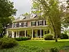 Spring Grove Forge Mansion |
July 11, 1984 (#84003447) |
Spring Grove Road 40°08′41″N 76°01′17″W |
East Earl Township | |
| 124 | Christian Stauffer House |  Christian Stauffer House |
October 16, 1986 (#86002889) |
Millcross Road 40°03′36″N 76°15′17″W |
East Lampeter Township | |
| 125 | Steel Hopper Car No. 33164 | 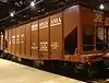 Steel Hopper Car No. 33164 |
December 17, 1979 (#79002277) |
Railroad Museum of Pennsylvania 39°58′56″N 76°09′40″W |
Strasburg Township | |
| 126 | Steel Passenger Coach No. 1650 | 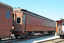 Steel Passenger Coach No. 1650 |
December 17, 1979 (#79002278) |
Railroad Museum of Pennsylvania 39°58′56″N 76°09′40″W |
Strasburg Township | |
| 127 | Steel Passenger Coach No. 1651 |  Steel Passenger Coach No. 1651 |
December 17, 1979 (#79002279) |
Railroad Museum of Pennsylvania 39°58′56″N 76°09′40″W |
Strasburg Township | |
| 128 | Stiegel-Coleman House |  Stiegel-Coleman House |
November 13, 1966 (#66000668) |
Pennsylvania Route 501 and U.S. Route 322, Brickerville 40°14′16″N 76°17′44″W |
Elizabeth Township | |
| 129 | Stehli Silk Mill | 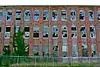 Stehli Silk Mill |
April 29, 2014 (#14000195) |
701 Martha Avenue 40°03′16″N 76°17′42″W |
Manheim Township | |
| 130 | John Casper Stoever Log House |  John Casper Stoever Log House |
January 6, 1987 (#86003561) |
200 West Main Street 40°06′04″N 76°05′33″W |
New Holland | |
| 131 | Strasburg Historic District |  Strasburg Historic District |
March 3, 1983 (#83002258) |
East and West Main, West Miller, South Decatur Streets 39°58′51″N 76°11′15″W |
Strasburg | |
| 132 | Strickler Site |  Strickler Site |
June 18, 1973 (#73001638) |
¾ mile north of Creswell Station, and 1 mile south of Washington Boro[14][15] 39°58′48″N 76°27′40″W |
Manor Township | |
| 133 | Julius Sturgis Pretzel House |  Julius Sturgis Pretzel House |
December 16, 1974 (#74001789) |
219–221 East Main Street 40°09′23″N 76°18′02″W |
Lititz | |
| 134 | Johann Agust Sutter House |  Johann Agust Sutter House |
April 20, 1982 (#82003795) |
17–19 East Main Street 40°09′26″N 76°18′24″W |
Lititz | |
| 135 | John and Elizabeth Swarr House | 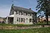 John and Elizabeth Swarr House |
April 24, 2020 (#100005207) |
3000 Crossings Blvd. 40°03′30″N 76°20′28″W |
Manheim Township | |
| 136 | Switcher No. 1670 | 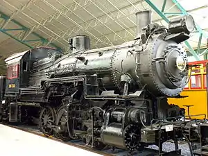 Switcher No. 1670 |
December 17, 1979 (#79002280) |
Railroad Museum of Pennsylvania 39°58′56″N 76°09′40″W |
Strasburg Township | |
| 137 | Switcher No. 94 | 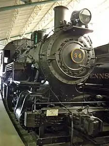 Switcher No. 94 |
December 17, 1979 (#79002281) |
Railroad Museum of Pennsylvania 39°58′56″N 76°09′40″W |
Strasburg Township | |
| 138 | Totten House | 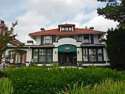 Totten House |
February 3, 1989 (#89000003) |
1049 East King Street 40°02′22″N 76°16′56″W |
Lancaster Township | |
| 139 | Henry Walter House | 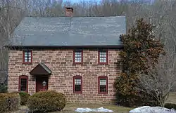 Henry Walter House |
July 26, 1984 (#84003449) |
Greenville Road 40°16′14″N 76°09′17″W |
West Cocalico Township | |
| 140 | Weaver's Mill Covered Bridge | 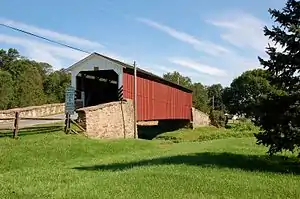 Weaver's Mill Covered Bridge |
December 11, 1980 (#80003511) |
Southwest of Churchtown on Township 773 40°07′47″N 75°58′35″W |
Caernarvon Township | |
| 141 | Henry Weaver Farmstead | _on_the_Henry_Weaver_(Weber)_homestead.JPG.webp) Henry Weaver Farmstead |
December 15, 1978 (#78002422) |
South of Terre Hill off U.S. Route 322 40°08′04″N 76°03′38″W |
East Earl Township | |
| 142 | Weber-Weaver Farm |  Weber-Weaver Farm |
May 27, 1999 (#99000646) |
1835 Pioneer Road 40°00′14″N 76°13′59″W |
West Lampeter Township | |
| 143 | William Werner House | 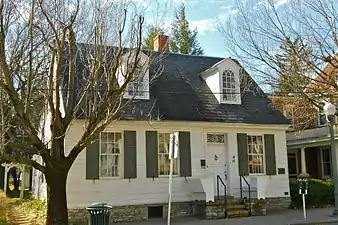 William Werner House |
May 10, 1984 (#84003451) |
66 East Main Street 40°09′24″N 76°18′19″W |
Lititz | |
| 144 | White Chimneys | 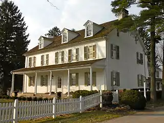 White Chimneys |
April 1, 1975 (#75001644) |
1 mile (1.6 km) northwest of Gap on U.S. Route 30 39°59′43″N 76°02′24″W |
Salisbury Township | |
| 145 | White Rock Forge Covered Bridge |  White Rock Forge Covered Bridge |
December 10, 1980 (#80003522) |
South of Kirkwood on Township 337 39°49′29″N 76°05′25″W |
Colerain and Little Britain Townships | |
| 146 | Windom Mill Farm |  Windom Mill Farm |
August 30, 1994 (#94001062) |
3407 Blue Rock Road 40°00′38″N 76°23′55″W |
Manor Township | |
| 147 | Windsor Forge Mansion |  Windsor Forge Mansion |
January 4, 1990 (#89002283) |
Windsor Road south of Bootjack Road 40°07′40″N 75°57′35″W |
Caernarvon Township | |
| 148 | Witmer's Tavern |  Witmer's Tavern |
December 1, 1978 (#78002416) |
2014 Old Philadelphia Pike 40°02′25″N 76°14′30″W |
East Lampeter Township | |
| 149 | Wooden Baggage Express No. 6 | 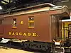 Wooden Baggage Express No. 6 |
December 17, 1979 (#79002282) |
Railroad Museum of Pennsylvania 39°58′56″N 76°09′40″W |
Strasburg Township | |
| 150 | Wooden Express Baggage No. 6076 |  Wooden Express Baggage No. 6076 |
December 17, 1979 (#79002283) |
Railroad Museum of Pennsylvania 39°58′56″N 76°09′40″W |
Strasburg Township | |
| 151 | Wooden Hopper Gondola No. 1818 | 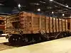 Wooden Hopper Gondola No. 1818 |
December 17, 1979 (#79002284) |
Railroad Museum of Pennsylvania 39°58′56″N 76°09′40″W |
Strasburg Township | |
| 152 | Wright's Ferry Mansion | 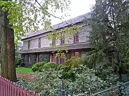 Wright's Ferry Mansion |
November 20, 1979 (#79002253) |
38 South 2nd Street 40°01′46″N 76°30′12″W |
Columbia | |
| 153 | Zook's Mill Covered Bridge | 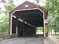 Zook's Mill Covered Bridge |
December 11, 1980 (#80003508) |
West of Brownstown on Township 797 40°07′50″N 76°13′54″W |
Warwick and West Earl Townships |
Former listings
| [3] | Name on the Register | Image | Date listed | Date removed | Location | Municipality | Summary |
|---|---|---|---|---|---|---|---|
| 1 | Jackson's Mill Covered Bridge | 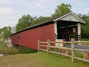 Jackson's Mill Covered Bridge |
December 11, 1980 (#80003520) | June 27, 1986 | North of Kirkwood |
Kirkwood | |
| 2 | Risser's Mill Covered Bridge | 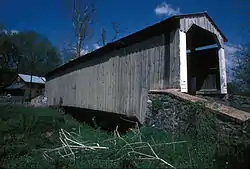 Risser's Mill Covered Bridge |
December 10, 1980 (#80004612) | December 5, 2003 | Southwest of Manheim on LR 36069 |
Manheim | Destroyed by arsonist in 2002. |
See also
| Wikimedia Commons has media related to National Register of Historic Places in Lancaster County, Pennsylvania. |
References
- The latitude and longitude information provided in this table was derived originally from the National Register Information System, which has been found to be fairly accurate for about 99% of listings. Some locations in this table may have been corrected to current GPS standards.
- "National Register of Historic Places: Weekly List Actions". National Park Service, United States Department of the Interior. Retrieved on January 29, 2021.
- Numbers represent an alphabetical ordering by significant words. Various colorings, defined here, differentiate National Historic Landmarks and historic districts from other NRHP buildings, structures, sites or objects.
- The eight-digit number below each date is the number assigned to each location in the National Register Information System database, which can be viewed by clicking the number.
- Location derived from the GNIS feature record for Indian Rock Island; the NRIS lists the site as "Address Restricted"
- Location derived from the historical marker pictured at this webpage; the NRIS lists the site as "Address Restricted"
- Location derived from its GNIS feature record; the NRIS lists the site as "Address Restricted"
- Location derived from its NRHP nomination form; the NRIS lists the site as "Address Restricted"
- Location derived from its NRHP nomination form; the NRIS lists the site as "Address Restricted"
- Location derived from its NRHP nomination form; the NRIS lists the site as "Address Restricted"
- Location derived from its NRHP form; the NRIS lists the site as "Address Restricted"
- Location derived from its NRHP nomination form; the NRIS lists the site as "Address Restricted"
- Cadzow, Donald A. Archaeological Studies of the Susquehannock Indians of Pennsylvania, Safe Harbor Report 2, 156. Accessed 2009-10-20. The NRIS lists the site as "Address Restricted".
- Cadzow, Donald A. Archaeological Studies of the Susquehannock Indians of Pennsylvania, Safe Harbor Report 2, 63. Accessed 2009-10-20.
- Magoon, Dane T. "'Chesapeake' Pipes and Uncritical Assumptions: A View from Northeastern North Carolina". North Carolina Archaeology 48 (1999), 118. Accessed 2009-12-26. The NRIS lists the site as "Address Restricted".
| Topics |  | |
|---|---|---|
| Lists by county |
| |
| Lists by city | ||
| Other lists | ||
| ||