National Register of Historic Places listings in Franklin County, Pennsylvania
This is a list of the National Register of Historic Places listings in Franklin County, Pennsylvania.
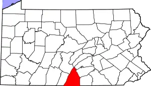
Location of Franklin County in Pennsylvania
This is intended to be a complete list of the properties and districts on the National Register of Historic Places in Franklin County, Pennsylvania, United States. The locations of National Register properties and districts for which the latitude and longitude coordinates are included below, may be seen in a map.[1]
There are 63 properties and districts listed on the National Register in the county. Another property was once listed but has been removed.
- This National Park Service list is complete through NPS recent listings posted January 29, 2021.[2]
Current listings
| [3] | Name on the Register | Image | Date listed[4] | Location | City or town | Description |
|---|---|---|---|---|---|---|
| 1 | Angle Farm | 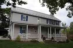 Angle Farm |
November 20, 1979 (#79002231) |
Southeast of Mercersburg 39°45′53″N 77°51′10″W |
Montgomery Township | |
| 2 | Borough Hall of the Borough of Waynesboro |  Borough Hall of the Borough of Waynesboro |
December 2, 1980 (#80003496) |
57 East Main Street 39°45′18″N 77°34′36″W |
Waynesboro | |
| 3 | Bridge between Guilford and Hamilton Townships | 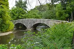 Bridge between Guilford and Hamilton Townships |
June 22, 1988 (#88000776) |
Legislative Route 28033 over Conococheague Creek near Social Island 39°53′09″N 77°42′48″W |
Guilford and Hamilton Townships | |
| 4 | Bridge in Metal Township |  Bridge in Metal Township |
June 22, 1988 (#88000763) |
Legislative Route 45 Spur east over West Branch Conococheague Creek, near Willow Hill 40°07′13″N 77°46′39″W |
Metal Township | |
| 5 | Brotherton Farm | 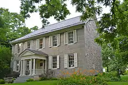 Brotherton Farm |
March 30, 1979 (#79002227) |
Southeast of Chambersburg on Falling Spring Road 39°54′43″N 77°36′58″W |
Guilford Township | |
| 6 | John Brown House | 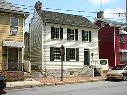 John Brown House |
March 5, 1970 (#70000548) |
225 East King Street 39°56′20″N 77°39′29″W |
Chambersburg | |
| 7 | Jeremiah Burns Farm | 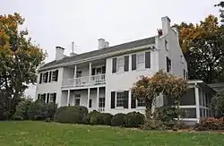 Jeremiah Burns Farm |
August 15, 2002 (#02000065) |
10988 Fish and Game Road 39°45′58″N 77°31′47″W |
Washington Township | |
| 8 | Carrick Furnace |  Carrick Furnace |
September 6, 1991 (#91001133) |
Pennsylvania Route 75 north of Metal 40°01′08″N 77°52′36″W |
Metal Township | |
| 9 | Chambersburg and Bedford Turnpike Road Company Toll House | 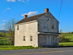 Chambersburg and Bedford Turnpike Road Company Toll House |
January 3, 1978 (#78002404) |
West of St. Thomas on U.S. Route 30 39°54′47″N 77°48′50″W |
St. Thomas Township | |
| 10 | Chambersburg Historic District | 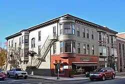 Chambersburg Historic District |
August 26, 1982 (#82003789) |
U.S. Routes 11 and 30 39°55′44″N 77°39′41″W |
Chambersburg | |
| 11 | Church Hill Farm | 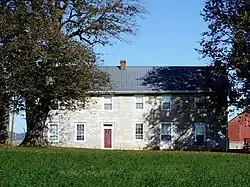 Church Hill Farm |
December 2, 1980 (#80003498) |
Northeast of Mercersburg at 8941 Kings Lane 39°50′21″N 77°51′11″W |
Peters Township | |
| 12 | Coldbrook Farm |  Coldbrook Farm |
March 28, 1996 (#96000321) |
955 Spring Lane 39°56′07″N 77°38′32″W |
Chambersburg | |
| 13 | Corker Hill | 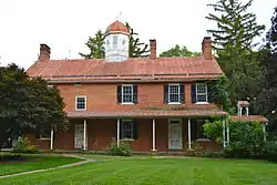 Corker Hill |
March 18, 2003 (#03000131) |
1237 Garver Lane, Scotland 39°58′27″N 77°34′51″W |
Greene Township | |
| 14 | Culbertson-Harbison Farm | 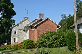 Culbertson-Harbison Farm |
June 27, 1980 (#80003499) |
South of Nyesville on Nyesville Road 40°01′02″N 77°37′44″W |
Greene Township | |
| 15 | Widow Donaldson Place | 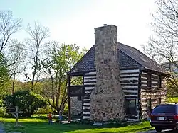 Widow Donaldson Place |
November 5, 1987 (#87001983) |
177 Bear Valley Road near Fort Loudon 39°54′48″N 77°53′45″W |
Peters Township | |
| 16 | Findlay Farm | 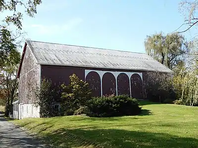 Findlay Farm |
April 21, 1983 (#83002245) |
6801 Findlay Road near Lamasters 39°49′50″N 77°51′55″W |
Peters Township | |
| 17 | James Finley House | 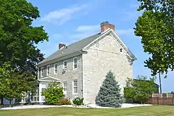 James Finley House |
November 19, 1974 (#74001783) |
Building No. 505, Letterkenny Army Depot 39°59′56″N 77°38′19″W |
Greene Township | |
| 18 | Franklin County Courthouse | 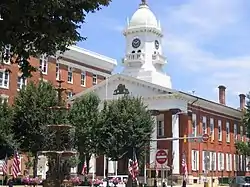 Franklin County Courthouse |
January 18, 1974 (#74001784) |
1 North Main Street, on Memorial Sq. 39°56′15″N 77°39′38″W |
Chambersburg | |
| 19 | Franklin County Jail | 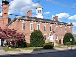 Franklin County Jail |
January 21, 1970 (#70000549) |
Northwestern corner of King and 2nd Streets 39°56′21″N 77°39′33″W |
Chambersburg | |
| 20 | Franklin Furnace Historic District |  Franklin Furnace Historic District |
September 6, 1991 (#91001136) |
Roughly bounded by Circle Drive and Cinder Street, near Edenville 39°57′32″N 77°49′21″W |
St. Thomas Township | |
| 21 | Gass House | 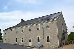 Gass House |
April 11, 1977 (#77001168) |
East of Chambersburg off U.S. Route 30 39°55′46″N 77°37′46″W |
Guilford Township | |
| 22 | Greencastle Historic District | 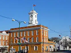 Greencastle Historic District |
December 24, 1992 (#92001722) |
Roughly bounded by Washington, Pennsylvania Route 2002, Jefferson, Mifflin, Chambers, Grant and Allison, and Baltimore north to Spring Grove 39°47′20″N 77°43′30″W |
Greencastle | |
| 23 | Alexander Hamilton House | 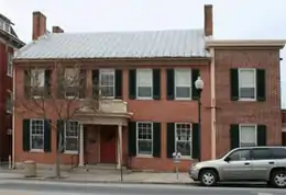 Alexander Hamilton House |
June 27, 1980 (#80003501) |
45 East Main Street 39°45′18″N 77°34′35″W |
Waynesboro | |
| 24 | Handycraft Farmstead | 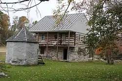 Handycraft Farmstead |
August 22, 2002 (#02000893) |
11071 Country Club Road 39°45′49″N 77°32′03″W |
Washington Township | |
| 25 | Harbaugh's Reformed Church | 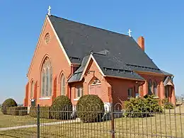 Harbaugh's Reformed Church |
March 20, 2002 (#02000228) |
14301 and 14269 Harbaugh Church Road 39°43′16″N 77°32′02″W |
Washington Township | |
| 26 | Hays Bridge Historic District | 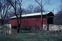 Hays Bridge Historic District |
July 31, 1978 (#78002402) |
East of Mercersburg on Pennsylvania Routes 331 and 328 39°47′19″N 77°51′15″W |
Montgomery Township | |
| 27 | Horse Valley Bridge | 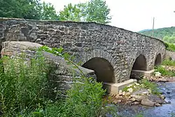 Horse Valley Bridge |
June 22, 1988 (#88000775) |
Legislative Route 28093 over Conodoguinet Creek near Upper Strasburg 40°03′57″N 77°45′34″W |
Letterkenny Township | |
| 28 | Irwinton Historic District | 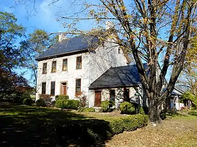 Irwinton Historic District |
December 26, 2012 (#12001096) |
9717 & 9685 Anderson Rd. 39°47′22″N 77°50′56″W |
Montgomery Township | |
| 29 | Robert Kennedy Memorial Presbyterian Church | 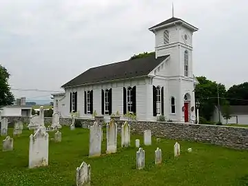 Robert Kennedy Memorial Presbyterian Church |
June 6, 2009 (#09000385) |
11799 Mercersburg Road 39°45′51″N 77°51′09″W |
Montgomery Township | |
| 30 | Lane House |  Lane House |
January 13, 1972 (#72001123) |
14 North Main Street 39°49′44″N 77°54′17″W |
Mercersburg | |
| 31 | Mansfield | 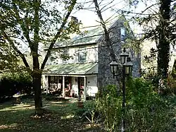 Mansfield |
April 26, 1979 (#79002232) |
Southeast of Mercersburg 39°47′34″N 77°51′44″W |
Montgomery Township | |
| 32 | Martin's Mill Covered Bridge |  Martin's Mill Covered Bridge |
February 15, 1974 (#74001786) |
Southwest of Greencastle over Conococheague Creek 39°45′53″N 77°46′33″W |
Antrim Township | |
| 33 | Masonic Temple | 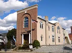 Masonic Temple |
June 18, 1976 (#76001640) |
74 South 2nd Street 39°56′09″N 77°39′33″W |
Chambersburg | |
| 34 | McClay's Twin Bridge (East) | .jpg.webp) McClay's Twin Bridge (East) |
June 22, 1988 (#88000777) |
Legislative Route 28010 over a tributary of Conodoguinet Creek, near Middle Spring 40°05′54″N 77°34′15″W |
Lurgan and Southampton Townships | |
| 35 | McClay's Twin Bridge (West) | .jpg.webp) McClay's Twin Bridge (West) |
June 22, 1988 (#88000779) |
Legislative Route 28010 over Conodoguinet Creek, near Middle Spring 40°05′53″N 77°34′12″W |
Lurgan Township | |
| 36 | McCoy-Shoemaker Farm | 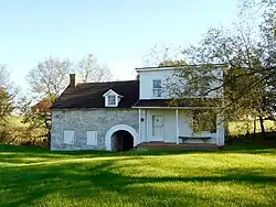 McCoy-Shoemaker Farm |
June 27, 1980 (#80003500) |
Southwest of Upton on Pennsylvania Route 995 39°47′57″N 77°49′20″W |
Peters Township | |
| 37 | Memorial Fountain and Statue |  Memorial Fountain and Statue |
May 19, 1978 (#78002400) |
Memorial Square 39°56′15″N 77°39′41″W |
Chambersburg | |
| 38 | Mercersburg Academy | 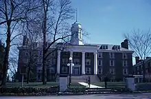 Mercersburg Academy |
June 21, 1984 (#84003374) |
Pennsylvania Route 16 39°49′34″N 77°53′54″W |
Mercersburg | |
| 39 | Mercersburg Historic District | 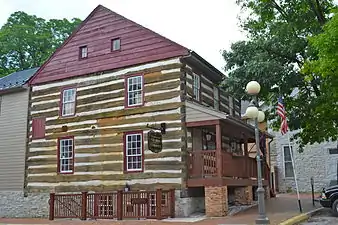 Mercersburg Historic District |
December 13, 1978(boundary increase May 17, 1989) (#78002403) |
Main and Seminary Streets 39°49′38″N 77°54′12″W |
Mercersburg | |
| 40 | Millmont Farm | 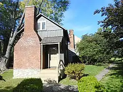 Millmont Farm |
April 27, 1979 (#79002233) |
East of Mercersburg at the junction of Pennsylvania Routes 16 and 416 39°48′16″N 77°52′24″W |
Montgomery Township | |
| 41 | Mitchell-Shook House | 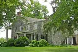 Mitchell-Shook House |
September 17, 1980 (#80003497) |
Leitersburg Street 39°46′48″N 77°43′26″W |
Greencastle | |
| 42 | Monterey Historic District | 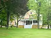 Monterey Historic District |
April 22, 1976 (#76001639) |
Off Pennsylvania Route 16 near Blue Ridge Summit 39°44′10″N 77°28′09″W |
Washington Township | |
| 43 | Mt. Pleasant Iron Works House | 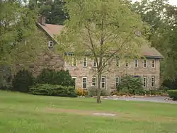 Mt. Pleasant Iron Works House |
December 31, 1974 (#74001785) |
About 4 miles (6.4 km) north of Fort Loudon on Pennsylvania Route 75 39°57′53″N 77°53′58″W |
Metal Township | |
| 44 | Old Brown's Mill School | 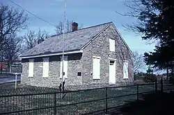 Old Brown's Mill School |
March 7, 1973 (#73001632) |
Off U.S. Route 11 near Kauffman 39°49′50″N 77°42′08″W |
Antrim Township | |
| 45 | Joseph J. Oller House | 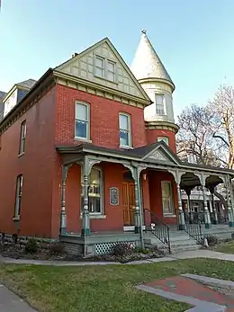 Joseph J. Oller House |
June 28, 1996 (#96000707) |
138 West Main Street 39°45′26″N 77°34′53″W |
Waynesboro | |
| 46 | Red Run Lodge | 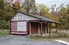 Red Run Lodge |
February 16, 1996 (#96000083) |
Buchanan Trail East (Pennsylvania Route 16) near Rouzerville 39°44′13″N 77°31′03″W |
Washington Township | |
| 47 | Rock Hill Farm | 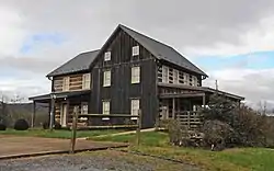 Rock Hill Farm |
July 28, 1999 (#99000880) |
12995 and 12755 Bain Road near Mercersburg 39°45′07″N 77°52′08″W |
Montgomery Township | |
| 48 | Rocky Spring Presbyterian Church | 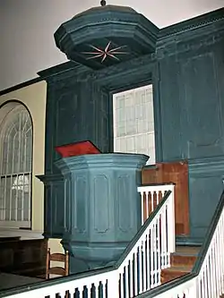 Rocky Spring Presbyterian Church |
May 13, 1994 (#94000430) |
Rocky Spring Road, approximately 0.5 miles (0.80 km) northwest of Funk Road 39°59′19″N 77°40′35″W |
Letterkenny Township | |
| 49 | Royer-Nicodemus House and Farm |  Royer-Nicodemus House and Farm |
August 28, 1976 (#76001641) |
1010 East Main Street 39°44′35″N 77°33′44″W |
Waynesboro | |
| 50 | Skinner Tavern | 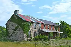 Skinner Tavern |
July 27, 2005 (#05000757) |
13361 Upper Strasburg Road 40°04′07″N 77°45′53″W |
Letterkenny Township | |
| 51 | Spring Grove Farm and Distillery | 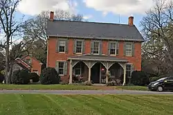 Spring Grove Farm and Distillery |
August 10, 1979 (#79002229) |
Northwest of Greencastle on Williamsport Pike 39°45′33″N 77°45′31″W |
Antrim Township | |
| 52 | Springdale Mills |  Springdale Mills |
September 18, 1975 (#75001642) |
Southeast of Waynesboro off Pennsylvania Route 16 on Amsterdam Road 39°44′05″N 77°32′56″W |
Washington Township | |
| 53 | Stover-Winger Farm | 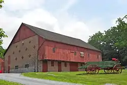 Stover-Winger Farm |
August 24, 1979 (#79002230) |
Leitersburg Road near Greencastle 39°46′44″N 77°43′12″W |
Antrim Township | |
| 54 | Townhouse Row | 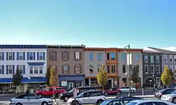 Townhouse Row |
December 18, 1978 (#78002401) |
57–85 North Main Street 39°56′20″N 77°39′40″W |
Chambersburg | |
| 55 | Waynesboro Armory | 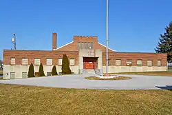 Waynesboro Armory |
December 22, 1989 (#89002080) |
410 North Grant Street near Waynesboro 39°45′56″N 77°34′45″W |
Waynesboro | |
| 56 | Waynesboro Historic District | April 24, 2020 (#100005205) |
Main St. corridor between Franklin St., and Clayton Ave., and Clayton Ave. between Main St. and 5th St., including adjacent blocks and cross streets 39°45′20″N 77°34′40″W |
Waynesboro | ||
| 57 | Welty's Mill Bridge |  Welty's Mill Bridge |
January 6, 1983 (#83002246) |
South of Waynesboro on Pennsylvania Route 997 39°44′16″N 77°34′20″W |
Washington Township | |
| 58 | White House Inn |  White House Inn |
February 27, 1986 (#86000304) |
10111 Lincoln Way West 39°54′13″N 77°51′15″W |
Peters Township | |
| 59 | Wilson College |  Wilson College |
July 21, 1995 (#95000888) |
1015 Philadelphia Avenue 39°57′02″N 77°39′20″W |
Chambersburg | |
| 60 | Woodland | 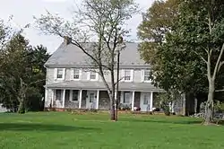 Woodland |
September 20, 1973 (#73001633) |
Southwest of St. Thomas on Pennsylvania Route 416 39°53′50″N 77°50′03″W |
St. Thomas Township | |
| 61 | Col. John Work House | 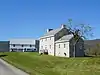 Col. John Work House |
November 20, 1979 (#79002234) |
Southeast of Mercersburg 39°47′48″N 77°56′27″W |
Montgomery Township | |
| 62 | Yeakle's Mill Bridge | 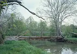 Yeakle's Mill Bridge |
November 14, 1988 (#88002169) |
Legislative Route 28042 over Little Cove Creek 39°44′06″N 78°02′15″W |
Warren Township | Replaced in 2007 |
| 63 | Zion Reformed Church | 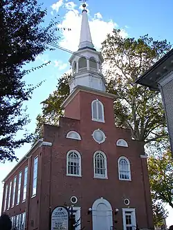 Zion Reformed Church |
December 17, 1979 (#79002228) |
South Main and West Liberty Streets 39°55′58″N 77°39′45″W |
Chambersburg |
Former listing
| [3] | Name on the Register | Image | Date listed | Date removed | Location | City or town | Summary |
|---|---|---|---|---|---|---|---|
| 1 | J. Allison Eyster Farmstead | unknown (#65008819) | May 8, 2017 | Guilford Spring Rd. |
Chambersburg |
See also
| Wikimedia Commons has media related to National Register of Historic Places in Franklin County, Pennsylvania. |
References
- The latitude and longitude information provided in this table was derived originally from the National Register Information System, which has been found to be fairly accurate for about 99% of listings. Some locations in this table may have been corrected to current GPS standards.
- "National Register of Historic Places: Weekly List Actions". National Park Service, United States Department of the Interior. Retrieved on January 29, 2021.
- Numbers represent an alphabetical ordering by significant words. Various colorings, defined here, differentiate National Historic Landmarks and historic districts from other NRHP buildings, structures, sites or objects.
- The eight-digit number below each date is the number assigned to each location in the National Register Information System database, which can be viewed by clicking the number.
| Topics |  | |
|---|---|---|
| Lists by county |
| |
| Lists by city | ||
| Other lists | ||
| ||
Municipalities and communities of Franklin County, Pennsylvania, United States | ||
|---|---|---|
| Boroughs | | |
| Townships | ||
| CDPs | ||
| Unincorporated communities |
| |
| Footnotes | ‡This populated place also has portions in an adjacent county or counties | |
| ||
This article is issued from Wikipedia. The text is licensed under Creative Commons - Attribution - Sharealike. Additional terms may apply for the media files.