National Register of Historic Places listings in Charlotte County, Virginia
This is a list of the National Register of Historic Places listings in Charlotte County, Virginia.
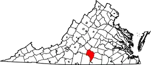
Location of Charlotte County in Virginia
This is intended to be a complete list of the properties and districts on the National Register of Historic Places in Charlotte County, Virginia, United States. The locations of National Register properties and districts for which the latitude and longitude coordinates are included below, may be seen in a Google map.[1]
There are 19 properties and districts listed on the National Register in the county.
- This National Park Service list is complete through NPS recent listings posted January 29, 2021.[2]
Current listings
| [3] | Name on the Register[4] | Image | Date listed[5] | Location | City or town | Description |
|---|---|---|---|---|---|---|
| 1 | Annefield |  Annefield |
November 12, 2009 (#09000920) |
3200 Sunny Side Rd. 36°55′41″N 78°37′21″W |
Saxe | |
| 2 | Charlotte County Courthouse |  Charlotte County Courthouse |
May 7, 1980 (#80004178) |
State Routes 40 and 47 37°03′22″N 78°38′15″W |
Charlotte Court House | |
| 3 | Charlotte Court House Historic District |  Charlotte Court House Historic District |
February 8, 1995 (#95000023) |
State Route 40 between Evergreen Rd. and State Route 47 37°03′23″N 78°38′17″W |
Charlotte Court House | |
| 4 | Clarkton Bridge |  Clarkton Bridge |
January 26, 2007 (#06000747) |
Clarkton Bridge Rd. over the Staunton River 36°58′42″N 78°53′48″W |
Nathalie | Extends into Halifax County |
| 5 | Four Locust Farm |  Four Locust Farm |
December 3, 2009 (#09001053) |
U.S. Route 15 37°03′48″N 78°28′30″W |
Keysville | |
| 6 | Gravel Hill |  Gravel Hill |
February 16, 2001 (#01000150) |
3990 Fearstown Rd. 37°02′14″N 78°44′41″W |
Charlotte Court House | |
| 7 | Greenfield |  Greenfield |
April 2, 1973 (#73002000) |
East of Charlotte Court House on Greenfield Rd. 37°04′01″N 78°35′02″W |
Charlotte Court House | |
| 8 | Keysville Railroad Station | Keysville Railroad Station |
November 12, 2008 (#08001050) |
Railroad Ave. 37°02′23″N 78°29′06″W |
Keysville | |
| 9 | Maple Roads | 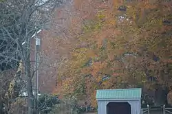 Maple Roads |
September 14, 2002 (#02000999) |
1325 Richardson Rd. 37°03′44″N 78°31′21″W |
Keysville | |
| 10 | Mulberry Hill | .jpg.webp) Mulberry Hill |
March 20, 1973 (#73002001) |
North of Randolph on Roanoke Creek Rd. 36°54′31″N 78°41′56″W |
Randolph | |
| 11 | Red Hill |  Red Hill |
February 14, 1978 (#78003012) |
Southeast of Brookneal on Red Hill Rd. 37°01′56″N 78°53′53″W |
Brookneal | |
| 12 | Roanoke Plantation | 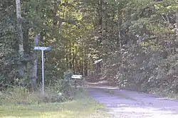 Roanoke Plantation |
April 11, 1973 (#73002002) |
West of Saxe off Scuffletown Rd. 36°55′17″N 78°42′35″W |
Saxe | |
| 13 | Salem School | 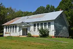 Salem School |
October 30, 1998 (#98001309) |
Junction of Tobacco Hill and Cargills Creek Rds. 36°46′10″N 78°38′13″W |
Red Oak | |
| 14 | Staunton Hill |  Staunton Hill |
October 1, 1969 (#69000229) |
Southwest of the junction of Terrell and Staunton Creek Rds. 36°59′35″N 78°51′09″W |
Brookneal | |
| 15 | Toombs Tobacco Farm | 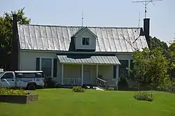 Toombs Tobacco Farm |
January 28, 2000 (#00000027) |
1125 Tates Mill Rd. 36°47′17″N 78°35′36″W |
Red Oak | |
| 16 | Wade Archeological Site (44CH0062) | 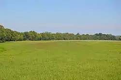 Wade Archeological Site (44CH0062) |
October 23, 2003 (#03001194) |
1035 Fort Hill Trail 36°53′13″N 78°42′17″W |
Randolph | |
| 17 | Watkins House |  Watkins House |
May 27, 2004 (#04000549) |
3115 Briery Rd. 37°04′19″N 78°30′25″W |
Keysville | |
| 18 | Westview | 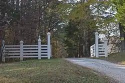 Westview |
February 4, 2000 (#00000067) |
1672 Terrell Rd. 37°01′43″N 78°51′50″W |
Brookneal | |
| 19 | Woodfork | 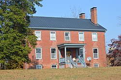 Woodfork |
January 24, 2002 (#01001509) |
3704 Woodfork Rd. 37°06′04″N 78°40′00″W |
Charlotte Court House |
See also
| Wikimedia Commons has media related to National Register of Historic Places in Charlotte County, Virginia. |
References
- The latitude and longitude information provided in this table was derived originally from the National Register Information System, which has been found to be fairly accurate for about 99% of listings. Some locations in this table may have been corrected to current GPS standards.
- "National Register of Historic Places: Weekly List Actions". National Park Service, United States Department of the Interior. Retrieved on January 29, 2021.
- Numbers represent an alphabetical ordering by significant words. Various colorings, defined here, differentiate National Historic Landmarks and historic districts from other NRHP buildings, structures, sites or objects.
- "National Register Information System". National Register of Historic Places. National Park Service. April 24, 2008.
- The eight-digit number below each date is the number assigned to each location in the National Register Information System database, which can be viewed by clicking the number.

Municipalities and communities of Charlotte County, Virginia, United States | ||
|---|---|---|
| Towns | Map of Virginia highlighting Charlotte County | |
| Unincorporated communities | ||
| ||
This article is issued from Wikipedia. The text is licensed under Creative Commons - Attribution - Sharealike. Additional terms may apply for the media files.