Meppadi
Meppadi is a town in the Indian state of Kerala. It is an extremely scenic hill station on the State Highway between Kozhikode and Ooty. The nearest city is Kalpetta which is the headquarters of the Wayanad revenue district.
Meppadi | |
|---|---|
Town/Village | |
.jpg.webp) | |
 Meppadi | |
| Coordinates: 11.55786°N 76.13199°E | |
| Country | India |
| State | Kerala |
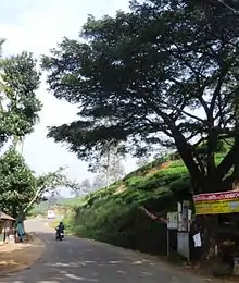
Onnam Mile, Meppadi
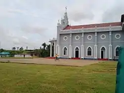
St.Josephs Church, Meppadi

School on Chundale Road, Meppadi
Economy
Tea cultivation is the main economic activity of Meppadi village. There are also some vegetable cultivation on small scale. Most of the people living in Meppadi are workers in various tea estates where they cultivate cardamom too. There is a small town catering to locals and the tourists. The tourists come to enjoy the salubrious climate of the place.[1]
Distance
Meppadi is 12 km from Kalpetta town in the Wayanad District. It is 78 km from Kozhikode (Calicut), 106 km from Ooty, and 281 km from Bangalore.[2]
Tourist attractions
- Kanthanpara Water falls
- Soochipara Falls
- Meenmutty Falls, Wayanad
- Edakkal Caves
- Pookot Lake
- Chembra Peak
- Karapuzha Dam
- Vellarimala
- Sunrise valley
- Karapuzha Dam
- Thanhilode[3]
Image gallery
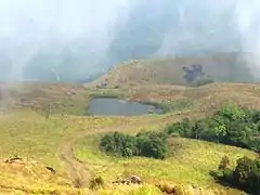 Chembra
 Entering Soochippara
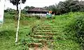 Muster Office
 St.Josephs School
 Inside the St.Joseph Church
See also
- Chundale town
- Kalpetta town
- Mango Orange village
- Vaduvanchal town
References
| Wikimedia Commons has media related to Meppadi. |
| Wikivoyage has a travel guide for Meppadi. |
| History of Wayanad | |||||
|---|---|---|---|---|---|
| Cities | |||||
| Transport |
| ||||
| Education in Wayanad |
| ||||
| Visitor attractions | |||||
| Places of worship | |||||
| Other topics | |||||
| |||||
This article is issued from Wikipedia. The text is licensed under Creative Commons - Attribution - Sharealike. Additional terms may apply for the media files.