Marquion
Marquion is a commune in the Pas-de-Calais department in the Hauts-de-France region of France.
Marquion | |
|---|---|
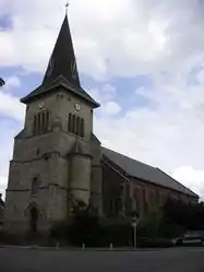 The church of Marquion | |
 Coat of arms | |
Location of Marquion 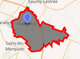
| |
 Marquion  Marquion | |
| Coordinates: 50°12′42″N 3°05′12″E | |
| Country | France |
| Region | Hauts-de-France |
| Department | Pas-de-Calais |
| Arrondissement | Arras |
| Canton | Bapaume |
| Intercommunality | CC Osartis Marquion |
| Government | |
| • Mayor (2008–2014) | Julien Olivier |
| Area 1 | 8.22 km2 (3.17 sq mi) |
| Population (2017-01-01)[1] | 976 |
| • Density | 120/km2 (310/sq mi) |
| Time zone | UTC+01:00 (CET) |
| • Summer (DST) | UTC+02:00 (CEST) |
| INSEE/Postal code | 62559 /62860 |
| Elevation | 43–79 m (141–259 ft) (avg. 52 m or 171 ft) |
| 1 French Land Register data, which excludes lakes, ponds, glaciers > 1 km2 (0.386 sq mi or 247 acres) and river estuaries. | |
Geography
Marquion is a farming and light industrial village situated 18 miles (29 km) southwest of Arras, at the junction of the D939 and the D15 roads. Junction 8 of the A26 autoroute is just a mile away.
Population
| Year | Pop. | ±% p.a. |
|---|---|---|
| 1968 | 859 | — |
| 1975 | 874 | +0.25% |
| 1982 | 887 | +0.21% |
| 1990 | 947 | +0.82% |
| 1999 | 1,008 | +0.70% |
| 2007 | 953 | −0.70% |
| 2012 | 963 | +0.21% |
| 2017 | 976 | +0.27% |
| Source: INSEE[2] | ||
Places of interest
- The church of St. Aignan dating from the sixteenth century.
References
- "Populations légales 2017". INSEE. Retrieved 6 January 2020.
- Population en historique depuis 1968, INSEE
External links
| Wikimedia Commons has media related to Marquion. |
- The orchestra of the commune - Harmonie de Marquion (in French)
- Marquion on the Quid website (in French)
| Authority control |
|---|
This article is issued from Wikipedia. The text is licensed under Creative Commons - Attribution - Sharealike. Additional terms may apply for the media files.