List of Ancestral Puebloan dwellings in New Mexico
This is a list of Ancestral Puebloan dwellings in New Mexico, United States.
| Part of a series on |
| Ancestral Puebloan dwellings |
|---|
Locations
| Site name | Pueblo people | Nearest town (modern name) | Location | Type | Description | Photo | |
|---|---|---|---|---|---|---|---|
| Abó | Tiwa/Tompiro | Mountainair | Ruins located in the Salinas Pueblo Missions National Monument. | 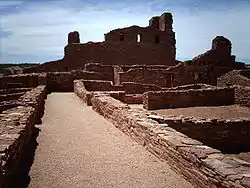 | |||
| Acacagua | Ruins | ||||||
| Acoma | Keres | Village | Also called "Sky City", Acoma is an active pueblo. A National Historic Landmark and a National Trust Historic Site. Home of one of the 21 federally recognized Pueblos. | 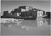 | |||
| Acoti | Taos | Ruins. The "birth place of Montezuma". | |||||
| Alameda | Tiwa | Bernalillo | Great House | Ruins. Located on the present-day site of Alameda Elementary School. One of the 12 pueblos of Tiwa Indians along both sides of the Rio Grande, north and south of present-day Bernalillo | |||
| Apache Creek | Mogollon | Apache Creek | Ruins with as many as 25 rooms.[1][2] | ||||
| Arroyo Hondo | Tano | Galisteo | Great House | Ruins located on the Galisteo Basin also known as Kua-Kay. 24 great houses with about 1200 rooms total, each about three stories high, surrounded eight plazas, and had at least eight kivas. The inhabitants also constructed an acequia system (irrigation ditch) from a permanent spring below the pueblo to their fields. | |||
| Atica | Ruins. Juan de Oñate identified this pueblo in 1598. Its location is lost. | ||||||
| Aychini | Ruins. Juan de Oñate identified this pueblo in 1598. Its location is lost. | ||||||
| Aztec Ruins | Ancestral Puebloan | Aztec | Great House | Ruins. A National Monument, an historical property of the National Park Service, listed on the National Register of Historic Places, added to the UNESCO list of World Heritage Sites, and part of the Chaco Culture National Historical Park. | 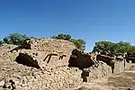 | ||
| Baguacat | Ruins. Juan de Oñate identified this pueblo in 1598. Its location is lost. | ||||||
| Bandelier | Los Alamos |  | |||||
| Burnt Corn | Tano | Galisteo | Great House | Ruins located on the Galisteo Basin also known as Burned Corn Pueblo, or Burnt Corn Ruin. As many as 20 great houses surrounded a central plaza with an unknown number of kivas. | |||
| Casa Blanca | Ruins. Juan de Oñate identified this pueblo in 1598. Its location is lost. | ||||||
| Casa del Eco | Great House | Ruins. Juan de Oñate identified this pueblo in 1598. Its location is lost. | |||||
| Casa Montezuma | Ruins | ||||||
| Castildavid | Ruins | ||||||
| Caceres | Tiwa | Bernalillo | Great House | Ruins. One of the 12 pueblos of Tiwa Indians along both sides of the Rio Grande, north and south of present-day Bernalillo | |||
| Campos | Tiwa | Bernalillo | Great House | Ruins. One of the 12 pueblos of Tiwa Indians along both sides of the Rio Grande, north and south of present-day Bernalillo | |||
| Casa Chiquita | Ancestral Puebloan | Crownpoint | Great House | "The Little Girl's House". Ruins located in the Chaco Culture National Historical Park. | |||
| Casamero Pueblo | Ancestral Puebloan | Prewitt | Great House | Ruins located just north of the power plant along County Road 19 approximately three miles north of Interstate 40. Very informative plaques and signs. This may be the Casa Moreno reported by Stephen Holsinger in 1901. Andrews Outlier is supposedly 4.5 km southeast. | |||
| Casa Rinconada | Ancestral Puebloan | Crownpoint | Great Kiva | Ruins located in Chaco Culture National Historical Park. | |||
| Cempoala | Tiwa | Great House | Ruins. One of the 12 pueblos of Tiwa Indians along both sides of the Rio Grande, north and south of present-day Bernalillo, New Mexico | ||||
| Chamisa Locita | Tano | Galisteo | Great House | Ruins located on the Galisteo Basin featuring a 300-room great house. | |||
| Chamisal | Tiwa | Bernalillo | Great House | Ruins. One of the 12 pueblos of Tiwa Indians along both sides of the Rio Grande, north and south of present-day Bernalillo | |||
| Chetro Ketl | Ancestral Puebloan | Crownpoint | Great House | The meaning of, "Chetro Ketl" has been lost. Ruins located in the Chaco Culture National Historical Park. | 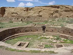 | ||
| Chipiinuinge | Tewa | Canones | Ruins. Name means "house at the pointed peak". | ||||
| Cochiti | Keres | Cochiti | Great house; cliff dwellings | Active with ruins on-site. Home of one of the 21 federally recognized Pueblos. |  | ||
| Canador Peak | Hohokam | Trincheras | Ruins | ||||
| Cox Ranch | Quemado | Great house | Ruins | ||||
| Cristone | Abiquiu | Ruins | |||||
| Crumbled House | Ancestral Puebloan | Newcomb | Great house | Ruins. Great house with over 100 rooms, plus a compound with about 150 rooms. Occupied 1100 to 1250 AD | |||
| East Community | Ancestral Puebloan | Chaco Canyon | |||||
| Embree | Mogollon | Las Cruces | Ruins | ||||
| Gallo Cliff Dwelling | Ancestral Puebloan | Gallo Canyon, New Mexico | Ruins | ||||
| Gila | Mogollon | Silver City | Cliff Dwellings, Pit Houses[3] | Ruins | .jpg.webp) | ||
| Goesling Ranch | Quemado | Great house | Ruins | ||||
| Gran Quivira | Tiwa | Mountainair | Ruins located in the Salinas Pueblo Missions National Monument. |  | |||
| Great Kivas | Zuni | Zuni | Ruins located on the Zuni Indian Reservation in the Zuni-Cibola Complex and that is listed as a National Historic Landmark. | ||||
| Halfway House Outlier | Ancestral Puebloan | New Mexico | Ruins | 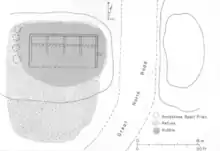 Site map of Halfway House Outlier, with Great North Road | |||
| Hawikuh | Zuni | Zuni | Ruins located on the Zuni Indian Reservation in the Zuni-Cibola Complex and that is listed as a National Historic Landmark. | 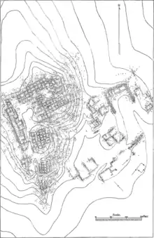 | |||
| Houiri | Homayo | Great house | Ruins | ||||
| Hungo Pavi | Ancestral Puebloan | Crownpoint | Great house | The meaning of, "Hungo Pavi" has been lost. It may be a mispronunciation of the Hopi, "Shungopovi", meaning a Hopi village. Ruins located in Chaco Culture National Historical Park. An unexcavated Chacoan great house (monumental public building) containing over 150 rooms, a great kiva, and an enclosed plaza. | |||
| Isleta | Tiwa | South Valley | Great house | Active pueblo with ruins on-site. Home of one of the 21 federally recognized Pueblos. |  | ||
| Jemez | Towa | Jemez Springs | Great house | An active pueblo that is home of one of the 21 federally recognized Pueblos, known as the Walatowa. |  | ||
| Kechipbowa | Zuni | Zuni | Ruins located on the Zuni Indian Reservation in the Zuni-Cibola Complex and that is listed as a National Historic Landmark. | ||||
| Kewa | Keres | An active pueblo that is home of one of the 21 federally recognized Pueblos. Called the "Santo Domingo Pueblo" by the Spanish, reacknowledged as Kewa in 2010. | |||||
| Kin Cheops | Quemado | Great house | Ruins | ||||
| Kin Kletso | Ancestral Puebloan | Crownpoint | Great House | "Yellow House". Ruins located in the Chaco Culture National Historical Park. | |||
| Kin Klizhin | Ancestral Puebloan | Crownpoint | Great House | "Black House". Ruins located on the far western edge of the Chaco Culture National Historical Park. | |||
| Kin Nahasbas | Ancestral Puebloan | Crownpoint | Great Kiva | "Round House". Ruins located in the Chaco Culture National Historical Park. Previously thought to be a great kiva, now considered a possible part of a great house. | |||
| Kintyel | Ancestral Puebloan | Crownpoint | Ruins located in Chaco Culture National Historical Park. | ||||
| Kin Ya'a | Ancestral Puebloan | Great House | "Tall House". Ruins located immediately south of Crownpoint approximately one-half-mile east of Route 371. Entrance is unlocked gate on south side of Ikard-Newson Propane business. Fairly bad dirt road to the site, walking from the gate may be a better idea. Chacoan roads are fairly evident. Several difficult-to-spot remains of smaller buildings. |  | |||
| Kuaua | Tiwa | Village | Excavated in the 1930s and now the site of the Coronado State Monument and listed on the National Register of Historic Places. |  | |||
| Kyaki:ma | Zuni | Zuni | Ruins located on the Zuni Indian Reservation in the Zuni-Cibola Complex and that is listed as a National Historic Landmark. | ||||
| La Cienega | Tano | Galisteo | Great house | Ruins located on the Galisteo Basin with 140 rooms, also known as Tzi-gu-ma or Pueblo La Mesita. | |||
| Laguna | Keres | Great house | An active pueblo that is home of one of the 21 federally recognized Pueblos. |  | |||
| Las Madres | Tano | Galisteo | Ruins located on the Galisteo Basin. | ||||
| Maigua | Tiwa | Bernalillo | Great house | Ruins. One of the 12 pueblos of Tiwa Indians along both sides of the Rio Grande, north and south of present-day Bernalillo | |||
| Malpais | Tiwa | Bernalillo | Great house | Ruins. One of the 12 pueblos of Tiwa Indians along both sides of the Rio Grande, north and south of present-day Bernalillo | |||
| Mats'a:kya | Zuni | Zuni | Ruins located on the Zuni Indian Reservation in the Zuni-Cibola Complex and that is listed as a National Historic Landmark. | ||||
| Nambe | Tewa | Great house | An active pueblo that is home of one of the 21 federally recognized Pueblos. | ||||
| Nompe | Tiwa | Bernalillo | Great house | Ruins. One of the 12 pueblos of Tiwa Indians along both sides of the Rio Grande, north and south of present-day Bernalillo | |||
| Ohkay Owingeh | Tewa | Española | Great house | An active pueblo with ruins on-site. Once called the "San Juan Pueblo"; re-acknowledged tribal name in 2005. Home of one of the 21 federally recognized Pueblos. |  | ||
| Paa-ko | Tano | Galisteo | Great house | Ruins located on the Galisteo Basin. | |||
| Pecos | Towa | Pecos | Ruins. Now a National Historic Landmark |  | |||
| Peñasco Blanco | Ancestral Puebloan | Crownpoint | "White Rock Point". Ruins located in Chaco Culture National Historical Park. Unusual in at least three ways; oval in shape, one of only two great houses on the south edge of Chaco Canyon, and it has at least four great kiva. | 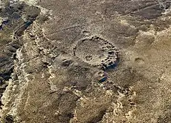 | |||
| Picuris | Tiwa | Peñasco | Great house | An active pueblo that is home of one of the 21 federally recognized Pueblos. |  | ||
| Pilabó | Tiwa | Socorro | Great house | Ruins. Once the home of the Piro Pueblo, located at the site of the present town of the city of Socorro. | |||
| Poblazon | Bernalillo | Ruins. | |||||
| Pojoaque | Tewa | Great house | An active pueblo that is home of one of the 21 federally recognized Pueblos. | ||||
| Posege | Taos | Ruins | |||||
| Poshuouinge | Tewa | Abiquiu | Ruins of 700-room pueblo | Two large courtyards and a kiva can still be seen. | 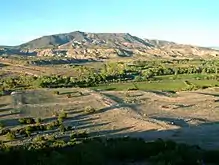 | ||
| Pot Creek Pueblo | Tiwa | Talpa | Ruins of 400 ground floor room pueblo | Pueblo room and kiva can be seen | |||
| Puaray | Tiwa | Bernalillo | Great house | Redeveloped into modern homes. The Chamuscado and Rodriguez Expedition left people here in 1582. One of the 12 pueblos of Tiwa Indians along both sides of the Rio Grande, north and south of present-day Bernalillo | |||
| Pueblo Alto | Ancestral Puebloan | Crownpoint | Great House | "High Town". Ruins located in the Chaco Culture National Historical Park. Sits adjacent to New Alto and Rabbit Ruins. | |||
| Pueblo Bonito | Ancestral Puebloan | Crownpoint | Great House | "Beautiful Town". Ruins located in the Chaco Culture National Historical Park. Standing within 70 ft of the north wall of the canyon, the building was five stories high. There are at least 27 circular kivas, and in some cases the interior of the kivas is of fine tablet masonry. | 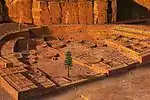 | ||
| Pueblo del Alto | Piros | Belen | Ruins lie on the east side of the Rio Grande. | ||||
| Pueblo Blanco | Piros | 34° 30' | Ruins on the west rim of the Médano, east of the Rio Grande. | ||||
| Pueblo Caja del Rio | Cochiti | Ruins | |||||
| Pueblo de la Parida | Piro | Ruins located on the west run of the Médano east of the Rio Grande. | |||||
| Pueblo del Arroyo | Ancestral Puebloan | Crownpoint | Great House | "Town by the Arroyo". Ruins located in the Chaco Culture National Historical Park. Located near Pueblo Bonito, it is on the north side of the arroyo. The original height was probably 4 stories, with two kivas in the court, three built within the pueblo walls, and four outside the main building. | 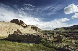 | ||
| Pueblo del Encierro | Keresan | Cochiti | Ruins located near the Cochiti Pueblo. | ||||
| Pueblo de los Jumanos | Jumano | Great house | The definite location of the pueblo is not known, although it is supposed to have been situated near the base of the elevation called Mesa de los Jumanes. According to Escalante the pueblo was destroyed by the Apache. | ||||
| Pueblo de los Silos | Tewa | Pecos | Ruins that are situated in the Galisteo Basin between the Keresan pueblos of the Rio Grande. | ||||
| Pueblo Galisteo | Tano | Galisteo | Great house | Ruins located on the Galisteo Basin with 47 rooms that were inhabited up into the 1700s. The inhabitants of both sites moved to Santa Domingo Pueblo. | |||
| Pueblo de los Muertos | Hohokam | Cibola County | Ruins | ||||
| Pueblo Largo | Tano | Galisteo | Great house | Ruins located on the Galisteo Basin. There were eight rectangular great houses of stone and adobe with four regular kivas, five plazas, and a shrine. The pueblo was estimated to have contained more than 480 rooms, and although erosion has affected some of the rooms, many walls are still intact. | |||
| Pueblo Pardo | Tiwa | Mountair | Ruins | ||||
| Pintado | Ancestral Puebloan | McKinley County | Great House | "Painted Town". Ruins that are part of the Chaco Culture National Historical Park. The most easterly of the Chaco Canyon group, the building is L-shaped, the two wings measuring 238 feet and 174 feet, exterior measure. The inclosed court was occupied by two kivas and other semi-subterranean structures, while just outside the court is another large kiva. There are at least ten minor pueblos surrounding it. |  | ||
| Pueblo Viejo | Socorro | Ruins | |||||
| Puye | Española | Cliff dwelling | Ruins located in the Santa Clara Pueblo, it is a National Historic Landmark. |  | |||
| Quarai | Tiwa | Manzano | Ruins located in the Salinas Pueblo Missions National Monument. |  | |||
| Robledo Mountain | Mogollon | Las Cruces | Ruins | ||||
| Salmon Ruins | Ancestral Puebloan | Bloomfield | Great House | Ruins. Listed on the New Mexico State Register of Cultural Properties and the National Register of Historic Places. |  | ||
| San Cristobal | Tano | Galisteo | Great house | Ruins located on the Galisteo Basin, this pueblo is also known as Yam-p-ham-ba. Stone and adobe were used to build rectangular roomblocks and kivas. At one time, San Cristobal was one of the largest pueblos in the Southwest, four or five stories high and containing as many as 600 ground-floor rooms. | |||
| Sandia | Tiwa | Bernalillo | Great house | Ruins but now occupied with 1742 Sandia Pueblo. One of the 12 pueblos of Tiwa Indians along both sides of the Rio Grande, north and south of present-day Bernalillo | |||
| San Lazaro | Tano | Santa Fe | Village | Ruins located on the Galisteo Basin, this pueblo is listed on the National Register of Historic Places as a National Historic Landmark. A 450-room pueblo that included a kiva, a plaza, an irrigation reservoir, two roomblocks, and a sweat lodge.[4] | |||
| San Marcos | Tano | Galisteo | Great house | Ruins located on the Galisteo Basin. A major trade center for the region, there were great houses with more than a hundred rooms are located around a central plaza with numerous kivas. San Marcos became an important paraje, or campsite, on one of the main routes of El Camino Real de Tierra Adentro. After the Pueblo Revolt in 1680 the people of San Marcos joined the Navajo and Apache in refugee communities in Potrero Viejo. The Keresan inhabitants fled to Acoma pueblo, and others to Hopi. | |||
| Sandia | Tiwa | Albuquerque | An active pueblo that is home of one of the 21 federally recognized Pueblos. | ||||
| Santa Ana | Keres | An active pueblo that is home of one of the 21 federally recognized Pueblos. | |||||
| Santa Clara | Tewa | Española | An active pueblo that is home of one of the 21 federally recognized Pueblos. | ||||
| San Pascual | Piro | Socorro | Ruins located east of the Rio Grande, on a butte, on the western slope of the Little San Pascual Mountain, near the eastern boundary of the Bosque del Apache National Wildlife Refuge. | ||||
| San Felipe | Keres | Great house | An active pueblo that is home of one of the 21 federally recognized Pueblos. | ||||
| San Ildefonso | Tewa | Great house | An active pueblo that is home of one of the 21 federally recognized Pueblos. |  | |||
| San Rafael de los Gentiles | Ruins | ||||||
| Santiago | Tiwa | Bernalillo | Village | Excavated in the 1930s and now the site of modern homes. One of the 12 pueblos of Tiwa Indians along both sides of the Rio Grande, north and south of present-day Bernalillo; see Tiguex War. | |||
| Senecú | Tiwa | San Pasqual | Ruins. Once the home of the Piro Pueblo, the exact location of this pueblo has been lost. | ||||
| Starkweather | Mogollon | Reserve | Great house | Ruins | |||
| Taos | Tiwa | Taos | Great house | An active pueblo that is home of one of the 21 federally recognized Pueblos. | 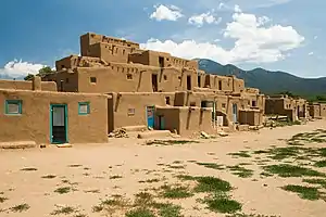 | ||
| Tarque Pueblo | Tiwa | Mountainair | Ruins | ||||
| Tesuque | Tewa | Santa Fe | Great house | An active pueblo that is home of one of the 21 federally recognized Pueblos. |  | ||
| Teypana | Tiwa | Socorro | Great house | Ruins. Once the home of the Piro Pueblo. | |||
| Tijeras | Tijeras | Great house | Ruins |  | |||
| Tom's Rock | Pie Town | Great house | Ruins | ||||
| Tonque | San Felipe | Great house | Ruins on north side of Tonque Arroyo, about 7 miles southeast of San Felipe | ||||
| Tsankawi | White Rock | Ruins located in the Bandelier National Monument. | 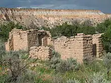 | ||||
| Tsin Kletzin | Ancestral Puebloan | Crownpoint | Great house | "Black Wood Place" or "Charcoal Place". Ruins located in Chaco Culture National Historical Park. One of only two great houses on the southern side of Chaco Canyon. Believed to be situated in order to provide a line-of-sight of at least six other great houses (Pueblo Alto, Penasco Blanco, Kin Kletso, Bis sa'ani, Kin Klizhin, and Kin Ya'a). Built on a north-south line with Casa Rinconada and Pueblo Alto. | |||
| Tsirege | White Rock | Great house | Ruins. Located on property owned by the Los Alamos National Laboratory, it is regarded as ancestral by the San Ildefonso Pueblo. | ||||
| Tyuonyi | Ruins located in the Bandelier National Monument. | 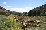 | |||||
| Una Vida | Ancestral Puebloan | Crownpoint | Great house | "One Life". Unexcavated ruins located in the Chaco Culture National Historical Park within 100 metres of the visitor center. | |||
| Upper Arroyo Hondo | Tano | Galisteo | Great house | Ruins. This neighbor to larger Arroyo Hondo pueblo contained about 50 rooms and one kiva on the Galisteo Basin.[5] | |||
| Wachte | Tiwa | Bernalillo | Great house | Ruins. One of the 12 pueblos of Tiwa Indians along both sides of the Rio Grande, north and south of present-day Bernalillo | |||
| Wijiji | Ancestral Puebloan | Crownpoint | Great House | "Black Greasewood". Ruins located in the Chaco Culture National Historical Park. | |||
| Yellow House | Zuni | Zuni | Ruins located on the Zuni Indian Reservation in the Zuni-Cibola Complex and that is listed as a National Historic Landmark. | ||||
| Zia | Keres | Great house | An active pueblo that is home of one of the 21 federally recognized Pueblos. |
See also
References
- Federal Register: July 22, 1998 (Volume 63, Number 140). National Park Service. Retrieved 6/14/07.
- Hegmon, M., Nelson, M. and Ruth, S. (1998). "Abandonment and Reorganization in the Mimbres Region of the American Southwest." American Anthropologist. 100(1) March. pp. 152.
- "Gila Cliff Dwellings NM: An Administrative History (Introduction)". www.nps.gov. Retrieved 2017-02-05.
- "San Lazaro Pueblo" Archived 2012-10-04 at the Wayback Machine, National Historic Landmark program. National Park System. Retrieved June 11, 2011.
- "Galisteo Basin Archaeological Sites" Archived 2011-07-26 at the Wayback Machine. Retrieved July 11, 2011.
This article is issued from Wikipedia. The text is licensed under Creative Commons - Attribution - Sharealike. Additional terms may apply for the media files.
