Lacommande
Lacommande is a commune in the Pyrénées-Atlantiques department in south-western France.
Lacommande | |
|---|---|
_La_mairie.JPG.webp) Town Hall | |
Location of Lacommande 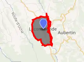
| |
 Lacommande 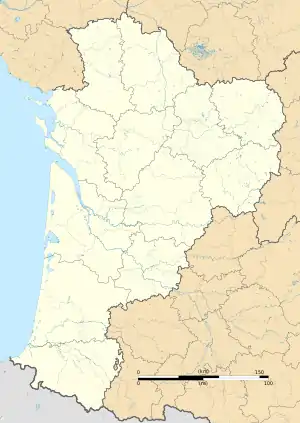 Lacommande | |
| Coordinates: 43°16′42″N 0°30′27″W | |
| Country | France |
| Region | Nouvelle-Aquitaine |
| Department | Pyrénées-Atlantiques |
| Arrondissement | Pau |
| Canton | Le Cœur de Béarn |
| Intercommunality | Lacq-Orthez |
| Government | |
| • Mayor (2008–2014) | Paul Montaut |
| Area 1 | 3.33 km2 (1.29 sq mi) |
| Population (2017-01-01)[1] | 214 |
| • Density | 64/km2 (170/sq mi) |
| Time zone | UTC+01:00 (CET) |
| • Summer (DST) | UTC+02:00 (CEST) |
| INSEE/Postal code | 64299 /64360 |
| Elevation | 150–262 m (492–860 ft) |
| 1 French Land Register data, which excludes lakes, ponds, glaciers > 1 km2 (0.386 sq mi or 247 acres) and river estuaries. | |
Géography
Lacommande township is located some 11 km of Pau, 12,3 km of Oloron-Sainte-Marie and 8,8 km of Monein, on GR653, on crossroads of D 146 and D 34.
Hydrography
Rivers Baïse de Lasseube of Bayse flow from south to north and distinct the communes of Lacommande and commune of Aubertin. Its main tributaries flow the Lacommande territory from west to east named Seubemale stream, Brouqua stream, Bernatouse stream and the Coigdarrens stream who delimits the border with Monein.

L'église Saint-Blaise, monument historique
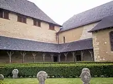
La Commanderie, monument historique
_st%C3%A8le_avec_un_coin_du_cimeti%C3%A8re.JPG.webp)
_st%C3%A8le_1.JPG.webp)
_st%C3%A8le_2.JPG.webp)
_st%C3%A8le_4.JPG.webp)
_st%C3%A8le_5.JPG.webp)
_st%C3%A8le_6.JPG.webp)
_st%C3%A8le_7.JPG.webp)
References
- "Populations légales 2017". INSEE. Retrieved 6 January 2020.
| Wikimedia Commons has media related to Lacommande. |
| Authority control |
|
|---|
This article is issued from Wikipedia. The text is licensed under Creative Commons - Attribution - Sharealike. Additional terms may apply for the media files.