Grade I listed buildings in East Devon
There are over 9,000 Grade I listed buildings in England. This page is a list of these buildings in the district of East Devon in Devon.
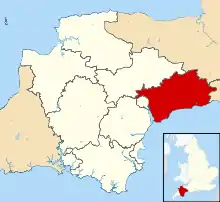
East Devon shown in Devon
List
| Name | Location | Type | Completed [note 1] | Date designated | Grid ref.[note 2] Geo-coordinates |
Entry number [note 3] | Image |
|---|---|---|---|---|---|---|---|
| Church of St Michael and All Angels | Awliscombe | Parish church | Late 15th/early 16th century | 27 January 1989 | ST1337701829 50°48′34″N 3°13′51″W |
1098097 | 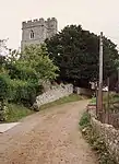 Church of St Michael and All Angels |
| Weycroft Hall | Weycroft, Axminster | Manor house | c.1400 | 6 June 1983 | SY3080699851 50°47′39″N 2°58′59″W |
1098625 |  Weycroft Hall |
| Church of St Michael | Axmouth | Parish church | 12th century | 8 May 1967 | SY2563791036 50°42′51″N 3°03′17″W |
1098593 | 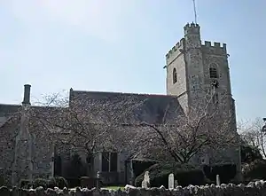 Church of St Michael |
| Stedcombe House | Stedcombe, Axmouth | Country house | c.1697 | 11 September 1951 | SY2641291980 50°43′22″N 3°02′38″W |
1098596 | 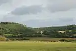 Stedcombe House |
| Palm House including greenhouse to south-east and terrace walls to south-west | Bicton Park, Bicton | Greenhouse | c. 1820–25 | 10 February 1987 | SY0724085997 50°39′58″N 3°18′50″W |
1097548 | 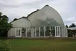 Palm House including greenhouse to south-east and terrace walls to south-west |
| Rolle Mausoleum including the ruins of the Old Church, adjoining to west | Bicton Park, Bicton | Mausoleum | 1850 mausoleum, 15th century church | 30 June 1961 | SY0726885746 50°39′50″N 3°18′48″W |
1203804 |  Rolle Mausoleum including the ruins of the Old Church, adjoining to west |
| The Parish Church of St Peter | Brampford Speke | Parish church | 15th century | 30 June 1961 | SX9274498237 50°46′26″N 3°31′21″W |
1163855 | .jpg.webp) The Parish Church of St Peter |
| Church of St Winifred | Branscombe | Parish church | Early 12th century | 22 February 1955 | SY1954788462 50°41′25″N 3°08′25″W |
1309398 | 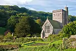 Church of St Winifred |
| Chapel of the Holy Evangelists | Killerton Park, Broadclyst | Chapel | 1840–41 | 20 May 1985 | SS9768100339 50°47′37″N 3°27′11″W |
1098332 | .jpg.webp) Chapel of the Holy Evangelists |
| Parish Church of St John the Baptist | Broadclyst | Parish church | 14th century | 20 May 1985 | SX9817897271 50°45′58″N 3°26′43″W |
1170465 | 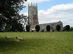 Parish Church of St John the Baptist |
| Church of St Andrew | Broadhembury | Parish church | 14th/15th century | 22 February 1955 | ST1018404708 50°50′06″N 3°16′37″W |
1281269 | 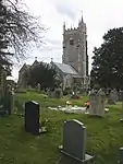 Church of St Andrew |
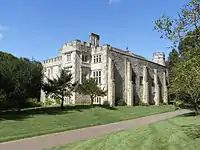
| Grange | Broadhembury | Country house | c. early 16th century | 27 January 1989 | ST0928404212 50°49′49″N 3°17′22″W |
1098064 | 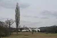 Grange |
| Church of St Andrew | Clyst Hydon | Parish church | 15th century | 30 June 1961 | ST0354201675 50°48′24″N 3°22′13″W |
1162001 | .jpg.webp) Church of St Andrew |
| Church of St Lawrence | Clyst St Lawrence | Parish church | 15th century | 30 June 1961 | SY0266499975 50°47′28″N 3°22′56″W |
1333709 | 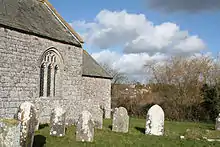 Church of St Lawrence |
| Church of St Andrew | Colyton | Parish church | 15th century | 8 May 1967 | SY2459994093 50°44′30″N 3°04′12″W |
1306053 | 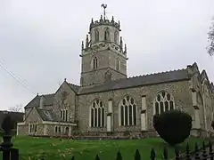 Church of St Andrew |
| The Chantry | Combe Raleigh | Chantry house | Late 15th century | 22 February 1955 | ST1594602372 50°48′53″N 3°11′40″W |
1098020 |  |
| Church of St Mary | Combpyne, Combpyne Rousdon | Parish church | 13th century | 8 May 1967 | SY2901592384 50°43′36″N 3°00′25″W |
1170551 | 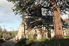 Church of St Mary |
| Church of St Peter | Dalwood | Parish church | 15th century | 8 May 1967 | ST2479000537 50°47′58″N 3°04′07″W |
1170586 | 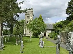 Church of St Peter |
| Church of All Saints | East Budleigh | Parish church | 15th century | 30 June 1961 | SY0661884922 50°39′23″N 3°19′21″W |
1204468 | 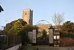 Church of All Saints |
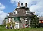
| A La Ronde | Withycombe Raleigh, Exmouth | Cottage orné | 1798 | 6 December 1949 | SY0048083390 50°38′30″N 3°24′32″W |
1164838 | |
| The Manse of the Point in View | Withycombe Raleigh, Exmouth | Manse | 1825 | 15 June 1978 | SY0083083523 50°38′35″N 3°24′14″W |
1103806 | |
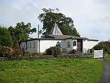
| The Point in View | Withycombe Raleigh, Exmouth | Chapel, school and almshouses | 1811 | 6 December 1949 | SY0078883506 50°38′34″N 3°24′16″W |
1164937 | |
| Church of St Michael | Gittisham | Parish church | Possibly 14th century | 22 February 1955 | SY1337398366 50°46′42″N 3°13′48″W |
1097994 |  Church of St Michael |
| Combe House | Combe, Gittisham | House | 17th century | 22 February 1955 | SY1427397863 50°46′26″N 3°13′02″W |
1098026 | |
| Church of St John the Baptist | Hawkchurch | Parish church | 12th century | 8 May 1967 | ST3431500414 50°47′58″N 2°56′00″W |
1098492 | 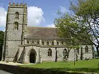 Church of St John the Baptist |
| Church of St Mary | Luppitt | Parish church | Late 13th/early 14th century | 22 February 1955 | ST1690406758 50°51′16″N 3°10′55″W |
1307043 | 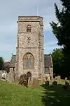 Church of St Mary |
| Church of St John the Baptist | Membury | Parish church | 12th century | 8 May 1967 | ST2762702941 50°49′17″N 3°01′44″W |
1170817 | 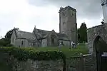 Church of St John the Baptist |
| Church of St Michael | Musbury | Parish church | 15th century | 8 May 1967 | SY2756494564 50°44′46″N 3°01′41″W |
1333564 | 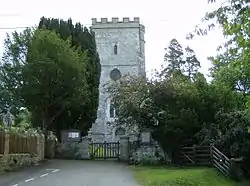 Church of St Michael |
| Nether Exe Parish Church (St John the Baptist) | Nether Exe | Parish church | Late 15th century | 30 June 1961 | SX9312699830 50°47′17″N 3°31′03″W |
1097624 | 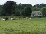 Nether Exe Parish Church (St John the Baptist) |
| Church of the Blessed Virgin Mary | Offwell | Parish church | 13th century | 22 February 1955 | SY1948599575 50°47′24″N 3°08′37″W |
1104090 |  Church of the Blessed Virgin Mary |
| Cadhay | Ottery St Mary | House | 16th century | 28 April 1952 | SY0893796238 50°45′31″N 3°17′33″W |
1289400 | |
| Church of St Mary | Ottery St. Mary | Church | 1260 | 28 April 1952 | SY0985895567 50°45′10″N 3°16′45″W |
1212599 | |
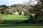
| Knightstone | Wiggaton, Ottery St Mary | Country house | 16th century | 28 April 1952 | SY1072194156 50°44′24″N 3°16′00″W |
1213714 | .jpg.webp) Knightstone |
| Church of St Mary | Payhembury | Parish church | Early 16th century | 22 February 1955 | ST0886801793 50°48′31″N 3°17′41″W |
1333739 | 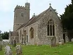 Church of St Mary |
| Church of St John the Baptist | Plymtree | Parish church | 15th century | 22 February 1955 | ST0518102908 50°49′05″N 3°20′51″W |
1333727 | 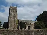 Church of St John the Baptist |
| The Parish Church of St Mary | Poltimore | Parish church | Late 15th century | 30 June 1961 | SX9659696831 50°45′43″N 3°28′03″W |
1333257 | 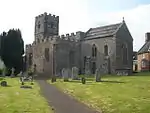 The Parish Church of St Mary |
| The Parish Church of St Mary | Rewe | Parish church | 15th century | 30 June 1961 | SX9456399222 50°46′59″N 3°29′49″W |
1305699 | 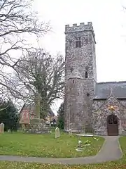 The Parish Church of St Mary |
| Rockbeare Manor Including Terraces Adjoining to South | Rockbeare | Country house | Mid-18th century | 11 November 1952 | SY0316294044 50°44′16″N 3°22′25″W |
1203803 | |
| Church of St Gregory | Seaton | Parish church | Early 14th century | 2 October 1951 | SY2471590576 50°42′36″N 3°04′03″W |
1164812 | 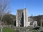 Church of St Gregory |
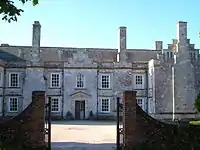
| Gate House at Old Shute House Including Flanking Walls and Pavilions | Shute | Gatehouse | c. 1570 or earlier 16th century | 8 May 1967 | SY2521497494 50°46′20″N 3°03′43″W |
1098437 | 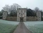 Gate House at Old Shute House Including Flanking Walls and Pavilions |
| Old Shute House | Shute | Manor house | c. 1380 | 14 December 1955 | SY2524497412 50°46′17″N 3°03′41″W |
1171033 | |
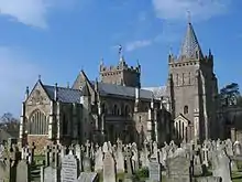
| Church of St Giles and St Peter | Sidbury, Sidmouth | Church | 12th century | 12 October 1951 | SY1397091749 50°43′08″N 3°13′12″W |
1216540 | 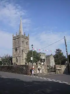 Church of St Giles and St Peter |
| Royal Glen Hotel | Sidmouth | House | m.SubMatches(0) 1820 | 12 October 1951 | SY1216387222 50°40′41″N 3°14′40″W |
1097909 | |
| The Old Chancel | Sidmouth | House | 1864 | 12 October 1951 | SY1246787484 50°40′49″N 3°14′25″W |
1289171 | |
| Bishop's Court | Sowton | Country house | 1860–64 | 11 November 1952 | SX9807891904 50°43′04″N 3°26′42″W |
1097577 | 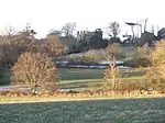 Bishop's Court |
| Parish Church of St Michael and All Angels | Sowton | Parish church | 1844–45 | 19 March 1987 | SX9758792513 50°43′23″N 3°27′08″W |
1334001 |  Parish Church of St Michael and All Angels |
| Stable Block Adjoining Tithe Barn to North-north-west | Sowton | Stable | Early 16th century | 19 March 1987 | SX9815091812 50°43′01″N 3°26′39″W |
1333998 | |
| Tithe Barn 150 Metres South-east of Bishop's Court | Sowton | Tithe barn | Probably early 14th century | 11 November 1952 | SX9813091801 50°43′01″N 3°26′40″W |
1164637 | |
| Church of St Michael | Stockland | Parish church | 13th century | 8 May 1967 | ST2446104528 50°50′07″N 3°04′27″W |
1098406 | 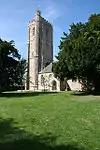 Church of St Michael |
| The Parish Church of St Mary Magdalene | Stoke Canon | Parish church | Late 15th century | 30 June 1961 | SX9395698016 50°46′19″N 3°30′19″W |
1333984 | 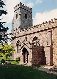 The Parish Church of St Mary Magdalene |
| Church of St James | Talaton | Parish church | 15th century | 22 February 1955 | SY0674599734 50°47′23″N 3°19′28″W |
1098109 | 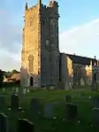 Church of St James |
| The Parish Church of Our Lady | Upton Pyne | Parish church | 15th century | 30 June 1961 | SX9101997708 50°46′07″N 3°32′48″W |
1334009 | 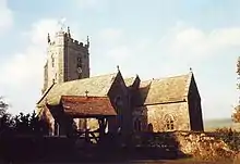 The Parish Church of Our Lady |
| Parish Church of St Swithun | Woodbury | Parish church | 1409 | 30 June 1961 | SY0093887191 50°40′33″N 3°24′12″W |
1104176 | 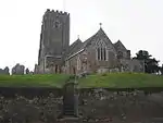 Parish Church of St Swithun |
| Church of St John the Baptist | Yarcombe | Parish church | 15th century | 22 February 1955 | ST2455408195 50°52′06″N 3°04′25″W |
1098193 | 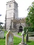 Church of St John the Baptist |
Notes
- The date given is the date used by Historic England as significant for the initial building or that of an important part in the structure's description.
- Sometimes known as OSGB36, the grid reference is based on the British national grid reference system used by the Ordnance Survey.
- The "List Entry Number" is a unique number assigned to each listed building and scheduled monument by Historic England.
External links
This article is issued from Wikipedia. The text is licensed under Creative Commons - Attribution - Sharealike. Additional terms may apply for the media files.