Grade II* listed buildings in East Devon
There are over 20,000 Grade II* listed buildings in England. This page is a list of these buildings in the district of East Devon in Devon.
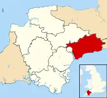
East Devon shown in Devon
East Devon
| Name | Location | Type | Completed [note 1] | Date designated | Grid ref.[note 2] Geo-coordinates |
Entry number [note 3] | Image |
|---|---|---|---|---|---|---|---|
| Coaxdon Hall | All Saints | House | c. 1590 | 8 May 1967 | ST3110600839 50°48′11″N 2°58′45″W |
1098577 |  |
| Wadhayes Farmhouse | Awliscombe | Farmhouse | 1621 | 22 February 1955 | ST1363203173 50°49′18″N 3°13′39″W |
1098096 | |
| Church of St Mary | Axminster | Parish church | 13th century | 11 August 1950 | SY2964198492 50°46′54″N 2°59′58″W |
1333520 | |
| Oak House | Axminster | House | 1758 | 11 August 1950 | SY2985098677 50°47′00″N 2°59′47″W |
1103761 | |
| Premises of G C Bateman | Axminster | Shop | Early 19th century | 11 August 1950 | SY2979398598 50°46′58″N 2°59′50″W |
1098640 | |
| Weycroft Manor and Weycroft Well House | Weycroft, Axminster | Manor house | c. 16th century | 6 June 1983 | SY3076299846 50°47′38″N 2°59′01″W |
1162537 |  Weycroft Manor and Weycroft Well House |
| Axmouth Bridge | Axmouth | Road bridge | 1877 | 19 October 1984 | SY2529889982 50°42′17″N 3°03′33″W |
1098598 | 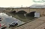 Axmouth Bridge |
| Bindon Manor House | Axmouth | Manor house | 15th century | 8 May 1967 | SY2706690457 50°42′33″N 3°02′03″W |
1169515 | |
| Outbuildings, garden walls and enclosing wall and balustrade to Stedcombe House | Stedcombe, Axmouth | Stableyard and garden walls | 1690s | 19 October 1984 | SY2638391954 50°43′21″N 3°02′39″W |
1333511 | |
| Stepps Country Club | Axmouth | House | 16th century | 8 May 1967 | SY2609190946 50°42′48″N 3°02′54″W |
1098599 | |
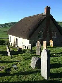
| Church of the Blessed Virgin Mary | Aylesbeare | Parish church | Early 16th century | 30 June 1961 | SY0376991952 50°43′09″N 3°21′52″W |
1328734 |  Church of the Blessed Virgin Mary |
| Bovey House including outbuilding adjoining north | Beer | Manor house | Late 16th century | 11 September 1951 | SY2084890370 50°42′27″N 3°07′20″W |
1333514 |  Bovey House including outbuilding adjoining north |
| Front garden boundary wall and gateway immediately east of Bovey House | Beer | Garden wall and gateway | 17th century | 19 October 1984 | SY2088090345 50°42′26″N 3°07′19″W |
1169601 | |
| Bicton Cross | Bicton | Cross | 1743 | 30 June 1961 | SY0717385326 50°39′37″N 3°18′53″W |
1097585 |  Bicton Cross |
| Bicton House, Devon School of Agriculture | Bicton | Country house | c. 1800 | 11 November 1952 | SY0704086432 50°40′12″N 3°19′01″W |
1334023 | 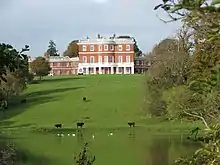 Bicton House, Devon School of Agriculture |
| Church of St Mary | Bicton | Parish church | 1850 | 30 June 1961 | SY0730585738 50°39′50″N 3°18′46″W |
1203724 |  Church of St Mary |
| Garden ornaments and furniture in the Italianate Gardens at Bicton Park | Bicton | Garden ornaments | Early 19th century | 11 November 1952 | SY0727085940 50°39′57″N 3°18′48″W |
1097550 | 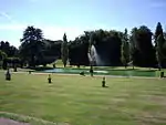 Garden ornaments and furniture in the Italianate Gardens at Bicton Park |
| Orangery including hot houses adjoining to north west and south east of Bicton Park | Bicton | Orangery | Early 19th century | 10 February 1987 | SY0736085968 50°39′58″N 3°18′44″W |
1097549 | |
| Sidmouth Lodge and adjoining boundary walls at Bicton Park | Bicton | Entrance lodge | Late 18th – early 19th century | 11 November 1952 | SY0767785934 50°39′57″N 3°18′28″W |
1281498 | |
| The hermitage including pond, rockeries and waterfalls to the south of Bicton Park | Bicton | Summer house | c. 1840 | 10 February 1987 | SY0677886218 50°40′05″N 3°19′14″W |
1097547 |  The hermitage including pond, rockeries and waterfalls to the south of Bicton Park |
| Homeliving | Brampford Speke | Farmhouse | Early 16th century | 11 November 1952 | SX9257198579 50°46′37″N 3°31′30″W |
1333977 | |
| Church Living and Church Living Cottage | Branscombe | Cruck house | Late 15th – early 16th century | 22 February 1955 | SY1957188517 50°41′27″N 3°08′24″W |
1104143 | |
| Edge Barton Manor | Branscombe | Manor house | 16th century | 22 February 1955 | SY1853689932 50°42′12″N 3°09′18″W |
1104129 | |
| Hole Farmhouse including gate piers adjoining east end | Branscombe | Farmhouse | Early to mid 16th century | 22 February 1955 | SY1913789471 50°41′57″N 3°08′47″W |
1333291 | |
| Margells | Branscombe Street, Branscombe | Cruck house | Late 16th century | 22 February 1955 | SY1885288845 50°41′37″N 3°09′01″W |
1104149 | |
| Killerton House and Ha Ha approximately 20 metres in front of entrance | Killerton Park, Broad Clyst | Country house | 1778 | 11 November 1952 | SS9734900089 50°47′28″N 3°27′28″W |
1098331 | 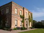 Killerton House and Ha Ha approximately 20 metres in front of entrance |
| The Bear's Hut 220 metres north north west of Killerton House | Killerton Park, Broad Clyst | Summer house | Before 1831 | 20 May 1985 | SS9714100154 50°47′30″N 3°27′39″W |
1170706 | 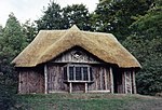 The Bear's Hut 220 metres north north west of Killerton House |
| Marker's Cottage | Broad Clyst | House | 16th century | 20 May 1985 | SX9854497224 50°45′57″N 3°26′24″W |
1170878 |  Marker's Cottage |
| Newhall Farmhouse and Ha Ha to Rear | Broad Clyst | Farmhouse | 15th century | 20 May 1985 | SX9810599213 50°47′01″N 3°26′48″W |
1170183 | 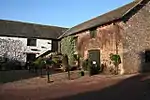 Newhall Farmhouse and Ha Ha to Rear |
| Old Park | Broad Clyst | Farmhouse | 14th or early 15th century | 20 May 1985 | SX9650895202 50°44′50″N 3°28′06″W |
1170252 | |
| Bakers Dairy Cottage and Bakers Farmhouse | Dulford, Broadhembury | House | 17th century | 27 January 1989 | ST0703405936 50°50′44″N 3°19′19″W |
1333792 | |
| Church Gate | Broadhembury | House | 16th century | 22 February 1955 | ST1015004722 50°50′06″N 3°16′38″W |
1204377 | |
| Theydon | Broadhembury | Cruck house | Early 17th century | 27 January 1989 | ST1014404756 50°50′07″N 3°16′39″W |
1098073 | |
| Kerswell Priory including walls of walled garden | Kerswell, Broadhembury | House | c. late 16th century | 27 January 1989 | ST0742506429 50°51′00″N 3°18′59″W |
1098042 | 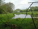 Kerswell Priory including walls of walled garden |
| Pale House | Kerswell, Broadhembury | House | 17th century | 27 January 1989 | ST0796306058 50°50′48″N 3°18′31″W |
1281115 | |
| The Drewe Arms Including Curved Wall adjoining at North West | Broadhembury | Public house | 17th century | 22 February 1951 | ST1010904758 50°50′07″N 3°16′40″W |
1204396 | 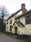 The Drewe Arms Including Curved Wall adjoining at North West |
| Church of St Mary and St Giles | Buckerell | Parish church | 1319 | 22 February 1955 | ST1232200363 50°47′46″N 3°14′44″W |
1333760 | 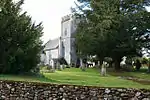 Church of St Mary and St Giles |
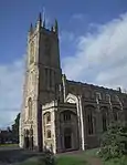
| Church of St Andrew | Chardstock | Parish church | 15th century, rebuilt 1864 | 8 May 1967 | ST3088304440 50°50′07″N 2°58′58″W |
1333540 | 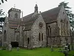 Church of St Andrew |
| Lower Ridge | Chardstock | Farmhouse | Late/mid 17th century | 8 May 1967 | ST2993805946 50°50′56″N 2°59′48″W |
1098584 | |
| The George Public House including Outbuilding Adjoining North East | Chardstock | Public house | c. 16th century | 8 May 1967 | ST3098004479 50°50′09″N 2°58′53″W |
1333537 | .jpg.webp) The George Public House including Outbuilding Adjoining North East |
| Church of St Michael | Clyst Honiton | Parish church | 15th century or earlier | 30 June 1961 | SX9894293525 50°43′57″N 3°26′00″W |
1203333 | 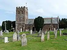 Church of St Michael |
| Great Auncke Manor and Auncke Cottage | Aunk, Clyst Hydon | House | Late 17th century | 11 November 1952 | ST0480200361 50°47′42″N 3°21′08″W |
1098165 | .jpg.webp) Great Auncke Manor and Auncke Cottage |
| Town Tenement Farmhouse | Clyst Hydon | Farmhouse | Early 16th century | 24 October 1988 | ST0336401485 50°48′17″N 3°22′22″W |
1162129 | |
| Ebford Manor | Ebford, Clyst St George | Detached house | 1710 | 11 November 1952 | SX9814987713 50°40′48″N 3°26′35″W |
1104182 |  Ebford Manor |
| Gates and Gatepiers 12 Metres North-west of Ebford Manor with Length of Garden Wall to Right | Ebford, Clyst St George | Gate | c. 1710 | 11 November 1952 | SX9814187729 50°40′49″N 3°26′35″W |
1166058 | |
| The Old Rectory Including Kitchen Garden Walls adjoining to North | Clyst St Lawrence | House | Early 16th century | 24 October 1988 | ST0266600046 50°47′30″N 3°22′56″W |
1162222 | |
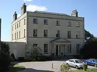
| Winslade Park | Clyst St Mary | House | c. 1800 | 19 March 1987 | SX9781090314 50°42′12″N 3°26′55″W |
1097566 | |
| White Lodge | Winslade Park, Clyst St Mary | Lodge | 1812 | 11 November 1952 | SX9764290926 50°42′32″N 3°27′04″W |
1097571 | 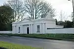 White Lodge |
| Church of St John the Baptist | Colaton Raleigh | Church | Late 15th – early 16th century | 30 June 1961 | SY0816187168 50°40′37″N 3°18′04″W |
1097559 | 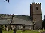 Church of St John the Baptist |
| Place Court | Colaton Raleigh | House | 16th – 17th century | 11 November 1952 | SY0800287314 50°40′41″N 3°18′12″W |
1097561 | |
| Great House | Colyton | House | c. late 16th century | 8 May 1967 | SY2464693924 50°44′24″N 3°04′09″W |
1098541 | 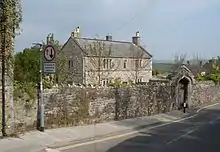 Great House |
| Church of St Nicholas | Combe Raleigh | Parish church | 15th century | 22 February 1955 | ST1585802332 50°48′52″N 3°11′45″W |
1333782 | 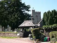 Church of St Nicholas |
| All Hallows School including Former Stables Adjoining West and Forecourt Area Wall and Gate Piers to North | Rousdon, Combpyne Rousdon | Country house | 1874 | 2 September 1983 | SY2951690530 50°42′36″N 2°59′59″W |
1098515 | |
| Film Studio at All Hallows School & the Old Church | Rousdon, Combpyne Rousdon | Church | c. 1870 | 14 June 1977 | SY2938890496 50°42′35″N 3°00′05″W |
1170563 | |
| Church of St Michael | Cotleigh | Parish church | Early 16th century | 22 February 1955 | ST2063602209 50°48′50″N 3°07′40″W |
1098246 | 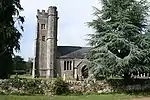 Church of St Michael |
| Cotleigh House | Cotleigh | House | Probably late 18th or early 19th century | 22 February 1955 | ST2068702226 50°48′51″N 3°07′38″W |
1333667 | |
| South Wood Farmhouse | Cotleigh | Farmhouse | Late 15th to early 16th century | 22 February 1955 | ST2085604053 50°49′50″N 3°07′31″W |
1098289 | |
| Loughwood Chapel | Dalwood | Baptist chapel | Probably late 17th or early 18th century | 8 May 1967 | SY2531999267 50°47′17″N 3°03′39″W |
1333577 | |
| Connets Farmhouse including Outbuilding adjoining to the South-east and Front Garden Walls | Dunkeswell | Farmhouse | 17th century | 22 February 1955 | ST1409507744 50°51′46″N 3°13′19″W |
1146555 | |
| Coxen, Long Orchard | Knowle, East Budleigh | House | 1911 | 3 December 1982 | SY0465583126 50°38′24″N 3°20′59″W |
1097529 | |
| Hayes Barton including Garden Walls Adjoining to the South East | East Budleigh | Farmhouse | Late 16th – early 17th century | 11 November 1952 | SY0503585207 50°39′32″N 3°20′42″W |
1334014 |  Hayes Barton including Garden Walls Adjoining to the South East |
| Salem Church including Boundary Walls and Assembly Room | East Budleigh | Chapel | 1719 | 30 June 1961 | SY0702585057 50°39′28″N 3°19′00″W |
1097511 | |
| Tidwell Manor | East Budleigh | Country house | 1725 | 11 November 1952 | SY0598583295 50°38′30″N 3°19′51″W |
1097565 | 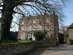 Tidwell Manor |
| Vicarsmead including Boundary Walls adjoining to East and West | East Budleigh | House | 17th century | 11 November 1952 | SY0644884821 50°39′20″N 3°19′29″W |
1281217 | |
| Church of St John in the Wilderness | Withycombe Raleigh, Exmouth | Parish church | 15th century | 6 December 1949 | SY0281483370 50°38′31″N 3°22′33″W |
1333479 | 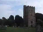 Church of St John in the Wilderness |
| Parish Church of St Margaret and St Andrew | Littleham, Exmouth | Parish church | Late medieval | 6 December 1949 | SY0290981296 50°37′24″N 3°22′26″W |
1317702 | |
| Parish Church of the Holy Trinity | Exmouth | Parish church | 1824 | 15 June 1978 | SY0021180659 50°37′01″N 3°24′43″W |
1333475 | |
| The Barn | Exmouth | House | 1897 | 6 November 1972 | SY0141880007 50°36′41″N 3°23′41″W |
1164569 | |
| Church of St Petrock and St Barnabus | Farringdon | Parish church | 1870 | 26 May 1987 | SY0177291221 50°42′44″N 3°23′33″W |
1328759 | 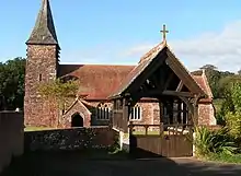 Church of St Petrock and St Barnabus |
| Upham Farmhouse | Farringdon | Farmhouse | Early 17th century | 26 May 1987 | SY0212490704 50°42′28″N 3°23′15″W |
1141401 | |
| Boycombe Farmhouse | Farway | Farmhouse | Late 16th century | 22 February 1955 | SY1671496166 50°45′33″N 3°10′56″W |
1333316 |  Boycombe Farmhouse |
| Church of St Michael | Church Green, Farway | Parish church | 15th century | 22 February 1955 | SY1723896463 50°45′43″N 3°10′29″W |
1309200 |  Church of St Michael |
| Hornshayne Farmhouse Including Front Garden Wall Adjoining to South and Granary and Stables Adjoining to North | Farway | Farmhouse | c. 1700 | 22 February 1955 | SY1957894584 50°44′43″N 3°08′28″W |
1104109 | |
| Poltimore Farmhouse | Farway | Farmhouse | Probably mid to late 15th century | 22 February 1955 | SY1768697105 50°46′04″N 3°10′07″W |
1333319 | |
| Woodbridge Farmhouse including Former Stables adjoining South-west | Farway | Farmhouse | Probably early to mid 16th century | 8 March 1988 | SY1880295234 50°45′04″N 3°09′09″W |
1163559 | |
| Church of St Andrew | Feniton | Parish church | Early 16th century | 22 February 1955 | SY1086399420 50°47′15″N 3°15′57″W |
1333731 | 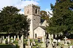 Church of St Andrew |
| Shermans Farmhouse | Gittisham | Farmhouse | 1575 | 22 February 1955 | SY1273497560 50°46′16″N 3°14′20″W |
1098025 | |
| Town Farmhouse including Walls to Walled Garden to the South | Gittisham | Farmhouse | 18th century | 22 February 1955 | SY1329398423 50°46′44″N 3°13′52″W |
1205084 | |
| Walls to the Vineyard including Gate Piers and Walls to the Terraced Beds | Combe House, Gittisham | Walls and gate piers | 17th century or earlier | 27 January 1989 | SY1439897936 50°46′29″N 3°12′55″W |
1098028 | |
| Wild Court | Hawkchurch | House | Late 16th century | 8 May 1967 | ST3417800775 50°48′10″N 2°56′08″W |
1098497 | |
| Church of St Michael | Honiton | Parish church | Late 15th century | 1 June 1949 | SY1669999905 50°47′34″N 3°11′00″W |
1306112 | 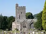 Church of St Michael |
| Manor House | Honiton | House | Probably 17th century | 21 November 1957 | ST1613500628 50°47′57″N 3°11′29″W |
1319754 | |
| Marwood House | Honiton | House | 1619 | 1 June 1949 | ST1672200898 50°48′06″N 3°10′59″W |
1116982 | |
| 46 High Street | Honiton | House | 18th century | 1 June 1949 | ST1646200740 50°48′01″N 3°11′12″W |
1319812 | |
| 39 and 41 New Street | Honiton | House | 17th century or earlier | 1 June 1949 | ST1640300481 50°47′52″N 3°11′15″W |
1319884 | |
| 62 High Street | Honiton | House | Early 18th century | 1 June 1949 | ST1639900712 50°48′00″N 3°11′16″W |
1116675 | |
| Church of St John the Baptist (now St Mary's) | Huxham | Parish church | 1871 | 30 June 1961 | SX9465097808 50°46′13″N 3°29′43″W |
1098307 | 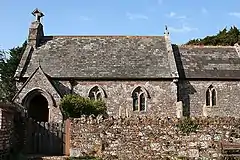 Church of St John the Baptist (now St Mary's) |
| Church of St Giles | Kilmington | Parish church | 15th century | 8 May 1967 | SY2730797984 50°46′37″N 3°01′57″W |
1098461 | 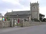 Church of St Giles |
| Greenway Farmhouse | Luppitt | Farmhouse | Probably 17th century | 22 February 1955 | ST1639205328 50°50′29″N 3°11′20″W |
1333672 | |
| Mohuns Ottery Gatehouse and Front Garden Walls about 5m south of Mohuns Ottery Farmhouse | Luppitt | Gatehouse and walls | Gatehouse 16th century, walls 19th century | 16 March 1988 | ST1893005553 50°50′38″N 3°09′10″W |
1098265 | |
| Pound Farmhouse Including Front Garden Walls | Luppitt | Farmhouse | c. 1670–90 | 16 March 1988 | ST1846405193 50°50′26″N 3°09′34″W |
1098266 | |
| Red Doors Farmhouse Including Front Courtyard Wall Adjoining to North | Beacon, Luppitt | Farmhouse | Early 16th century | 16 March 1988 | ST1796005071 50°50′22″N 3°09′59″W |
1307082 | |
| Smithenhayes Farmhouse | Luppitt | Farmhouse | Late 16th to early 17th century | 16 March 1988 | ST1844104256 50°49′55″N 3°09′34″W |
1098226 | |
| Stoneacre Farmhouse including Barn adjoining to the North-west and Front Garden Walls | Luppitt | Farmhouse | Early to mid 16th century | 16 March 1988 | ST1636606653 50°51′12″N 3°11′22″W |
1333696 | |
| Parish Church of the Nativity of the Blessed Virgin Mary | Lympstone | Parish church | Tower c. 1409 | 30 June 1961 | SX9928884272 50°38′58″N 3°25′33″W |
1165089 | 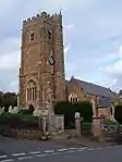 Parish Church of the Nativity of the Blessed Virgin Mary |
| Membury Court | Membury | Farmhouse | c. 16th century | 8 May 1967 | ST2638903785 50°49′44″N 3°02′48″W |
1170743 | |
| Former Chapel Immediately North of Membury Court | Membury Court, Membury | Chapel | c. early 14th century | 8 May 1967 | ST2641003811 50°49′45″N 3°02′47″W |
1098473 | |
| Lugg's Farmhouse Including Outbuilding Adjoining South East | Lugg's Farm, Membury | Farmhouse | c. 16th century | 8 May 1967 | ST2579806480 50°51′11″N 3°03′20″W |
1333598 | |
| Church of St Mary Magdalene | Monkton | Parish church | 15th century | 22 February 1955 | ST1874003106 50°49′18″N 3°09′18″W |
1333700 |  Church of St Mary Magdalene |
| Ashe House | Ashe House, Musbury | House | 1669–83 | 11 September 1951 | SY2768695958 50°45′31″N 3°01′36″W |
1170915 | |
| Netherexe Barton | Nether Exe | Farmhouse | 17th century | 25 October 1984 | SX9344699974 50°47′22″N 3°30′47″W |
1163920 | |
| Church of St Gregory | Harpford, Newton Poppleford and Harpford | Parish church | Late 15th century | 26 May 1987 | SY0907690326 50°42′20″N 3°17′20″W |
1141405 | 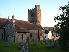 Church of St Gregory |
| Church of St Gregory | Venn Ottery, Newton Poppleford and Harpford | Parish church | Tower 15th century | 30 June 1961 | SY0787191173 50°42′46″N 3°18′23″W |
1328749 | 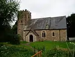 Church of St Gregory |
| Church of St Luke | Newton Poppleford, Newton Poppleford and Harpford | Chapel of ease | 15th century tower | 30 June 1961 | SY0856889710 50°41′59″N 3°17′46″W |
1281606 | 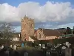 Church of St Luke |
| Conen Cottage & Oak Apple Cottage & Primrose Cottage & the Cottage | Station Rd, Newton Poppleford, Newton Poppleford and Harpford | House | Probably 17th century | 30 June 1961 | SY0877989758 50°42′01″N 3°17′35″W |
1141373 | |
| Ham Cottage | Newton Poppleford, Newton Poppleford and Harpford | House | Early 16th century | 11 November 1952 | SY0876189738 50°42′00″N 3°17′36″W |
1141374 | |
| Malthouse Cottage & St Marys Cottage | Newton Poppleford, Newton Poppleford and Harpford | House | 16th to early 17th century | 8 November 1984 | SY0872489763 50°42′01″N 3°17′38″W |
1328747 | |
| The Old Bakery | Newton Poppleford, Newton Poppleford and Harpford | House | 16th to 17th century | 11 November 1952 | SY0877289738 50°42′00″N 3°17′35″W |
1328746 |  The Old Bakery |
| Church of St Giles | Northleigh | Parish church | Late 15th to early 16th century | 22 February 1955 | SY1958495873 50°45′25″N 3°08′29″W |
1333285 | .jpg.webp) Church of St Giles |
| Basclose | Otterton | House | 17th century | 30 June 1961 | SY0815885282 50°39′36″N 3°18′03″W |
1097486 | |
| Church of St Michael | Otterton | Parish church | Tower late 11th century | 30 June 1961 | SY0799385165 50°39′32″N 3°18′11″W |
1281083 | .jpg.webp) Church of St Michael |
| Otterton Mill including Mill Leat and Sluices to North | Otterton | Mill | Mid 19th century | 11 November 1952 | SY0798685235 50°39′34″N 3°18′11″W |
1334034 | 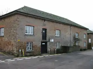 Otterton Mill including Mill Leat and Sluices to North |
| Passaford Farmhouse | Otterton | Farmhouse | Late 16th to early 17th century | 10 February 1987 | SY0904287651 50°40′53″N 3°17′20″W |
1097499 | 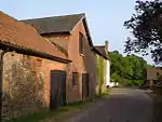 Passaford Farmhouse |
| Pavers Farmhouse including Garden Walls to South and East | Otterton | Farmhouse | Late 15th to early 16th century | 10 February 1987 | SY0897387657 50°40′53″N 3°17′23″W |
1205007 | |
| Front Garden Wall of Knightstone | Wiggaton, Ottery St Mary | Wall | 17th century | 11 January 1974 | SY1066694150 50°44′24″N 3°16′03″W |
1213783 | |
| Hall's Farmhouse | Metcombe, Ottery St Mary | Farmhouse | Early 17th century or earlier | 11 January 1974 | SY0751192013 50°43′13″N 3°18′42″W |
1213329 | |
| The Chanter's House | The College, Ottery St Mary | House | 17th century | 28 April 1952 | SY0977895627 50°45′12″N 3°16′49″W |
1212841 | |
| The Priory | Ottery St Mary | House | 18th century | 28 April 1952 | SY0993295607 50°45′11″N 3°16′41″W |
1213372 | |
| Leyhill | Payhembury | Farmhouse | Early 18th century | 22 February 1955 | ST0992602280 50°48′47″N 3°16′48″W |
1098151 | |
| Lower House including Rear Garden Walls | Payhembury | Farmhouse | Mid to late 16th century | 22 February 1955 | ST0893501648 50°48′26″N 3°17′38″W |
1333702 | |
| Agricultural Outbuildings adjoining to North of Woodbeer Court | Plymtree | Outbuildings | Early 18th century | 24 October 1988 | ST0657004019 50°49′41″N 3°19′41″W |
1098131 | |
| Fordmoor Farmhouse including Front Garden Walls and Gate Piers | Plymtree | Manor house | Late 17th century | 22 February 1955 | ST0584003229 50°49′15″N 3°20′17″W |
1162543 | |
| Little Clyst William Farmhouse | Plymtree | Farmhouse | Early to mid 16th century | 24 October 1988 | ST0662202698 50°48′59″N 3°19′37″W |
1098126 | |
| Middle Clyst William Farmhouse | Plymtree | Farmhouse | Mid to late 15th century | 22 February 1955 | ST0683402716 50°48′59″N 3°19′26″W |
1098127 | |
| Pencepool Farmhouse Including Service Outbuilding to Rear | Plymtree | Farmhouse | Early 16th century | 6 October 1987 | ST0525403122 50°49′12″N 3°20′47″W |
1098136 | |
| Plymtree Manor | Plymtree | Manor house | Early 18th century | 22 February 1955 | ST0586602939 50°49′06″N 3°20′16″W |
1098129 | |
| Woodbeer Court including Front Garden Walls Adjoining to South | Plymtree | Farmhouse | Late 15th to early 16th century | 22 February 1955 | ST0659103998 50°49′41″N 3°19′40″W |
1162634 | |
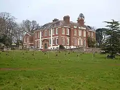
| Poltimore House | Poltimore | House | Late 16th century | 11 November 1952 | SX9676796399 50°45′29″N 3°27′54″W |
1098310 | |
| Paddleford Bridge | Rewe | Road bridge | c. 1700 | 30 June 1961 | SX9521599808 50°47′18″N 3°29′16″W |
1171175 | |
| Church of the Blessed Virgin Mary | Rockbeare | Parish church | Late 15th century | 30 June 1961 | SY0202695261 50°44′55″N 3°23′24″W |
1203864 |  Church of the Blessed Virgin Mary |
| Gate Piers and Gates approximately 350 Metres North West of Rockbeare Manor | Rockbeare | Gate | Piers mid 18th century, gates c. 1820 | 26 May 1987 | SY0299094393 50°44′28″N 3°22′34″W |
1141388 | 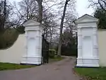 Gate Piers and Gates approximately 350 Metres North West of Rockbeare Manor |
| Stables and Coach Houses Approximately 10 Metres East of Rockbeare Manor | Rockbeare | Stables and house | Probably mid 18th century | 26 May 1987 | SY0320394021 50°44′16″N 3°22′23″W |
1141386 | |
| Lower Northcott Farmhouse | Sheldon | Farmhouse | Mid 17th century | 27 January 1989 | ST1196109112 50°52′29″N 3°15′10″W |
1205128 | |
| Old Sheldon Grange | Sheldon | Farmhouse | Late 15th to early 16th century | 2 July 1987 | ST1295409766 50°52′51″N 3°14′19″W |
1098251 | |
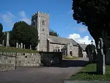
| Church of St Michael | Shute | Parish church | 13th century | 8 May 1967 | SY2527997451 50°46′19″N 3°03′40″W |
1171002 | 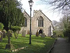 Church of St Michael |
| Shute House | Shute | Country house | 1790 | 8 May 1967 | SY2556996978 50°46′03″N 3°03′25″W |
1171008 | |
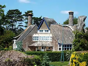
| Audley | Sidmouth | Cottage orné | c. 1810 | 11 November 1970 | SY1231587636 50°40′54″N 3°14′33″W |
1098005 | |
| Aurora & Church House | Sidmouth | House | c. 1820 | 12 October 1951 | SY1243887398 50°40′47″N 3°14′26″W |
1097959 | |
| Beach House | Sidmouth | Villa | c. 1820 | 12 October 1951 | SY1265787247 50°40′42″N 3°14′15″W |
1097933 | |
| Bedford Hotel | Sidmouth | Library | c. 1810 | 12 October 1951 | SY1250387209 50°40′41″N 3°14′23″W |
1097931 | .jpg.webp) Bedford Hotel |
| Church of St Giles with St Nicholas | Sidmouth | Parish church | Late medieval tower | 12 October 1951 | SY1255487374 50°40′46″N 3°14′21″W |
1333807 | 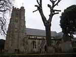 Church of St Giles with St Nicholas |
| Church of St Mary and St Peter | Salcombe Regis, Sidmouth | Parish church | Late medieval | 12 October 1951 | SY1483288834 50°41′34″N 3°12′26″W |
1216101 |  Church of St Mary and St Peter |
| Coburg Terrace | Sidmouth | House | c. 1830 | 12 October 1951 | SY1244787456 50°40′49″N 3°14′26″W |
1097956 | |
| Little Cob & Merton Cottage & Tudor Cottage | Sidmouth | Row | c. 1500 | 12 February 1973 | SY1253387290 50°40′43″N 3°14′22″W |
1333802 | |
| Manstone Old House | Sidmouth | Farmhouse | Medieval | 12 October 1951 | SY1264489416 50°41′52″N 3°14′18″W |
1287980 | |
| Sand | Sidbury, Sidmouth | House | 1594 | 12 October 1951 | SY1470992516 50°43′34″N 3°12′35″W |
1287811 |  Sand |
| Sand Lodge | Sand, Sidbury, Sidmouth | Outbuilding | 1600 | 12 October 1951 | SY1467692524 50°43′34″N 3°12′37″W |
1287812 | |
| Sidholme | Sidmouth | Villa | 1826 | 12 November 1973 | SY1254888067 50°41′08″N 3°14′21″W |
1097928 | |
| St David's | Sidmouth | Terraced house | 1800 | 12 October 1951 | SY1234587315 50°40′44″N 3°14′31″W |
1097908 | |
| Church of St Lawrence | Southleigh | Parish church | 15th century | 22 February 1955 | SY2047493403 50°44′05″N 3°07′42″W |
1252576 | .jpg.webp) Church of St Lawrence |
| Wiscombe Park | Southleigh | Country house | 1826 | 22 February 1955 | SY1862593057 50°43′53″N 3°09′16″W |
1318004 | |
| Lychgate 15 Metres South-east of Sowton Parish Church | Sowton | Lychgate | c. 1852 | 19 March 1987 | SX9759792494 50°43′23″N 3°27′08″W |
1164889 | |
| Broadhayes House | Broadhayes House, Stockland | House | Mid 18th century | 8 May 1967 | ST2337602527 50°49′02″N 3°05′21″W |
1305771 | |
| Lower Lye | Lower Lye, Stockland | Farmhouse | c. early 16th century | 19 October 1984 | ST2476805557 50°50′41″N 3°04′12″W |
1171239 | |
| Townsend Farm House | Stockland | Farmhouse | c. early 16th century | 8 May 1967 | ST2454504692 50°50′13″N 3°04′23″W |
1171316 | |
| Stoke Canon Bridge and Causeway | Stoke Canon | Road bridge | Probably 15th century | 7 March 1990 | SX9380897526 50°46′03″N 3°30′26″W |
1253020 | 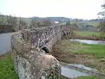 Stoke Canon Bridge and Causeway |
| Harris's Farmhouse | Talaton | Farmhouse | 1687 | 24 October 1988 | SY0680599772 50°47′24″N 3°19′25″W |
1098111 |  Harris's Farmhouse |
| Hawthorn Cottage | Talaton | House | Late 17th century | 22 February 1955 | SY0833997725 50°46′19″N 3°18′05″W |
1098100 | |
| Stoney Court | Talaton | House | Late 15th to early 16th century | 24 October 1988 | SY0670199585 50°47′18″N 3°19′30″W |
1333754 | |
| Talaton Farm Cottage & Talaton Farmhouse | Talaton | Farmhouse | Late 15th to early 16th century | 24 October 1988 | SY0764697864 50°46′23″N 3°18′40″W |
1098105 |  Talaton Farm Cottage & Talaton Farmhouse |
| The Old Manor | Talaton | Farmhouse | Late 15th to early 16th century | 22 February 1955 | SY0679799670 50°47′21″N 3°19′25″W |
1333753 | |
| Church of St Peter and St Paul | Uplyme | Parish church | 15th century | 8 May 1967 | SY3249693511 50°44′14″N 2°57′29″W |
1333613 | .jpg.webp) Church of St Peter and St Paul |
| Charleshayes Farmhouse | Upottery | Farmhouse | Late 15th to early 16th century | 16 March 1988 | ST2122808920 50°52′28″N 3°07′15″W |
1168491 | |
| Church of St Mary the Virgin | Upottery | Parish church | 15th century | 22 February 1955 | ST2019807546 50°51′43″N 3°08′07″W |
1168979 | .jpg.webp) Church of St Mary the Virgin |
| Cowley Bridge | Cowley, Upton Pyne | Road bridge | 1813–14 | 29 January 1953 | SX9073395502 50°44′56″N 3°33′01″W |
1164147 | 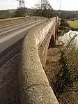 Cowley Bridge |
| Pynes | Upton Pyne | House | c. 1700–1725 | 11 November 1952 | SX9141296350 50°45′24″N 3°32′27″W |
1097597 | |
| Church of St Mary | Whimple | Parish church | 16th century | 30 June 1961 | SY0441797207 50°46′00″N 3°21′24″W |
1163149 | 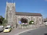 Church of St Mary |
| Fordton Farmhouse | Whimple | Farmhouse | Early 16th century | 15 November 1982 | SY0416497528 50°46′10″N 3°21′37″W |
1098081 | |
| Lower Woodhayes Farmhouse | Whimple | Farmhouse | Early 16th century | 24 October 1988 | SY0478796662 50°45′42″N 3°21′05″W |
1333756 | |
| Church of St Cuthbert | Widworthy | Parish church | Mid to late 14th century | 22 February 1955 | SY2142299288 50°47′16″N 3°06′58″W |
1317948 | 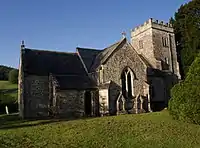 Church of St Cuthbert |
| Cookshayes Farmhouse Including Gate Piers Adjoining to South | Widworthy | Farmhouse | Late 16th to early 17th century | 22 February 1955 | SY2102997529 50°46′19″N 3°07′17″W |
1163959 | |
| Old Triffords Farmhouse | Widworthy | Farmhouse | Early to mid 16th century | 6 October 1987 | SY2252899218 50°47′14″N 3°06′01″W |
1104100 |  Old Triffords Farmhouse |
| Stockers Farmhouse | Widworthy | Farmhouse | Early to mid 16th century | 8 March 1988 | SY2121497210 50°46′09″N 3°07′07″W |
1104101 | |
| Widworthy Barton | Widworthy | Manor house | Early 17th century | 22 February 1955 | SY2136699252 50°47′15″N 3°07′01″W |
1164128 | 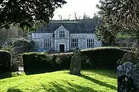 Widworthy Barton |
| Brown's Farmhouse | Woodbury Salterton, Woodbury | Farmhouse | c. 1700 | 11 November 1952 | SY0149288472 50°41′15″N 3°23′45″W |
1104166 | |
| Exton Farmhouse | Exton, Woodbury | Farmhouse | Early to mid 17th century | 11 November 1952 | SX9844686454 50°40′08″N 3°26′18″W |
1104187 | |
| Exton House | Exton, Woodbury | Farmhouse | Late 16th century | 24 May 1976 | SX9842086441 50°40′07″N 3°26′20″W |
1333278 | |
| Former Indoor Riding School 10 Metres South-west of Nutwell Home Farm | Lympstone, Woodbury | Riding school | c. 1800 | 21 April 1986 | SX9875785264 50°39′30″N 3°26′01″W |
1104156 | |
| Nutwell Court | Lympstone, Woodbury | Country house | 18th century | 11 November 1952 | SX9878085035 50°39′22″N 3°26′00″W |
1333302 | |
| 2 and 3 The Green | Woodbury | Cruck house | Early 17th century | 21 April 1986 | SY0101787165 50°40′33″N 3°24′08″W |
1333280 | |
| Livenhayes Farmhouse | Yarcombe | Farmhouse | Probably early 16th century | 22 February 1955 | ST2386607384 50°51′39″N 3°04′59″W |
1333714 | 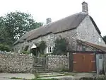 Livenhayes Farmhouse |
| North Waterhayne Farmhouse | Yarcombe | Farmhouse | Early 16th century | 22 February 1955 | ST2557508317 50°52′10″N 3°03′33″W |
1169407 | |
| Sheafhayne Manor including Terraces on All Sides and Outbuildings Adjoining to North | Yarcombe | Manor house | 16th century, rebuilt 19th century | 22 February 1955 | ST2572309287 50°52′42″N 3°03′26″W |
1333716 | |
| Underdown Farmhouse including Front Garden Boundary Walls | Yarcombe | Farmhouse | Late 15th to early 16th century | 16 March 1988 | ST2389707764 50°51′52″N 3°04′58″W |
1169539 |  Underdown Farmhouse including Front Garden Boundary Walls |


.jpg.webp)

Notes
- The date given is the date used by Historic England as significant for the initial building or that of an important part in the structure's description.
- Sometimes known as OSGB36, the grid reference is based on the British national grid reference system used by the Ordnance Survey.
- The "List Entry Number" is a unique number assigned to each listed building and scheduled monument by Historic England.
External links
![]() Media related to Grade II* listed buildings in Devon at Wikimedia Commons
Media related to Grade II* listed buildings in Devon at Wikimedia Commons
This article is issued from Wikipedia. The text is licensed under Creative Commons - Attribution - Sharealike. Additional terms may apply for the media files.