Road signs in Ukraine
Road signs in Ukraine are governed by a combination of standards set out by the Vienna Convention on Road Signs and Signals, the European Union, and Ukraine Transport and Roads Agency. Ukrainian signs are similar to the signs of non-EU post-Soviet states (Russia, Belarus, Kazakhstan, etc.) and are set out in 7 separate categories based on meaning; Warning, Priority, Prohibitory, Mandatory, Information, Guide, and Additional Plates.[1]
Ukraine drives on the right as with the rest of Europe, except for Cyprus, Ireland, Malta and the United Kingdom.
Warning
Warning signs are an upward-pointing red triangle, with white backgrounds and black pictograms. Yellow backgrounds are used for temporary dangers or roadworks conditions. Signs may include additional plates detailing the danger, who the signs apply to, or other necessary information.
- Warning signs
 Curve to the right
 Curve to the left
 Series of curves, first to the right
 Series of curves, first to the left
 Sharp deviation to right marker
 Sharp deviation to left marker
 Abrupt end of road marker
 Road narrows on both sides
 Road narrows on the right
 Road narrows on the left
 Upwards slope (with grade percentage)
 Downwards slope (with grade percentage)
 Unprotected riverbank or quayside near road
 Tunnel
 Uneven road surface
 Bump
Bump Dip
Dip Slippery road surface
 Loose road surface
 Uneven road shoulder
 Danger of falling rocks
 Powerful crosswinds area
 Low-flying aircraft
 Roundabout ahead
 Tram crossing
 Crossroad ahead with priority to the right
 Crossroads ahead with a minor road
 Minor road ahead on right
 Minor road ahead on left
 Staggered crossroads ahead with first on right
 Staggered crossroads ahead with first on left
 Traffic signals ahead
 Draw bridge ahead
 Two-way traffic ahead
 Railway crossing ahead with gates or barriers
 Railway crossing ahead without gates or barriers
 Railway crossbuck (one track)
 Railway crossbuck (multiple tracks)
 Countdown beacon to railway crossing on right side of road (300 metres to crossing)
 Countdown beacon to railway crossing on right side of road (160 metres to crossing)
 Countdown beacon to railway crossing on right side of road (80 metres to crossing)
 Countdown beacon to railway crossing on left side of road (300 metres to crossing)
 Countdown beacon to railway crossing on left side of road (160 metres to crossing)
 Countdown beacon to railway crossing on left side of road (80 metres to crossing)
 Pedestrian crossing ahead
 Watch for children
 Watch for cyclists
 Watch for farm animals
 Watch for wild animals
 Roadworks
 Traffic queues likely
 Attention: Other Dangers! (will have an additional plate describing the danger)
 End of paved road surface
Priority
Priority signs regulate the movement of vehicles in an orderly fashion. The priority road sign tells drives that they have priority at all intersections ahead on the road until the end sign. The traffic bottleneck signs are used where the road is too narrow to permit vehicles to pass side-by-side, but rather must alternate.
- Priority signs


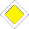 Priority road
 End of priority road
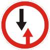 Give way to vehicles coming from the opposite direction
 Priority over vehicles in opposite direction
Prohibitory
Prohibitory signs regulate the use of the road based on movement, classes of vehicles, or other restrictions.
- Prohibitory signs
 Road closed to all traffic
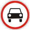 No motor vehicles
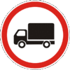 No trucks/heavy goods vehicles
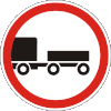 No vehicles pulling trailers
 No farm vehicles/equipment
 No motorcycles
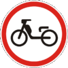 No mopeds
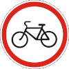 No bicycles
 No pedestrians
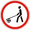 No pedestrians with handcarts
 No horse-drawn carts
 No vehicles carrying dangerous goods
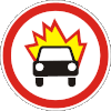 No vehicles carrying explosives
 No vehicles carrying goods that may pollute the water
 No vehicles over 7 tonnes
 No vehicles over 5 tonnes per axle
 No vehicles wider than 2.7 metres
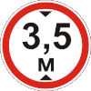 No vehicles higher than 3.5 metres
 No vehicles longer than 10 metres
 Drivers must maintain a distance of at least 70 metres
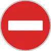 No entry
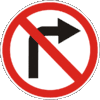 No right turn
 No left turn
 No U-turn
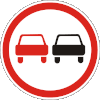 No Overtaking
 End overtaking prohibition
 No overtaking by trucks/heavy goods vehicles
 End overtaking prohibition for trucks/heavy goods vehicles
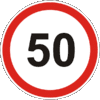 50 km/h speed limit
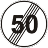 End 50 km/h speed limit (limit reverts to default for road class)
 50 km/h speed limit zone
 End 50 km/h speed limit zone (limit reverts to default for road class)
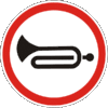 No sounding your horn or excessive noise
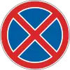 No stopping or parking
 No parking
 No parking on odd-numbered days
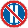 No parking on even-numbered days
 No parking zone
 End no parking zone
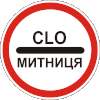 Stop at customs required
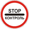 Stop for other road control
 End all previously signed restrictions or prohibitions
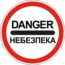 Stop for dangers, including traffic accidents, natural disasters or other road obstructions
Mandatory
Mandatory signs instruct drivers on actions they must take or obey, or may mark types of vehicles permitted to use the road.
- Mandatory signs
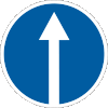 Proceed straight ahead only
 Turn right only
 Turn left only
 Proceed straight or turn right
 Proceed straight or turn left
 Turn left or right (no straight ahead)
 Keep right
 Keep left
 Pass either side
 Roundabout
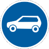 Motor vehicles only
 Bicycles only
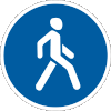 Pedestrians only
 Bicyclists and pedestrians only
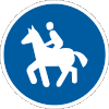 Equestrians only
 50 km/h minimum speed limit
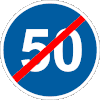 End 50 km/h minimum speed limit
 Vehicles carrying dangerous goods may proceed straight ahead only
 Vehicles carrying dangerous goods may turn right only
 Vehicles carrying dangerous goods may turn left only
Information
Information signs describe conditions of the road and area that do not require a danger warning, mandatory instruction or prohibition.
- Information signs
 Dual-carriageway motorway begins
 Dual-carriageway motorway ends
 Motorway begins
 Motorway ends
 Forward one-way street begins
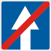 Forward one-way street ends
 Rightward one-way street
 Leftward one-way street
 Forward one-way street with reverse lane for public transport
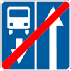 Forward one-way street with reverse lane for public transport ends
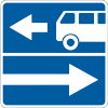 Rightward one-way street with reverse lane for public transport
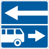 Leftward one-way street with reverse lane for public transport
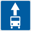 Street with lane for public transport begins
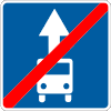 Street with lane for public transport ends
 Street with reversible lane begins
 Street with reversible lane ends
 Crossing the street with reversible lane
 Lane movement permitted
 Lane movement permitted
 Lane movement permitted
 Lane movement permitted
 Lane movement permitted with vehicle class restriction
 Additional lane on the right begins
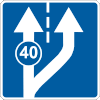 Additional lane on the right begins with minimum speed limit for left lane
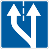 Additional lane on the left begins
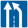 Right lane ends
 Left lane ends
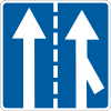 Right lane merges with traffic coming from other road
 Lane on the right begins with traffic coming from other road
 Lane closed, proceed into opposing lane
 Do not enter opposing lane, return to your lane
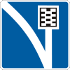 Emergency escape lane for runaway vehicles
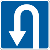 U-turn permitted
 U-turn zone
 Trucks/heavy goods vehicles proceed forward
 Trucks/heavy goods vehicles proceed right
 Trucks/heavy goods vehicles proceed left
 Dead-end street
 Dead-end street ahead on the left
 Dead-end street ahead on the right
 50 km/h advisory speed
 Shared living street zone
 Shared living street zone ends
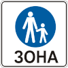 Pedestrians zone
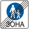 Pedestrians zone ends
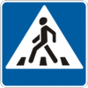 Pedestrian crossing (placed on right side of road)
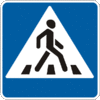 Pedestrian crossing (placed on left side of road)
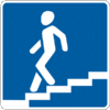 Stairway down
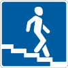 Stairway down
 Stairway up
 Stairway up
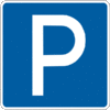 Parking
 Parking zone
 Parking zone ends
 Bus stop (may include schedules and times)
 Bus stop (alternative)
 Tram stop (may include schedules and times)
 Tram stop (alternative)
 Trolleybus stop (may include schedules and times)
 Trolleybus stop (alternative)
 Taxi Stop/Stand/Rank
 Community begins
 Community ends
 Village begins
 Village ends
 National speed limits (used at border crossings with other countries)
 Other road restrictions (such as for a mountainous road ahead)
 Route guide sign with destinations
 Route guide sign with destinations
 Route guide sign with destinations
 Route guide sign with destinations
 Route guide sign with destinations
 Route guide sign with destinations
 Alternative route to meet your destination where left turn is prohibited
 Alternative route for closed road
 Detour route marker
 Detour route marker
 Detour route marker
 Street name sign
 River name sign
 Destinations sign with distances
 Road distance interval marker
 Road route number sign
 Road route number sign with arrow to route
 Road route number sign with arrow to route
 Stop (used where a regular stop sign is not needed, such as unprotected railway crossings)
 Built-up area begins
 Built-up area ends
 New road signage ahead
 Airport
 Train station
 Bus station
 Church (may include name or religious denomination)
 Factory
 Traffic cameras area
Guide
Guide signs mark the way to road services that may be required by the driver. They may include arrows, distances to, or names of the service.
- Guide signs
 First point of medical care
 Hospital
 Emergency phone
 Emergency fire extinguisher
 Mechanic
 Car wash
 Full-service petrol station
 Filling-only petrol station
 Petrol station with mixed services
 Pay telephone
 Information booth
 Traffic police
 Public washrooms
 Water
Water Restaurant
 Refreshments
 Picnic area
 Hotel
Hotel Tourist booth
 Campgrounds
 Caravan parking
 Campgrounds with caravan parking
 Holiday home/rent house
 Trail
Trail Beaches or public pools
 National historic/cultural/tourist site
Additional Plates
Additional plates provide extra information about the sign above it.
- Additional signs
 Above sign effective in 300 metres
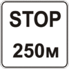 Stop ahead in 250 metres (placed below the Give Way sign to warn of a stop sign ahead)
 Above danger 300 metres to the left
 Above danger 100 metres to the right
 Above danger sign effective for 300 metres
 Above prohibition sign effective in 10 metres
 Above prohibition sign ends
 Above prohibition sign effective in both directions
 Above prohibition sign effective for 30 metres to the right
 Above prohibition sign effective for 30 metres to the left
 Above sign warning of object on the right
 Above sign warning of object on the left
 Above sign warning of object on both sides of road
 Above sign effective during Saturdays, Sundays and public holidays
 Above sign effective during working days
 Above sign effective during weekdays
 Above sign effective during times
 Above sign effective during Saturdays, Sundays and public holidays during times
 Above sign effective during working days during times
 Above sign effective during weekdays during times
 Above sign applies to trucks/heavy goods vehicles
 Above sign applies to vehicles pulling trailers
 Above sign applies to motor vehicles
 Above sign applies to buses
 Above sign applies to farm vehicles/equipment
 Above sign applies to motorcycles
 Above sign applies to bicyclists
 Above sign applies to vehicles carrying dangerous goods
 How to park
 How to park
 How to park
 How to park
 How to park
 No idling during parking
 Diagram of road priority
 Above sign applies to this lane only
 Number of curves in road
 Approach to ferry
 Above sign applied during winter conditions
 Above sign applies during bad weather
 Toll/payment required
 Dock or observation well
 Blind pedestrians may be crossing
 Disabled parking
 Above sign does not apply to disabled persons
 Maximum length for parking
 Above sign enters force on date
 Other Danger: accident area
 Other Danger: accident area
 Other Danger: accident area
 Other Danger: accident area
 Other Danger: this section of road passes near ski slopes or trails, or other winter sports areas