National Register of Historic Places listings in Jamestown, Rhode Island
This is a list of Registered Historic Places in Jamestown, Rhode Island, which has been transferred from and is an integral part of National Register of Historic Places listings in Newport County, Rhode Island.
Bristol | Kent | Newport | Providence | Washington |
- This National Park Service list is complete through NPS recent listings posted January 29, 2021.[1]
| [2] | Name on the Register[3] | Image | Date listed[4] | Location | City or town | Description |
|---|---|---|---|---|---|---|
| 1 | Artillery Park |  Artillery Park |
March 7, 1973 (#73000054) |
North Rd. and Narragansett Ave. 41°29′47″N 71°22′29″W |
Jamestown | |
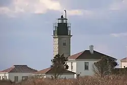
| 2 | Beavertail Light |  Beavertail Light |
December 12, 1977 (#77000024) |
Beavertail Rd. 41°26′58″N 71°23′59″W |
Jamestown | Continuously operating gateway to Narragansett Bay since 1749; part of the Lighthouses of Rhode Island Thematic Resource (TR) |
| 3 | Thomas Carr Farmstead Site (Keeler Site RI-707) | November 1, 1984 (#84000356) |
Address Restricted |
Jamestown | ||
| 4 | Conanicut Battery | July 2, 1973 (#73000055) |
West of Beaver Tail Rd. 41°28′49″N 71°23′38″W |
Jamestown | ||
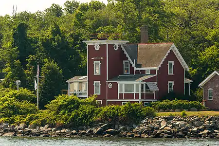
| 5 | Conanicut Island Lighthouse |  Conanicut Island Lighthouse |
February 25, 1988 (#87001698) |
64 N. Bay View Ave. 41°34′24″N 71°22′21″W |
Jamestown | part of the Lighthouses of Rhode Island TR |
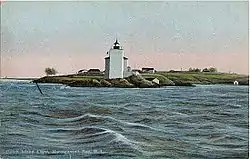
| 6 | Dutch Island Lighthouse |  Dutch Island Lighthouse |
February 25, 1988 (#87001701) |
Southern end of Dutch Island 41°29′44″N 71°24′16″W |
Jamestown | part of the Lighthouses of Rhode Island TR |
| 7 | Fort Dumpling Site |  Fort Dumpling Site |
March 16, 1972 (#72000021) |
Fort Wetherill 41°28′38″N 71°21′28″W |
Jamestown | Fort Wetherill was built on the site of Fort Dumpling. |
| 8 | Friends Meetinghouse |  Friends Meetinghouse |
March 7, 1973 (#73000276) |
North Rd. and Weeden Lane 41°30′52″N 71°22′31″W |
Jamestown | |
| 9 | Hazard Farmstead (Joyner Site RI-706) | November 1, 1984 (#84000365) |
Address Restricted |
Jamestown | ||
| 10 | Horsehead-Marbella |  Horsehead-Marbella |
June 16, 1999 (#99000675) |
240 Highland Dr. 41°28′34″N 71°22′32″W |
Jamestown | |
| 11 | Jamestown Archeological District | December 10, 1989 (#83004869) |
Address Restricted |
Jamestown | ||
| 12 | Jamestown Windmill |  Jamestown Windmill |
March 14, 1973 (#73000057) |
North Rd., north of Weeden Lane 41°30′59″N 71°22′28″W |
Jamestown | |
| 13 | Old Friends Archeological Site | November 7, 1995 (#95001269) |
Address Restricted |
Jamestown | ||
| 14 | Shoreby Hill Historic District[5] |  Shoreby Hill Historic District |
September 15, 2011 (#11000674) |
Roughly bounded by Whittier Rd., Prudence Ln., Emerson Rd., Conanicus Ave., Knowles Ct., Coronado St. & Longfellow Rd. 41°29′57″N 71°22′08″W |
Jamestown | |
| 15 | Windmill Hill Historic District |  Windmill Hill Historic District |
October 2, 1978 (#78000067) |
Eldred Ave. and N. Main Rd. 41°31′04″N 71°22′44″W |
Jamestown |
See also
References
- "National Register of Historic Places: Weekly List Actions". National Park Service, United States Department of the Interior. Retrieved on January 29, 2021.
- Numbers represent an alphabetical ordering by significant words. Various colorings, defined here, differentiate National Historic Landmarks and historic districts from other NRHP buildings, structures, sites or objects.
- "National Register Information System". National Register of Historic Places. National Park Service. March 13, 2009.
- The eight-digit number below each date is the number assigned to each location in the National Register Information System database, which can be viewed by clicking the number.
- "Weekly list of actions taken on properties: 9/12/11 through 9/16/11". National Park Service. September 16, 2011. Retrieved September 18, 2012.
This article is issued from Wikipedia. The text is licensed under Creative Commons - Attribution - Sharealike. Additional terms may apply for the media files.
_(extra_close)_(US48).svg.png.webp)