National Register of Historic Places listings in Foster, Rhode Island
This is a list of Registered Historic Places in Foster, Rhode Island.
Bristol | Kent | Newport | Providence | Washington |
- This National Park Service list is complete through NPS recent listings posted January 29, 2021.[1]
| [2] | Name on the Register[3] | Image | Date listed[4] | Location | City or town | Description |
|---|---|---|---|---|---|---|
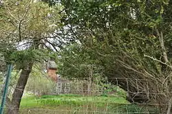
| 1 | Borders Farm |  Borders Farm |
July 29, 2009 (#09000576) |
31-38 N. Rd. 41°47′17″N 71°44′38″W |
Foster | |
| 2 | Breezy Hill Site (RI-957) | September 28, 1985 (#85002700) |
Address Restricted |
Foster | ||
| 3 | Clayville Historic District |  Clayville Historic District |
December 29, 1988 (#88003079) |
Roughly bounded by Cole Ave., Plainfield Pike, Field Hill Rd., and Victory Highway 41°46′37″N 71°40′35″W |
Foster and Scituate | |
| 4 | Capt. George Dorrance House |  Capt. George Dorrance House |
March 16, 1972 (#72000039) |
2 Jencks Rd. 41°44′22″N 71°47′12″W |
Foster | |
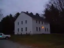
| 5 | Foster Center Historic District |  Foster Center Historic District |
May 11, 1974 (#74000050) |
Foster 41°47′07″N 71°43′18″W |
Foster | |
| 6 | Moosup Valley Historic District |  Moosup Valley Historic District |
May 11, 1988 (#88000521) |
Roughly bounded by Harrington, Johnson, Moosup Valley and Barb Hill, and Cucumber Hill Rds. 41°44′25″N 71°45′23″W |
Foster | |
| 7 | Mt. Hygeia |  Mt. Hygeia |
August 12, 1977 (#77000008) |
Mt. Hygeia Rd. 41°50′48″N 71°45′17″W |
Foster | Also known as the Solomon Drown House. |
| 8 | Mount Vernon Tavern |  Mount Vernon Tavern |
May 8, 1974 (#74000001) |
199 Plainfield Pike (RI 14) 41°43′51″N 71°42′52″W |
Foster | |
| 9 | Hopkins Mill Historic District |  Hopkins Mill Historic District |
May 10, 1984 (#84002013) |
Old Danielson Pike, U.S. Route 6, Maple Rock and Rams Trail Rds. 41°49′21″N 71°42′25″W |
Foster | Misspelled "Nopkins" in the National Register |
See also
References
- "National Register of Historic Places: Weekly List Actions". National Park Service, United States Department of the Interior. Retrieved on January 29, 2021.
- Numbers represent an alphabetical ordering by significant words. Various colorings, defined here, differentiate National Historic Landmarks and historic districts from other NRHP buildings, structures, sites or objects.
- "National Register Information System". National Register of Historic Places. National Park Service. March 13, 2009.
- The eight-digit number below each date is the number assigned to each location in the National Register Information System database, which can be viewed by clicking the number.
This article is issued from Wikipedia. The text is licensed under Creative Commons - Attribution - Sharealike. Additional terms may apply for the media files.
_(extra_close)_(US48).svg.png.webp)