National Register of Historic Places listings in Darke County, Ohio
This is a list of the National Register of Historic Places listings in Darke County, Ohio.

Location of Darke County in Ohio
This is intended to be a complete list of the properties and districts on the National Register of Historic Places in Darke County, Ohio, United States. The locations of National Register properties and districts for which the latitude and longitude coordinates are included below, may be seen in a Google map.[1]
There are 26 properties and districts listed on the National Register in the county.
- This National Park Service list is complete through NPS recent listings posted January 29, 2021.[2]
Current listings
| [3] | Name on the Register[4] | Image | Date listed[5] | Location | City or town | Description |
|---|---|---|---|---|---|---|
| 1 | Bear's Mill | 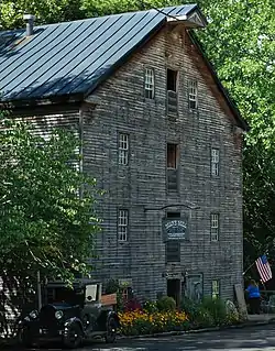 Bear's Mill |
June 10, 1975 (#75001372) |
6450 Arcanum-Bear's Mill Rd., east of Greenville 40°06′24″N 84°32′31″W |
Adams Township | |
| 2 | Anna Beir House | 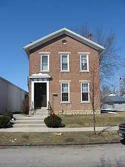 Anna Beir House |
April 11, 1977 (#77001055) |
214 E. 4th St. 40°06′08″N 84°37′47″W |
Greenville | |
| 3 | Broadway Bridge | 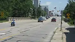 Broadway Bridge |
February 22, 1996 (#96000114) |
Broadway over Greenville Creek 40°06′15″N 84°38′07″W |
Greenville | |
| 4 | Brown Township Building |  Brown Township Building |
August 30, 1983 (#83001955) |
Main and Weller Sts. 40°12′49″N 84°38′14″W |
Ansonia | |
| 5 | Carnegie Library and Henry St. Clair Memorial Hall | 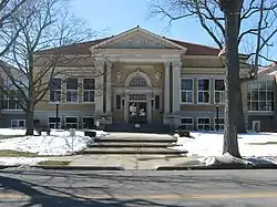 Carnegie Library and Henry St. Clair Memorial Hall |
November 26, 1980 (#80002986) |
520 Sycamore St. and W. 4th St. 40°05′59″N 84°37′58″W |
Greenville | |
| 6 | James and Sophia Clemens Farmstead | 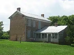 James and Sophia Clemens Farmstead |
March 15, 2001 (#01000199) |
467 Stingley Rd., northwest of Palestine 40°04′39″N 84°47′43″W |
Liberty Township | |
| 7 | Benjamin Franklin Coppess House |  Benjamin Franklin Coppess House |
March 10, 1978 (#78002052) |
209 Washington St. 40°05′54″N 84°37′48″W |
Greenville | |
| 8 | Darke County Courthouse, Sheriff's House and Jail | 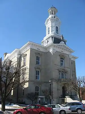 Darke County Courthouse, Sheriff's House and Jail |
December 12, 1976 (#76001409) |
4th and Broadway 40°06′02″N 84°37′54″W |
Greenville | |
| 9 | William English House | 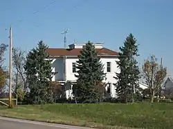 William English House |
June 2, 1982 (#82003562) |
11291 State Route 47, northeast of Versailles 40°15′05″N 84°27′34″W |
Wayne Township | |
| 10 | Fort Jefferson Site | 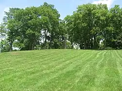 Fort Jefferson Site |
November 10, 1970 (#70000488) |
State Route 121, west of Fort Jefferson 40°01′32″N 84°39′24″W |
Neave Township | |
| 11 | Garst House |  Garst House |
November 16, 1977 (#77001056) |
205 N. Broadway 40°06′25″N 84°38′13″W |
Greenville | |
| 12 | Greenville Mausoleum | 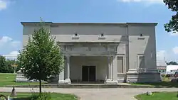 Greenville Mausoleum |
October 21, 1976 (#76001410) |
West St., Greenville Cemetery 40°06′25″N 84°38′27″W |
Greenville | |
| 13 | Greenville South Broadway Commercial District | 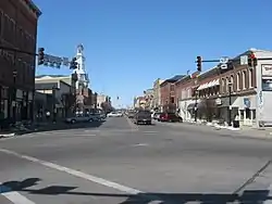 Greenville South Broadway Commercial District |
March 1, 1984 (#84003657) |
Roughly S. Broadway from Main to Washington and Martin Sts. 40°06′04″N 84°37′55″W |
Greenville | |
| 14 | Holy Family Catholic Church |  Holy Family Catholic Church |
July 26, 1979 (#79002817) |
State Route 185 at Frenchtown 40°14′46″N 84°31′25″W |
Wayne Township | |
| 15 | Knights of Pythias Hall |  Knights of Pythias Hall |
August 31, 2018 (#100002876) |
118 E. Washington St. 39°58′03″N 84°42′33″W |
New Madison | |
| 16 | Lambert-Parent House | 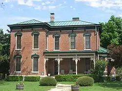 Lambert-Parent House |
May 23, 1980 (#80002987) |
631 E. Elm St. 40°12′03″N 84°47′57″W |
Union City | |
| 17 | Lansdowne House | 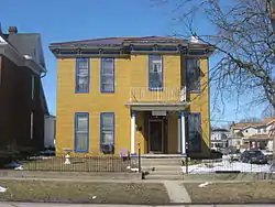 Lansdowne House |
April 20, 1979 (#79001824) |
338 E. 3rd St. 40°06′14″N 84°37′43″W |
Greenville | |
| 18 | Leftwich House | 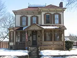 Leftwich House |
October 21, 1975 (#75001373) |
203 S. Washington St. 40°05′54″N 84°37′48″W |
Greenville | |
| 19 | Dr. Donovan Robeson House |  Dr. Donovan Robeson House |
December 12, 1976 (#76001411) |
330 W. 4th St. 40°05′55″N 84°38′07″W |
Greenville | |
| 20 | St. Louis Catholic Church and Rectory | 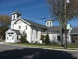 St. Louis Catholic Church and Rectory |
July 26, 1979 (#79002835) |
East of U.S. Route 127 40°19′29″N 84°34′13″W |
North Star | |
| 21 | St. Nicholas Catholic Church and Rectory |  St. Nicholas Catholic Church and Rectory |
July 26, 1979 (#79002841) |
State Route 705 and Washington St. 40°20′26″N 84°29′33″W |
Osgood | |
| 22 | St. Peter Evangelical Lutheran Church | 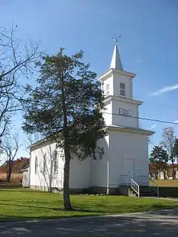 St. Peter Evangelical Lutheran Church |
June 4, 1980 (#80002988) |
South of Versailles on St. Peter Rd. 40°11′45″N 84°27′56″W |
Wayne Township | |
| 23 | Studabaker-Scott House and Beehive School | 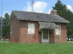 Studabaker-Scott House and Beehive School |
June 15, 1978 (#78002053) |
South of Greenville on State Route 49 40°04′15″N 84°37′56″W |
Greenville Township | |
| 24 | Versailles Town Hall and Wayne Township House | 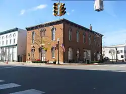 Versailles Town Hall and Wayne Township House |
February 18, 1981 (#81000432) |
4 W. Main St. 40°13′21″N 84°29′05″W |
Versailles | |
| 25 | Christopher C. Walker House and Farm | 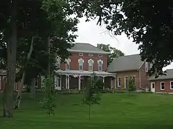 Christopher C. Walker House and Farm |
April 7, 1982 (#82003561) |
Southwest of New Madison, north of State Route 121 39°56′58″N 84°44′10″W |
Harrison Township | |
| 26 | Waring House | 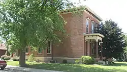 Waring House |
September 16, 1977 (#77001057) |
304 W. 3rd St. 40°05′59″N 84°38′07″W |
Greenville |
See also
| Wikimedia Commons has media related to National Register of Historic Places in Darke County, Ohio. |
References
- The latitude and longitude information provided in this table was derived originally from the National Register Information System, which has been found to be fairly accurate for about 99% of listings. Some locations in this table may have been corrected to current GPS standards.
- "National Register of Historic Places: Weekly List Actions". National Park Service, United States Department of the Interior. Retrieved on January 29, 2021.
- Numbers represent an alphabetical ordering by significant words. Various colorings, defined here, differentiate National Historic Landmarks and historic districts from other NRHP buildings, structures, sites or objects.
- "National Register Information System". National Register of Historic Places. National Park Service. April 24, 2008.
- The eight-digit number below each date is the number assigned to each location in the National Register Information System database, which can be viewed by clicking the number.

Municipalities and communities of Darke County, Ohio, United States | ||
|---|---|---|
| City | Map of Ohio highlighting Darke County | |
| Villages | ||
| Townships | ||
| Unincorporated communities | ||
| Footnotes | ‡This populated place also has portions in an adjacent county or counties | |
| ||
This article is issued from Wikipedia. The text is licensed under Creative Commons - Attribution - Sharealike. Additional terms may apply for the media files.