La Chapelle-Saint-Ouen
La Chapelle-Saint-Ouen is a commune in the Seine-Maritime department in the Normandy region in northern France.
La Chapelle-Saint-Ouen | |
|---|---|
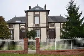 The town hall in La Chapelle-Saint-Ouen | |
Location of La Chapelle-Saint-Ouen 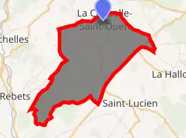
| |
 La Chapelle-Saint-Ouen 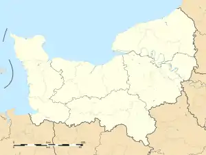 La Chapelle-Saint-Ouen | |
| Coordinates: 49°32′10″N 1°26′07″E | |
| Country | France |
| Region | Normandy |
| Department | Seine-Maritime |
| Arrondissement | Dieppe |
| Canton | Gournay-en-Bray |
| Intercommunality | CC 4 rivières |
| Area 1 | 7.85 km2 (3.03 sq mi) |
| Population (2017-01-01)[1] | 130 |
| • Density | 17/km2 (43/sq mi) |
| Time zone | UTC+01:00 (CET) |
| • Summer (DST) | UTC+02:00 (CEST) |
| INSEE/Postal code | 76171 /76780 |
| Elevation | 94–219 m (308–719 ft) (avg. 190 m or 620 ft) |
| 1 French Land Register data, which excludes lakes, ponds, glaciers > 1 km2 (0.386 sq mi or 247 acres) and river estuaries. | |
Geography
A very small farming village situated in the Pays de Bray, some 17 miles (27 km) northeast of Rouen at the junction of the D38 and the D57 roads.
Population
| Year | 1962 | 1968 | 1975 | 1982 | 1990 | 1999 | 2006 |
|---|---|---|---|---|---|---|---|
| Population | 102 | 105 | 78 | 71 | 76 | 72 | 87 |
| From the year 1962 on: No double counting—residents of multiple communes (e.g. students and military personnel) are counted only once. | |||||||
Places of interest
- An old manorhouse.
- The sixteenth-century château de Bruquedalle.
- The church of St.Ouen, dating from the eighteenth century.
- The church of St.Jean-Baptiste, dating from the eighteenth century.
References
- "Populations légales 2017". INSEE. Retrieved 6 January 2020.
| Wikimedia Commons has media related to La Chapelle-Saint-Ouen. |
| Authority control |
|---|
This article is issued from Wikipedia. The text is licensed under Creative Commons - Attribution - Sharealike. Additional terms may apply for the media files.