Kichha
Kichha is oldest tehseel of udham Singh Nagar district. It is older than Rudrapur city. It has its own municipal board, located in Udham Singh Nagar district, Uttarakhand, India.
Kichha | |
|---|---|
 Indira Gandhi playground in Kichha | |
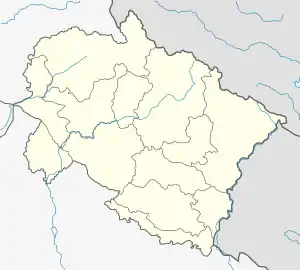
 Kichha Location in Uttarakhand, India  Kichha Kichha (India) | |
| Coordinates: 28.92°N 79.50°E | |
| Country | |
| State | Uttarakhand |
| District | Udham Singh Nagar |
| Named for | King Kichaka |
| Government | |
| • Type | Municipality |
| Elevation | 293 m (961 ft) |
| Population (2011) | |
| • Total | 41,965 |
| Languages | |
| • Official | Hindi , Kumaoni |
| Time zone | UTC+5:30 (IST) |
| PIN | 263148 |
| STD code | 05944 |
| Vehicle registration | UK 06 |
Geography
Kichha is located at 28.92°N 79.50°E.[1] The town has an average elevation of 293 meters (953 feet).
Demographics
As of 2011 India census,[2] Kichha, a small but beautiful town previously was in Nainital district, had a population of 41,965. Males constitute 53% of the population and females 47%. Kichha has an average literacy rate of 76%, higher than the national average of 59.5%. Male literacy is 83%, and female literacy is 59%. In Kichha, 12% of the population is under 6 years of age. Hindus form 45% of the population of Kichha, while Muslims constitute 30% and but Sikh contribute 20% of the same rest 5% are tribes of Tharu and Buxa. Among the total Hindu population, Punjabis and Baniya people are prominent along with a small number of Bengali laborers. The Tharu Buxa tribe, who were once widespread in the region, is today confined to a few nearby villages.
Muslims mainly Arain or Maliks are dominating landowners in the nearby region of the Kichha and Rudrapur. They are Punjabi Muslims who settled in Tarai region of Nainital i.e. Kichha, Bareilly, Pilibheet. They started cultivating the jungles of the area from the 18th century onwards.
Economy
Kichha has largely an agriculture-based economy. Paddy, wheat and sugarcane are the major crops here. Most of the farmers are rich and affluent due to the availability of rich arable land and their sheer hard work. There are some 30+ rice mills in its vicinity. After the establishment of SIDCUL, the economy has developed a lot.
References
- Falling Rain Genomics, Inc – Kichha
- "Census of India 2001: Data from the 2001 Census, including cities, villages and towns (Provisional)". Census Commission of India. Archived from the original on 16 June 2004. Retrieved 1 November 2008.