Gibraltar Hill (Williamsdale, New South Wales)
Gibraltar Hill is a hill in the Monaro region, near Williamsdale in New South Wales, Australia.[3]
| Gibraltar Hill | |
|---|---|
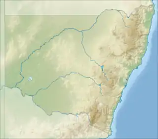
 Gibraltar Hill Location in New South Wales | |
| Highest point | |
| Elevation | 1,129 m (3,704 ft) [1] |
| Coordinates | 35°33′54″S 149°10′04″E [2] |
| Geography | |
| Location | Monaro region, New South Wales, Australia |
Murrumbidgee to Googong Water Transfer pipeline
The Murrumbidgee to Googong Water Transfer pipeline passes through the Gibraltar Range (also known as the Gibraltar Pass), south of Gibraltar Hill.[4][5] Construction of the 13 km (8.1 mi) pipeline began in 2008 and was completed in 2012.[6]
References
- "Eastern Capital City LGA" (PDF). Department of Lands. Division of Local Government. 2003. Archived from the original (PDF) on 26 March 2012. Retrieved 6 November 2012.
- "Gibraltar Hill". Geographical Names Register (GNR) of NSW. Geographical Names Board of New South Wales. Retrieved 5 November 2012.

- "Map of Gibraltar Hill, NSW". Bonzle Digital Atlas of Australia. Retrieved 5 November 2012.
- "Environmental impact statement for Murrumbidgee to Googong Water Transfer" (PDF). ACT Planning and Land Authority. December 2009: 48. Archived from the original (PDF) on 25 March 2012. Cite journal requires
|journal=(help) - Downie, Graham (23 April 2012). "$155m pipeline back on track after flood delay". The Canberra Times. Retrieved 6 November 2012.
- "Bulk Water Alliance (Murrumbidgee to Googong Pipeline)". Abigroup Limited. Retrieved 6 November 2012.
This article is issued from Wikipedia. The text is licensed under Creative Commons - Attribution - Sharealike. Additional terms may apply for the media files.