Colville, New Zealand
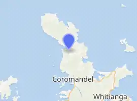
Colville, a small town in the north of the Coromandel Peninsula in the North Island of New Zealand, lies 26 kilometres north of Coromandel in Colville Bay on the Hauraki Gulf, and is the northernmost town of any note on the peninsula. North of Colville, 28 kilometres of rough road lead to the small settlement of Port Jackson, close to the peninsula's northwesternmost point, Cape Colville and 20 km to Port Charles on the northeastern side.
Colville | |
|---|---|

| |
| Coordinates: 36°38′3″S 175°28′35″E | |
| Country | New Zealand |
| Region | Waikato |
| District | Thames-Coromandel District |
| Population (2018) | |
| • Total | 1,485 |
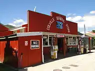
The town is the service and social centre for the area, with a co-operatively-owned general store, Postal Delivery Centre, volunteer fire brigade, school, community hall and several houses. Just beyond the town is the beginning of the Te Moehau Range, which forms the bulk of the northern end of the Coromandel Peninsula, and contains valuable ecological areas, including a population of the threatened North Island brown kiwi.
Colville the town took its name from the cape, which Captain James Cook named[1] on 18 November 1769 after Rear Admiral Lord Colville, under whom Cook had previously served (1759–1761) on HMS Northumberland in the Royal Navy.[2] Colville was also known as Cabbage Bay, thought to be in reference to the cabbage trees in the bay.

Colville township grew following the construction of a general store with a motor garage alongside.[3] This was built by Richard (Dick) Goudie, a local man whose grandparents had settled in Cabbage Bay. Dick Goudie later ran a taxi service from the town, being the first to drive a motor vehicle across the new bridge at Papa Aroha which opened up the northern peninsula from Coromandel. Fossicking for semi-precious stones such as carnelian and for kauri gum are popular activities among tourists visiting the town.[4]
Another member of the Goudie family, John, developed a motor camp a few kilometres north of the town some years later.
The Motukawao Islands lie five kilometres off the coast to the southwest of Colville, in the Hauraki Gulf.
Demographics
| Year | Pop. | ±% p.a. |
|---|---|---|
| 2006 | 1,371 | — |
| 2013 | 1,290 | −0.87% |
| 2018 | 1,485 | +2.86% |
| Source: [5] | ||
The statistical area of Colville at 543 square kilometres is much larger than the town, and covers the western side of the Coromandel Peninsula north of the Waikawau River and the entire area north of and including Kennedy Bay, but excludes Coromandel town. It had a population of 1,485 at the 2018 New Zealand census, an increase of 195 people (15.1%) since the 2013 census, and an increase of 114 people (8.3%) since the 2006 census. There were 573 households. There were 756 males and 729 females, giving a sex ratio of 1.04 males per female. The median age was 52.2 years, with 231 people (15.6%) aged under 15 years, 171 (11.5%) aged 15 to 29, 714 (48.1%) aged 30 to 64, and 366 (24.6%) aged 65 or older.
Ethnicities were 75.6% European/Pākehā, 37.8% Māori, 2.8% Pacific peoples, 1.0% Asian, and 1.8% other ethnicities (totals add to more than 100% since people could identify with multiple ethnicities).
The proportion of people born overseas was 14.3%, compared with 27.1% nationally.
Although some people objected to giving their religion, 58.4% had no religion, 26.5% were Christian, 0.2% were Hindu, 0.0% were Muslim, 1.4% were Buddhist and 7.3% had other religions.
Of those at least 15 years old, 189 (15.1%) people had a bachelor or higher degree, and 285 (22.7%) people had no formal qualifications. The median income was $22,300. The employment status of those at least 15 was that 447 (35.6%) people were employed full-time, 270 (21.5%) were part-time, and 51 (4.1%) were unemployed.[5]
Education
Colville School is a coeducational full primary (years 1–8) school with a decile rating of 2[6] and a roll of 31 students as of March 2020[7].
Notes
- Coromandel Peninsula Archived 2010-05-22 at the Wayback Machine
-
Compare: Arlidge, Allan S. (2016). "Some Factors Governing Cook". Captain Cook Society. Retrieved 1 November 2016.
[...] a part of one letter bears repetition in the context of this work, as it shows the good opinion that Cook's naval superiors had of him as early as 1762. On 30 December of that year, Lord Colville, commander-in-chief of the North American Station included in a letter to the Admiralty: [...] 'Mr Cook late Master of the Northumberland acquaints me that he has laid before their Lordships all his draughts and observations relating to the River St Laurence, part of the coast of Nova Scotia, and Newfoundland... I beg to inform their Lordships, that from my experience of Mr Cook's genius and capacity, I think him well fitted for the work he has undertaken, and for greater undertakings of the same kind.'
- Historic Colville New Zealand Began with the General Store
- "Colville Travel Guide". Jasons Travel Media.
- "Statistical area 1 dataset for 2018 Census". Statistics New Zealand. March 2020. Colville (166500). 2018 Census place summary: Colville
- Education Counts: Colville School
- "New Zealand Schools Directory". New Zealand Ministry of Education. Retrieved 26 April 2020.
References
- Reed, A. W. (2002). The Reed Dictionary of New Zealand Place Names. Auckland: Reed Books. ISBN 0-7900-0761-4.