Chabanais
Chabanais (Occitan: Chabanès) is a commune in the Charente department in southwestern France.
Chabanais | |
|---|---|
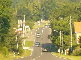
 Route nationale 141 | |
.svg.png.webp) Coat of arms | |
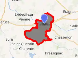
Location of Chabanais 
| |
 Chabanais  Chabanais | |
| Coordinates: 45°52′30″N 0°43′14″E | |
| Country | France |
| Region | Nouvelle-Aquitaine |
| Department | Charente |
| Arrondissement | Confolens |
| Canton | Charente-Vienne |
| Government | |
| • Mayor (2008–2014) | Michel Gealageas |
| Area 1 | 15.01 km2 (5.80 sq mi) |
| Population (2017-01-01)[1] | 1,651 |
| • Density | 110/km2 (280/sq mi) |
| Time zone | UTC+01:00 (CET) |
| • Summer (DST) | UTC+02:00 (CEST) |
| INSEE/Postal code | 16070 /16150 |
| Elevation | 148–250 m (486–820 ft) (avg. 156 m or 512 ft) |
| 1 French Land Register data, which excludes lakes, ponds, glaciers > 1 km2 (0.386 sq mi or 247 acres) and river estuaries. | |
Geography
The river Vienne passes through Chabanais. The village is located in the Rochechouart crater, an ancient asteroid impact crater that eroded away and is no longer visible. Located in the heart of the Charente, Chabanais is 42 km west of Limoges, 50 km northeast of Angoulême, 77 km north of Périgueux and 84 km southeast of Poitiers.
The town is small enough to be considered a large village and it boasts an open-air market every Thursday, adding to a number of small, privately owned shops. The town has a rail station connecting with Limoges to the east and Angoulême to the west.

History
Chabanais was struck by an F2 tornado on 5 May 1997. In the summer of 2018, the town centre and some surrounding hamlets were struck by a devastating hailstorm which punctured many roofs on buildings and destroyed hundreds of car windscreens and bodywork.
Population
| Year | Pop. | ±% |
|---|---|---|
| 1962 | 2,164 | — |
| 1968 | 2,439 | +12.7% |
| 1975 | 2,434 | −0.2% |
| 1982 | 2,242 | −7.9% |
| 1990 | 2,107 | −6.0% |
| 1999 | 1,944 | −7.7% |
| 2008 | 1,879 | −3.3% |
See also
References
- "Populations légales 2017". INSEE. Retrieved 6 January 2020.
| Wikimedia Commons has media related to Chabanais. |