Bukit Larut
Bukit Larut is a hill resort in Malaysia located in the state of Perak, Malaysia, 10 kilometres southwest from Taiping.[4] The area was established under the Pangkor Treaty of 1874 between the Sultan of Perak and the British Empire. The treaty enabled the British to administer Perak. The British Governor insisted to look for a place where the administration and the tin mining activity could be seen from a hilltop from a place of retreat for the English people near Larut and Taiping. Thus, the first bungalow was set up in 1884 for the Resident-General of Perak. The area was named Maxwell Hill after the British Malaya administrator George Maxwell. The name was used until 1979 after which it was renamed as Bukit Larut. An attempt to redevelop Bukit Larut with the inclusion of hotels, a highland flower garden, a lookout tower, a seminar centre, and 400 metres (1,300 ft) of suspension bridge was opposed by the public. The government of Perak cancelled the massive redevelopment project and scaled back to renovating the old colonial-era bungalows and rest houses.
Bukit Larut Maxwell Hill | |
|---|---|
| Other transcription(s) | |
| • Malay | Bukit Larut |
| • Jawi | بوكيت لاروت |
| • Chinese | 太平山 (Simplified) 太平山 (Traditional) |
| • Tamil | மெக்சுவல் மலை |
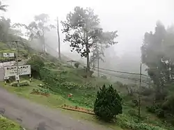 Mist at Bukit Larut | |
| Etymology: "George Maxwell," a British Malaya administrator | |
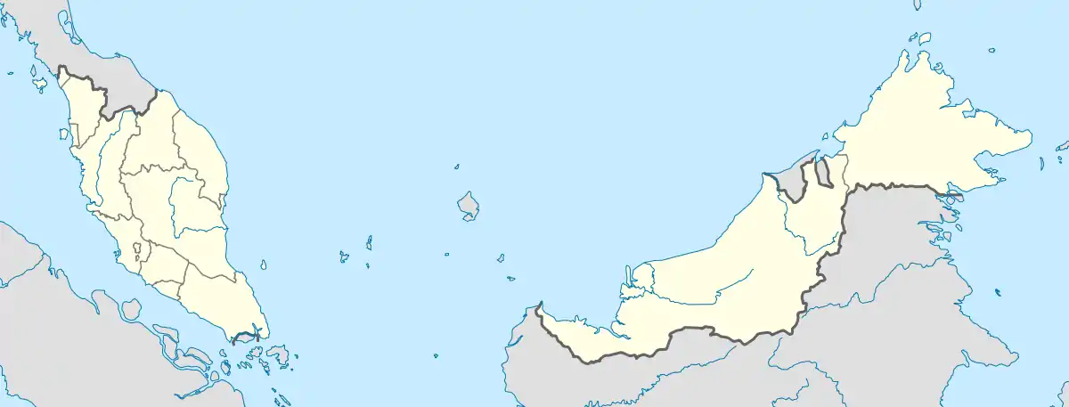 Bukit Larut Maxwell Hill  Bukit Larut Maxwell Hill | |
| Coordinates: 4°51′44.28″N 100°47′34.8″E | |
| Country | |
| State | |
| District | Larut, Matang and Selama District |
| Founded | 1884 |
| Renamed to Bukit Larut | 1979 |
| Elevation | 1,250 m (4,100 ft) |
| Population (2000)[2] | |
| • Total | 2 |
| Time zone | UTC+08:00 (MST) |
| Postcode | 34020[3] |
| Telephone area code | +6-05 |
Bukit Larut is rich in biodiversity which has been studied by various scientists and researchers. Bukit Larut is home to 621 highland plant species which accounts for 20.4% of the overall highland plant species found in Peninsular Malaysia, as well as 27 mammal, 227 bird, 9 reptile, and 56 amphibian species discovered in the area. The area is considered the wettest place in Malaysia due to the location receiving the highest rainfall in Malaysia as the precipitation can reach up to 5,800 millimetres (230 in) annually. Access to Bukit Larut's only road is restricted to only four-wheel vehicle or by foot due to the steep and narrow nature of the road. It is also the place where the annual International Trail Running Association (ITRA)-certified international trail running event, North Face Malaysia Mountain Trail Festival, is held, which is one of the events that act as a qualifier event for Ultra-Trail du Mont-Blanc (UTMB).
History
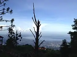
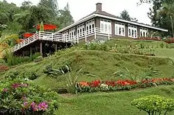
The history of Bukit Larut dates back to the Larut Wars which occurred in 1861 between Chinese underground societies Han San and Ghee Hin over tin mine control in Klian Pauh (predecessor to Taiping), leading to British intervention into Taiping and later The Pangkor Treaty of 1874 which allowed the British administration in Perak.[5] After the treaty was signed, Taiping received Captain Speedy, a British assistant, who was then looking for a way to overlook administration and tin mining from the hilltop. Maxwell Hill was strategically chosen not just as a Taiping observation place, but also as a retreat place for English people near Larut and Taiping. The place was named after George Maxwell, a British Malaya administrator. The first retreat bungalow, "The Cottage", was set up in 1884 for the Resident-General of Perak.[6] The development was followed by the construction of Tempinis Bungalow (formerly Treacher Bungalow) and Cendana Bungalow (formerly The Hut), in 1880 and 1889, to accommodate visitors of Maxwell Hill. The Tea Garden constructed in 1887 used to be part of a tea plantation estate for Assam Tea prior to its end at an unspecified date.[7] As the British realized that the landscape of Maxwell Hill was unable to fulfil their needs to build more buildings, facilities, and amenities such as hotels and railways due to lack of flat terrain, the British administration was in need to look for another mountain area which had a larger area that would allow for larger hill station development. Areas chosen to develop further hill stations were Fraser’s Hill and later Cameron Highlands.[6] Maxwell Hill was renamed to Bukit Larut in 1979, although not much development has taken place in the hill station.[8]
In early 1997, the government of Perak announced that it would plan to redevelop Bukit Larut, a plan that would cost RM 320 million, to enhance potential as a tourism area which was less exploited by the state government. The redevelopment of Bukit Larut included a three-floor four-star hotel, a highland flower garden, a lookout tower, a seminar centre and a 400 metres (1,300 ft) suspension bridge. However, due to opposition to redevelopment plans by residents and some Non-Governmental Organizations (NGO) in addition to political pressures,[9] the redevelopment plan was cancelled on July 20, 1997, and was instead focused on renovating the old colonial-era bungalows and rest houses, which costed RM 2 million instead. At the same time, the JKR Perak revealed that the road on Bukit Larut could not be widened further.[10]
Later on September 23, 2018, a group known as the "Taiping, Larut, Matang dan Selama Nature Lovers Group" opposed the proposed construction of a cable car in Bukit Larut after discussions between North Perak Chinese Chamber of Commerce and Industry and several construction companies that took place in early September, citing that the construction of the cable car would overwhelm the tourism system in Bukit Larut and would also potentially erode the biodiversity in that area.[11] The government of Perak, however, refuted the claim, stated that the cable car project will never take place in the future.[12]
Geography
Bukit Larut is located on the Bintang Range in the northwestern section of Peninsular Malaysia. The area is mountainous where it consists of three peaks, with the highest peak being Gunung Hijau at 1,448 metres (4,751 ft), followed by Gunung Biong at 1,218 metres (3,996 ft) and Wray’s Hill at 1,020 metres (3,350 ft). Due to the area being steep, it is not suitable for agricultural activities. The agricultural activities that were done in the past, such as tea and coffee planting, are now discontinued. The soil itself consists of granite, alluvium and organic deposits, with a high risk of erosion, where it is estimated 150 tons per hectare of soil will be lost annually. It is also an area where water catchment is important for water supply in Larut, Matang and Selama District since the water quality from the area is generally good. The water from Bukit Larut mainly flows to three major rivers in the district: Sungai Jana, Sungai Ranting, and Sungai Air Terjun.[13]
Climate
The temperature at Bukit Larut was recorded to be between 15 °C and 25 °C respectively during the daytime, and at night it was recorded as 10 °C.[14] The area is considered the wettest place in Malaysia because the location receives the highest rainfall in Malaysia, as the precipitation can reach up to 5,800 millimetres (230 in) annually.[15]
Biodiversity
Bukit Larut is known for its biodiversity hotspot in Peninsular Malaysia which has been studied by scientists and researchers. The total highland plant species that have been discovered in Bukit Larut as of 2000 are 621 highland plant species which accounts for 20.4% of the total highland plant species found in Peninsular Malaysia. Among the most popular plant groups found in Bukit Larut are Dicotyledons (410), Monocotyledons (192), ferns (14) and Gymnosperms (5). As of 1997, IUCN Red List classified two plants, Dendrobium aegle and Liparis furcate, as vulnerable due to over-exploitation that would lead to potential extinction in the future. In addition, 12 tree species listed in WCMC World List of Threatened Trees classified as threatened.[16] Various lichens are also found to growing in Bukit Larut, with 22 different lichens discovered in a 2004 study conducted by Universiti Kebangsaan Malaysia and Australia National University.[17]
As for the animal group, based on 2000 data, Bukit Larut houses 27 mammal, 227 bird and 9 reptile species, with one mammal species, the Indochinese tiger (Panthera tigris corbetti) classified as endangered by IUCN Red List. This accounts for 12.7% of overall mammals, 35% of overall birds and 4.2% of overall reptile in Peninsular Malaysia.[18] According to a study between February 2009 to June 2011, researchers from Universiti Sains Malaysia discovered 43 species of amphibians from 24 genera and seven families in Bukit Larut which accounts for 40% of overall 107 amphibian species that were discovered in Peninsular Malaysia. The most common amphibian species families in Bukit Larut are Ranidae (23.3%), Dicroglossidae (18.6%), Microhylidae (16.3%), Rhacophoridae (16.3%), Megophryidae (11.6%), Bufonidae (9.3%) and Ichthyophiidae (4.7%). The number of amphibian species also increased from 36 in 2009 to 56 in 2011.[19] Willemsella, a grasshopper under Acrididae and Hemiacridinae family, which was previously no longer found in Peninsular Malaysia since 1934 was rediscovered in Bukit Larut since 2012 and suggests the widespread availability of this species following its rediscovery from Fraser’s Hill.[20] Some of the flower-visiting orthoptera such as Phaneroptera brevis and Youngia japonica were also discovered in Bukit Larut.[21]
Economy
As Bukit Larut is a tourist attraction, the economy is only limited to tourism and hospitality, since the main source of income was mostly from accommodation services. The accommodations for visitors mostly consist of colonial rest houses and bungalows. No high-rise hotels are available in the area. There are several workers who work in the public sector in Bukit Larut such as gardeners and drivers for district officers. Bukit Larut also has several food stalls, but the hawkers who operate in the area are not residents of Bukit Larut, nor are they selling souvenirs or handicrafts. Aside from the food stalls, there is one restaurant operating on the hill which is located near the rest house. Historically, Bukit Larut used to have coffee and tea plantations on an experimental basis, but the operation was discontinued due to the inflexibility of the transportation system, since only four-wheel drive vehicles can drive into Bukit Larut. However, the Tea Garden House, which was previously part of the tea plantation area, remains unaffected from discontinuation.[2]
Transportation
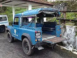
The summit is accessible by only one 13 km road that links between Taiping and Bukit Larut. Due to the steep and narrow nature of the road, only a single vehicle can pass in a single direction, hence road access is restricted to four-wheel vehicle or by foot only. The Larut, Matang and Selama District office provides passengers access to Bukit Larut with their Land Rover vehicles from 9 AM until 5 PM daily. The road is currently maintained by JKR and the condition is well maintained.[22]
Telecommunications
A radio transmitter is located inside Bukit Larut belonging to Radio Televisyen Malaysia that transmits radio and television signals to audiences in Perak. Among the channels that transmit from this tower are Radio Televisyen Malaysia radio and television channels, and TV3.[23]
Sports
Bukit Larut is the site for the annual international trail running event, The North Face Malaysia Mountain Trail Festival, an event sponsored by The North Face that is usually held in December, it attracting more than 2,100 runners from 35 countries.[24] Due to the success of the first event held in 2018, the organizer will continue to organize the event on an annual basis. The trail running event is certified by the International Trail Running Association (ITRA) and is listed as one of the qualifying races for the Ultra-Trail du Mont-Blanc (UTMB). Part of the registration fees will be channelled to the Bukit Larut tourism department for the maintenance of Bukit Larut.[25]
References
- Anbalagan, V. (2002-12-15). "Residents welcome Bukit Larut move". New Straits Times. Retrieved 2020-07-16.
- WWF Malaysia, December 2001. p. 139
- "Bukit Larut, Taiping - Postcode - 34020". postcode.my. Retrieved 2020-07-16.
- Planet, Lonely; Richmond, Simon; Atkinson, Brett; Brown, Lindsay; Bush, Austin; Harper, Damian; Kaminski, Anna; Isalska, Anita; Jong, Ria de (2019-08-01). Lonely Planet Malaysia, Singapore & Brunei. Lonely Planet. ISBN 978-1-78868-540-5.
- Eur (2002). The Far East and Australasia 2003. Psychology Press. ISBN 978-1-85743-133-9.
- Farrah Zaini, Siti; Md Ali, Zuraini; Anak Kayan, Brit (2017-11-16). "Site Selection Criteria for British Colonial Hill Stations in Malaya". International Symposium of Nusantara Cultural Heritage. 2: 3–4. Retrieved 2020-07-13.
- Nadarajah, Chitra, 1997. p. 3
- Bahauddin, Azizi; Mohamed, Badaruddin; Mat Som, Ahmad Puad; Irwana, Shida; Ghapar Othman, Abdul (November 2010). "The British Colonial Architectural Heritage of Fraser's Hill and Cameron Highlands, Malaysia". Transformation and Modernisation in Tourism, Hospitality and Gastronomy: 8. Retrieved 2020-07-13.
- Nadarajah, Chitra, 1997. p. 1
- Bala, S. (1997-07-20). "Bukit Larut, Lake Garden projects cancelled". New Straits Times. Retrieved 2020-07-16.
- Ahmad Pauzi, Shaiful Shahrin (2018-09-23). "Stop talks on Bukit Larut cable car project once and for all, state govt urged". New Straits Times. Retrieved 2020-07-16.
- Gim Ean, Tan (2020-06-18). "Author Liew Suet Fun hopes new book on Larut Hills will reconnect readers with its natural beauty". The Edge. Retrieved 2020-08-03.
- WWF Malaysia, December 2001. p. 130 - 131
- Teoh, Meng (2019-02-20). "What to do at Bukit Larut in Taiping, Perak". The Star. Retrieved 2020-07-16.
- Dill, Martin; John Williams, Douglas; Maschwitz, Ulrich (2002). Herdsmen Ants and Their Mealybug Partners. Cornell University. p. 184. ISBN 9783510613489.
- WWF Malaysia, December 2001. p. 132 - 134
- B. Din, Laily; Zakaria, Zuriati; A. Elix, John (July 2004). "Additional lichen records from Indonesia and Malaysia. 5 Lichens from Bukit Larut. Peninsula Malaysia". Australasian Lichenology. Australian Biological Resources Study. pp. 10–13. S2CID 129965683.
- WWF Malaysia, December 2001. p. 134 - 138
- Shahrudin, Shahriza; Jaafar, Ibrahim (2013-11-07). "The Amphibian Checklist of Bukit Larut, Perak, Malaysia". Pertanika J. Tropical Agriculture Science. 37 (1): 87–99. Retrieved 2020-07-16.
- Kai Tan, Ming; N Kamaruddn, Khairul (2016-03-07). "Redescription of the little-known grasshopper Willemsella (Acrididae, Hemiacridinae) fromPeninsular Malaysia". Biodiversity Data Journal. 4 (e7775): 2. doi:10.3897/BDJ.4.e7775. PMC 4822071. PMID 27099555.
- Kai Tan, Ming; et., al. (2017-11-24). "Overlooked flower-visiting Orthoptera in Southeast Asia" (PDF). Journal of Orthoptera Research. 26 (2): 143–153. doi:10.3897/jor.26.15021. Retrieved 2020-06-16.
- WWF Malaysia, December 2001. p. 142
- "Penang Hill folk receiving TV3". New Straits Times. 1985-11-18. Retrieved 2020-07-16.
- "Pelari dari Denmark rangkul juara acara Terbuka Lelaki 84KM TNF-MMTF 2019" [Danish runner won championship in 84 KM Male Open category in TNF-MMTF 2019]. The Star (in Malay). 2019-12-26. Retrieved 2020-07-16.
- Lee, JQ (2019-10-04). "BIGGER TURNOUT FOR THE NORTH FACE!". 12FLY.com.my. Retrieved 2020-07-16.
Further reading
- WWF Malaysia, November 2001. Study on the Development of Hill Stations: Final Report Volume 2 Petaling Jaya: World Wide Fund for Nature.
- Nadarajah, Chitra, 1997. A Biological Management Study of Bukit Larut & Its Surroundings, Perak, Malaysia Petaling Jaya: Education & Research Association for Consumers, Malaysia. ISBN 983-40038, OCLC 62895588
External links
| Wikimedia Commons has media related to Bukit Larut. |
.jpg.webp)
