2013 Solomon Islands earthquake
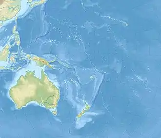
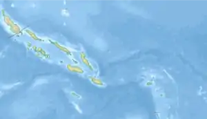
The 2013 Solomon Islands earthquake struck northeast of Australia on 6 February with a moment magnitude of 8.0 and a maximum Mercalli intensity of VIII (Severe). Its epicenter was the Solomon Islands, at the boundaries of the Australian and Pacific tectonic plates, causing local evacuations and a tsunami of 1.5 m (4.9 ft) and killing at least nine people.
  | |
| UTC time | 2013-02-06 23:12:25 |
|---|---|
| ISC event | 602419452 |
| USGS-ANSS | ComCat |
| Local date | February 6, 2013 |
| Local time | 12:12:25 SBT |
| Magnitude | 8.0 Mw |
| Depth | 24 km (15 mi) |
| Epicenter | 10.799°S 165.114°E |
| Type | Megathrust |
| Areas affected | Solomon Islands |
| Max. intensity | VIII (Severe) |
| Tsunami | Yes |
| Aftershocks | 20 |
| Casualties | 9 dead, 5 missing, 17 injured |
Tectonic setting
The Santa Cruz and Solomon Islands are located on the plate boundary between the Australian and Pacific plate. This highly seismic region has “near 90° bend in the boundary…"[1] This area experiences much plate movement as the Santa Cruz Island “has upper plate strike-slip and normal faulting, plate boundary under-thrusting, outer rise extensional faulting, and intraplate faulting” and the Solomon Islands are located on the subduction zone of the two boundaries.[1] On February 6, 2013, the largest under-thrusting earthquake ever to be recorded in that area caused a tsunami and both were destructive to the area. Major villages on both groups of islands, Lata and Nendö were destroyed and at least 724 homes were confirmed as damaged.
Earthquake
On 6 February 2013, at 12:12 local time (01:12 UTC) an earthquake struck the Solomon Islands, located in the south Pacific Ocean.[2] The epicenter was 76 kilometres (47 mi) west of Lata on Nendo Island.[2] The earthquake occurred due to the interaction between the Australian Plate and the Pacific Plate, and was preceded by dozens of foreshocks in the region.[2] The magnitude of this earthquake was put at 8.0 on the moment magnitude scale.[2] At least 20 aftershocks were reported,[3] including one measuring 7.1[4] on 8 February and two measuring M7.0.[5] “This event had a shallow dipping thrust faulting mechanism…” and “…produced a tsunami of ~ 1.5 height” on the Santa Cruz Islands.[1] Toward the end of the week before February 6, the area was very active and there were many magnitude 6 earthquakes that occurred in the area.
The closest island to the epicenter, Nendo and its largest city, Lata were said to experience the largest amount of shaking. Even though there were aftershock earthquakes of magnitude 6, the most worrisome effect of the earthquake was the potential tsunami. As the wait for the tsunami continued, many villages had already been destroyed. For example, earthquake shaking destroyed many villages to the west and south of Lata, on the coastline, before the tsunami arrived. Many Pacific countries ordered evacuations, as their authorities did not take any risks. Countries that were not on the warning list were evacuated. Residents of the Solomon Islands and other surrounding islands were working their way to higher ground. Major traffic jams were caused in Honiara, the capital city of Solomon Islands as people attempted to flee the coming wave. After the main shock, the epicenter area was hit by 13 aftershocks greater than magnitude 5.”
The earthquake was formed on the boundary between the Pacific and Australian plates. This area has complicated faulting patterns that are close to the Solomon Island arcs and Vanuatu Island arcs. The area is used to high frequency, low to moderate intensity seismic activity.[1] Many of the “larger events recorded have involved intraplate and interplate earthquakes with magnitudes up to about 8.0, several of which were located near the abrupt bends in the arcs.[1] The Solomon Islands appear to have more seismic activity than the other areas earthquake productivity than most areas. The area also seems to produce more earthquake “doublets” and “triplets,” a deviation from the normal earthquake aftershock in which a second and sometimes third earthquake can be produced from the aftershock of the first earthquake.[6] This occurs rarely, maybe once or twice a year, making this area a unique seismic area.
Damage
.jpg.webp)
In Honiara, the capital of the Solomon Islands, residents evacuated to higher ground,[7] causing traffic jams.[8] Local news agencies reported that four villages were destroyed.[3] Houses were flooded in eastern Temotu Province.[5] On Santa Cruz Island, 1.5 m (4.9 ft) waves damaged 50 buildings.[9] In Lata, the tsunami damaged the airport and flooded low-lying areas,[10] killing nine people, five elderly and one child.[11] More than 100 houses on the island were damaged, and the water and electricity services were interrupted.[12] It was reported that almost all houses in Nela village were washed away, and some homes in Venga village were shifted by water.[13] Officials in Noumea ordered residents to evacuate along the eastern coast of New Caledonia and nearby Loyalty Islands.[14] Residents also evacuated to higher ground in Suva, the capital of Fiji.[3] The earthquake killed 9 people, and 5 people remain listed as missing.[11]
Tsunami
The Pacific Tsunami Warning Center issued a tsunami warning for the Solomon Islands, Papua New Guinea, Fiji,[15] and several other islands in the region; the agency also issued a tsunami watch for Australia, New Zealand and eastern Indonesia.[7][16] The earthquake produced a tsunami measuring 1 metre (3 ft 3 in) at Lata, Solomon Islands,[7][16] that reached about 500 m (1,600 ft) inland.[3] Smaller tsunamis of 11 cm (4.3 in) and 50 cm (20 in) were reported in Vanuatu and New Caledonia, respectively.[8]
Environmental context
There are many human elements that affect the ecosystem and how both the Santa Cruz and Solomon Islands will recover from natural disasters. Though it was once one of the most diverse ecosystems in the world, very little attention is given in the Solomons to biodiversity and environmental conservation.[17] 85% of the people on these islands live a subsistence lifestyle.[17] The population is growing about 4.4% annually and as it grows, the people must use more of their natural resources as food and shelter.[17] The ecosystems in both of these islands are already being threatened by invasive species, major loss of coastal land, and overharvesting. That means that sudden major loss of biodiversity, like that caused by both the earthquake and tsunami, can lead to “hunger, poverty, disease, and conflict and is a threat to internal security…” to both islands.[17]
See also
References
- Lay, Thorne; Ye, Lingling; Kanamori, Hiroo; Yamazakic, Yoshiki; Cheung, Kwok Fai; Ammond, Charles J. (2013). "The February 6, 2013 Mw 8.0 Santa Cruz Islands earthquake and tsunami" (PDF). Tectonophysics. 608: 1109–1121. doi:10.1016/j.tecto.2013.07.001.
- USGS. "M8.0 – 76km W of Lata, Solomon Islands". United States Geological Survey.
- "Five dead as Solomons quake sparks Pacific tsunami". Times of India. Agence France-Presse. 2013-02-06. Archived from the original on February 6, 2013. Retrieved 2013-02-06.
- AFP (9 February 2013). "Villagers flee huge aftershock in tsunami-hit Solomon Islands". ChannelNewsAsia. Retrieved 9 February 2013.
- "Powerful earthquake strikes off Solomon Islands". BBC. 2013-02-05. Retrieved 2013-02-05.
- Kagan, Y.Y.; Jackson D.D. (1999). "Worldwide doublets of large shallow earthquakes". Bulletin of the Seismological Society of America. 89 (5): 1147–1155. Retrieved 22 October 2013.
- "Tsunami alert after Solomon Islands earthquake". The Guardian. 2013-02-05. Retrieved 2013-02-05.
- "Solomons quake triggers tsunami, destroys villages". ABC Australia. 2013-02-05. Retrieved 2013-02-05.
- "Tsunami damages dozens of homes in Solomon Islands". USAToday.com. Associated Press. 2013-02-05. Retrieved 2013-02-05.
- "Fears for villages after major quake hits near Solomons". Sydney Morning Herald. 2013-02-06. Retrieved 2013-02-05.
- Nicole Pryor And Agencies (2013-02-07). "Airport damage hits Solomons quake cleanup". Fairfax New Zealand Limited. Retrieved 2013-02-07.
- McFadden, Suzanne; Mullany, Gerry (2013-02-06). "Tsunami Causes Deaths and Damages Homes on Solomon Islands". The New York Times. Retrieved 2013-02-06.
- Updated at 9:53 pm on 7 February 2013 (2013-02-06). "Radio New Zealand : News : World : Airport flood hinders tsunami aid effort". Radionz.co.nz. Retrieved 2013-02-10.
- "Powerful quake strikes in South Pacific, sparks tsunami". CNN. 2013-02-05. Retrieved 2013-02-05.
- Vuibau, Tevita (6 February 2013). "Tsunami warning". The Fiji Times. Archived from the original on 2013-02-08. Retrieved 8 February 2013.
- Kaylene Hong (2013-02-05). "Magnitude 8 Quake Strikes Off Santa Cruz Islands". Wall Street Journal. News Corporation. Retrieved 2013-02-05.
- "Solomon Islands". Secretariat of the Pacific Regional Environment Programme. Retrieved 24 October 2013.
External links
| Wikimedia Commons has media related to 2013 Solomon Islands earthquake. |