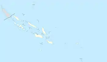
Lata, Solomon Islands
Lata is the provincial capital of Temotu Province, Solomon Islands. As of 2007, it had 553 inhabitants. There are a few rest houses for overnight stays. There is a post office, telecom office and numerous stores.
Lata | |
|---|---|
 Lata Location in the Solomon Islands | |
| Coordinates: 10°43′S 165°50′E | |
| Country | |
| Province | Temotu |
| Island | Nendo Island |
| Elevation | 0 m (0 ft) |
| Population (2007)[1] | |
| • Total | 553 |
| Time zone | UTC+11 (UTC) |
| Climate | Af |
The town contains a small air strip with flights to Makira and Honiara. Shipping service is irregular, but occasionally transport can be found to Honiara or the outer islands. Outboard canoe travel around the island of Nendo or to the Reef Islands is possible.
Temotu Province's main hospital, Lata Hospital is situated in Lata town.
The only fixed-wing service is by Solomon Islands Air. The RAMSI Regional Assistance Mission to the Solomon Islands provides its own helicopter flights fortnightly to Lata.
During the ethnic tensions of 2003, there were no problems in Lata, mainly due to its being so far away from the capital, Honiara.
Arguably the most famous former resident of Lata is the Solomon Islands-born Australian model, Casey Pritchard, who grew up between Lata and Melbourne.
Lata is serviced by one free to air analogue television channel broadcast in the VHF band on 175.25MHz providing a mix of sport and news content. The channel is provided by Telekom Television, wholly owned by Solomon Telekom one of two telecommunications providers in the Solomon Islands.
Climate
Lata has a tropical rainforest climate (Af) with very heavy rainfall year-round.
| Climate data for Lata | |||||||||||||
|---|---|---|---|---|---|---|---|---|---|---|---|---|---|
| Month | Jan | Feb | Mar | Apr | May | Jun | Jul | Aug | Sep | Oct | Nov | Dec | Year |
| Average high °C (°F) | 30.7 (87.3) |
30.7 (87.3) |
30.5 (86.9) |
30.6 (87.1) |
30.1 (86.2) |
29.9 (85.8) |
29.0 (84.2) |
29.0 (84.2) |
29.3 (84.7) |
29.9 (85.8) |
30.5 (86.9) |
30.8 (87.4) |
30.1 (86.2) |
| Daily mean °C (°F) | 27.3 (81.1) |
27.3 (81.1) |
27.2 (81.0) |
27.3 (81.1) |
27.0 (80.6) |
26.9 (80.4) |
26.3 (79.3) |
26.2 (79.2) |
26.4 (79.5) |
26.7 (80.1) |
27.2 (81.0) |
27.3 (81.1) |
26.9 (80.5) |
| Average low °C (°F) | 24.0 (75.2) |
24.0 (75.2) |
24.0 (75.2) |
24.0 (75.2) |
23.9 (75.0) |
23.9 (75.0) |
23.7 (74.7) |
23.4 (74.1) |
23.6 (74.5) |
23.6 (74.5) |
23.9 (75.0) |
23.9 (75.0) |
23.8 (74.9) |
| Average precipitation mm (inches) | 436 (17.2) |
372 (14.6) |
461 (18.1) |
305 (12.0) |
363 (14.3) |
296 (11.7) |
363 (14.3) |
366 (14.4) |
355 (14.0) |
363 (14.3) |
347 (13.7) |
335 (13.2) |
4,362 (171.8) |
| Source: Climate-Data.org[2] | |||||||||||||
References
- World Gazeteer Archived 2012-03-02 at the Wayback Machine
- "Climate: Lata". Climate-Data.org. Retrieved 21 October 2020.