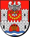
Zawiercie County
Zawiercie County (Polish: powiat zawierciański) is a unit of territorial administration and local government (powiat) in Silesian Voivodeship, southern Poland. It came into being on January 1, 1999, as a result of the Polish local government reforms passed in 1998. Its administrative seat and largest town is Zawiercie, which lies 41 kilometres (25 mi) north-east of the regional capital Katowice. The county contains five other towns: Poręba, 6 km (4 mi) west of Zawiercie, Łazy, 8 km (5 mi) south of Zawiercie, Ogrodzieniec, 9 km (6 mi) south-east of Zawiercie, Szczekociny, 33 km (21 mi) north-east of Zawiercie, and Pilica, 18 km (11 mi) east of Zawiercie.
Zawiercie County
Powiat zawierciański | |
|---|---|
 Flag  Coat of arms | |
 Location within Silesian Voivodeship | |
| Coordinates (Zawiercie): 50°30′N 19°25′E | |
| Country | |
| Voivodeship | Silesian |
| Seat | Zawiercie |
| Gminas | |
| Area | |
| • Total | 1,003.27 km2 (387.36 sq mi) |
| Population (2019-06-30[1]) | |
| • Total | 118,020 |
| • Density | 120/km2 (300/sq mi) |
| • Urban | 74,500 |
| • Rural | 43,520 |
| Car plates | SZA |
| Website | http://www.zawiercie.powiat.pl/ |
The county covers an area of 1,003.27 square kilometres (387.4 sq mi). As of 2019 its total population is 118,020. The most populated towns are Zawiercie with 49,334 inhabitants and Poręba with 8,525 inhabitants.
Neighbouring counties
Zawiercie County is bordered by Częstochowa County to the north, Włoszczowa County to the north-east, Jędrzejów County and Miechów County to the east, Olkusz County and the city of Dąbrowa Górnicza to the south, Będzin County to the south-west, and Myszków County to the west.
Administrative division
The county is subdivided into 10 gminas (two urban, four urban-rural and four rural). These are listed in the following table, in descending order of population.
| Gmina | Type | Area (km²) |
Population (2019) |
Seat |
| Zawiercie | urban | 85.2 | 49,334 | |
| Gmina Łazy | urban-rural | 132.6 | 15,923 | Łazy |
| Gmina Ogrodzieniec | urban-rural | 85.7 | 9,105 | Ogrodzieniec |
| Gmina Pilica | urban-rural | 138.9 | 8,625 | Pilica |
| Poręba | urban | 40.0 | 8,525 | |
| Gmina Szczekociny | urban-rural | 136.1 | 7,692 | Szczekociny |
| Gmina Kroczyce | rural | 110.2 | 6,331 | Kroczyce |
| Gmina Włodowice | rural | 76.3 | 5,235 | Włodowice |
| Gmina Żarnowiec | rural | 124.8 | 4,627 | Żarnowiec |
| Gmina Irządze | rural | 73.6 | 2,623 | Irządze |
References
- "Population. Size and structure and vital statistics in Poland by territorial divison in 2019. As of 30th June". stat.gov.pl. Statistics Poland. 2019-10-15. Retrieved 2020-02-14.
