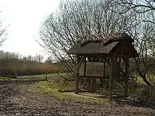
Woodwalton Fen
Woodwalton Fen is a 209 hectare biological Site of Special Scientific Interest in the parish of Woodwalton, west of Ramsey in Huntingdonshire, Cambridgeshire.[1][3] It is a Ramsar wetland site of international importance,[4] a National Nature Reserve,[5] a Special Area of Conservation[6][7] and a Nature Conservation Review site, Grade I.[8] The site is managed by Natural England.[9]
| Site of Special Scientific Interest | |
 Gordon's Mere, Woodwalton Fen | |
| Area of Search | Cambridgeshire |
|---|---|
| Grid reference | TL 229 844[1] |
| Interest | Biological |
| Area | 209 hectares[1] |
| Notification | 1985[1] |
| Location map | Magic Map |
| Designations | |
|---|---|
| Official name | Woodwalton Fen |
| Designated | 12 September 1995 |
| Reference no. | 753[2] |
History
One of the first nature reserves to be created in England, Woodwalton Fen was bought by Charles Rothschild in 1910.[10] Rothschild intended to present the site to the National Trust, but they declined it, and it was kept initially as a private nature reserve with a bungalow for the owner to stay in.[11]
The Fen View Heritage Centre opened in 2018.[12]
Geography
The area used to be Great Britain maritime coastline.[12]
The lowest land in Britain (2.7 meters below sea level) is located in the Fen.[12]
Ecology
The site has one of the few remaining ranges of flora characteristic of the East Anglian Fens. There are rare fen plants such as fen wood-rush and fen violet, and ditches have uncommon aquatic plants including bladderwort and water violet.[13]
Threats
As well as being a nature reserve, Woodwalton Fen is used to store winter flood water. There are issues relating to water quality. The flood water entering Woodwalton Fen has high silt and nutrient loads.
Relationship with other East Anglian fens
It is part of a Special Area of Conservation, Fenland SAC, which includes two other fragments of wild fenland in Cambridgeshire: Wicken Fen (about 38 miles from Woodwalton) and Chippenham Fen.
As part of the Great Fen Project, Woodwalton Fen is being connected to Holme Fen via habitat restoration of land which has been under arable cultivation. The Great Fen Project started with the purchase of 82 hectares of land (Darlows Farm), to the north of Woodwalton Fen in 2002.[14] The Cambridge Geological Society designed the Fen Edge Trail that runs along what used to be the maritime coast of England.[12]

Access
There is access to the reserve from Chapel Road in Ramsey Heights village.[9]
References
- "Designated Sites View: Woodwalton Fen". Sites of Special Scientific Interest. Natural England. Retrieved 14 December 2016.
- "Woodwalton Fen". Ramsar Sites Information Service. Retrieved 25 April 2018.
- "Map of Woodwalton Fen". Sites of Special Scientific Interest. Natural England. Retrieved 14 December 2016.
- "Information Sheet on Ramsar Wetlands (RIS): Woodwalton Fen" (PDF). Joint Nature Conservation Committee. Retrieved 14 December 2016.
- "Cambridgeshire's National Nature Reserves". Natural England. Retrieved 14 December 2016.
- "Fenland SAC". Joint Nature Conservation Committee. Retrieved 13 December 2016.
- "Fenland SAC (Woodwalton Fen, Wicken Fen & Chippenham Fen)" (PDF). Cambridgeshire County Council. Retrieved 13 December 2016.
- Ratcliffe, Derek, ed. (1977). A Nature Conservation Review. 2. Cambridge, UK: Cambridge University Press. p. 211. ISBN 0521 21403 3.
- "Visit Woodwalton Fen". Great Fen. Retrieved 13 December 2016.
- Barnes, Simon (December 2015). "The best way to honour Charles Rothschild's legacy is to cherish Britain's wild places". The Guardian (theguardian.com). Retrieved 16 January 2016.
- "Naturalist's bungalow gets a face-lift". Hunts Post. Retrieved 7 February 2016.
- Barkham, Patrick (2018-04-22). "'Weirder than any other landscape': a wild walk in the Fens". The Guardian. ISSN 0261-3077. Retrieved 2020-02-06.
- "Woodwalton Fen citation" (PDF). Sites of Special Scientific Interest. Natural England. Retrieved 14 December 2016.
- "Darlows Farm". Retrieved 17 January 2016.