West Harrow
West Harrow is a locality directly to the west/southwest of Harrow town in the London Borough of Harrow.
| West Harrow | |
|---|---|
 St Peter's Church on Sumner Road | |
 West Harrow Location within Greater London | |
| Population | 10,373 (2011 Census. Ward)[1] |
| OS grid reference | TQ145875 |
| London borough | |
| Ceremonial county | Greater London |
| Region | |
| Country | England |
| Sovereign state | United Kingdom |
| Post town | HARROW |
| Postcode district | HA1, HA2 |
| Dialling code | 020 |
| Police | Metropolitan |
| Fire | London |
| Ambulance | London |
| UK Parliament | |
| London Assembly | |
Location
As its name suggests, West Harrow is located on the western side of Harrow, roughly covering the area to the west of Bessborough Road, to the south of Pinner Road and to the north of Whitmore Road. To the south east of West Harrow is Harrow on the Hill, to its north east is the town centre of Harrow, to its west is Rayners Lane, to its north is North Harrow, and to its south are Roxeth and South Harrow.
Arts and culture
West Harrow is home to poet Tim Dooley, jazz pianist Alex Webb,[2] and musicians Courtney Pine, and Gary Crosby. The neighbourhood is also home to the Usurp Art Collective, a charity that, since 2010, has provided professional support to artists and cultural programmes by providing gallery and studio space.[3]
West Harrow Park, boasts a cafe, free gym equipment and has a large children's and under-fives play area for local families.
Demography
In the 2011 census, 55.8% of the population was of BAME (Black, Asian and minority ethnic) background.[4]
In the 2014/15 period, West Harrow ward had a crime rate of 31.2, which was 10th lowest out of the 628 wards of Greater London.[5]
Zoning information

West Harrow is almost exclusively residential, with a few threads of localized commercial zoning around its edges and an occasional small shop dotted within the residential areas.
History
Prior to the early 20th century West Harrow was overwhelmingly rural. The construction of the Uxbridge extension to the Metropolitan line in 1904, and specifically the new West Harrow tube station, triggered a steady growth of homes in the area, spreading out from the location of the new station. In his 1973 BBC TV film about London suburbia, Metroland, Sir John Betjeman stands in Vaughan Road and delivers a piece to camera about the development of the area in the 1900s.[6] The remaining open pockets of West Harrow were filled with small council and retirement estates in the second half of the 20th century.
Several of the roads in West Harrow are named after teachers at Harrow School, as described by Betjeman in his film: Drury Road (Joseph Drury); Vaughan Road (Charles Vaughan); Butler Road (Henry Montagu Butler); Bowen Road (Edward Ernest Bowen); Sumner Road (Robert Carey Sumner); and Heath Road (Benjamin Heath).[7] Merivale Road (Charles Merivale, one of the pair who started the Boat Race). All the roads on the Honeybun Estate (one of the borough's first Council estates are also named after Harrow schoolmasters.
Area amenities
- West Harrow Park, The Ridgeway, West Harrow
- St. Peter's Church (Church of England), Sumner Road, West Harrow
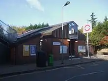
- West Harrow Station, The Gardens, West Harrow
Transport and locale
Geography
References
- "Harrow Ward population 2011". Neighbourhood Statistics. Office for National Statistics. Retrieved 23 October 2016.
- http://www.watfordobserver.co.uk/leisure/theatre/cfutheatrenews/9788356.Recreating_the_jazz_cafe_society/?ref=rss
- Proctor, Ian (15 September 2010). "New art gallery for West Harrow". My London. Retrieved 26 May 2020.
- https://data.london.gov.uk/dataset/ward-profiles-and-atlas
- https://data.london.gov.uk/dataset/ward-profiles-and-atlas
- http://www.bbc.co.uk/programmes/b00cyyqw
- John Guest (ed.). The Best of Betjeman (2000 ed.). Penguin Books. p. 224.

