Washington State Route 534
State Route 534 (SR 534) is a short Washington state highway located in Skagit County. The 5.08-mile (8.18 km) long route runs east from Interstate 5 (I-5) in Conway to SR 9 in Lake McMurray. The highway was first designated as a state-maintained highway in 1937, when it became Secondary State Highway 1H (SSH 1H) as part of the creation of the Primary and secondary state highways; SSH 1H later became SR 534 during the 1964 highway renumbering
| ||||
|---|---|---|---|---|
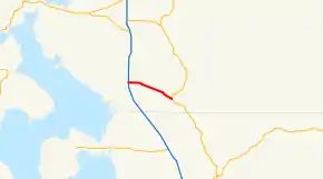
 SR 534 is highlighted in red. | ||||
| Route information | ||||
| Auxiliary route of I-5 | ||||
| Defined by RCW 47.17.765 | ||||
| Maintained by WSDOT | ||||
| Length | 5.08 mi[1] (8.18 km) | |||
| Existed | 1964[2]–present | |||
| Major junctions | ||||
| West end | ||||
| East end | ||||
| Highway system | ||||
| ||||
Route description
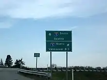
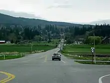
State Route 534 (SR 534) begins at an interchange with Interstate 5 (I-5) and the Pioneer Highway (former SR 530) in the census-designated place (CDP) of Conway. From Conway, the road travels eastward to intersect Cedardale Road and cross Carpenter Creek before curving southeast after intersecting Bulson Road. The highway passes Sixteen Lake before ending at SR 9 in the CDP of Lake McMurray.[3][4] At the I-5 interchange, the roadway was used by 8,500 motorists daily in 2007 based on average annual daily traffic (AADT) data collected by the Washington State Department of Transportation.[5]
History

The first highway that would later become SR 534 was Secondary State Highway 1H (SSH 1H), which was first designated in 1937.[6] The road ran from Primary State Highway 1 (PSH 1) in Conway to SSH 1A in Lake McMurray.[6] During the 1964 highway renumbering, SSH 1H became SR 534, PSH 1 became Interstate 5 (I-5) and SSH 1A became SR 9.[7] The highway's interchange with I-5 in Conway was built in 1971 to replace an at-grade crossing.[8]
Major intersections
The entire route is in Skagit County.
| Location | mi[1] | km | Destinations | Notes | |
|---|---|---|---|---|---|
| Conway | 0.00 | 0.00 | Pioneer Highway – Stanwood | Former SR 530 | |
| Lake McMurray | 5.08 | 8.18 | |||
| 1.000 mi = 1.609 km; 1.000 km = 0.621 mi | |||||
References

- Washington State Department of Transportation (2006). "State Highway Log: Planning Report, SR 2 to SR 971" (PDF). Retrieved June 9, 2009.
- Washington State Legislature. "RCW 47.17.765: State route No. 534". Retrieved June 9, 2009.
- Google (June 9, 2009). "State Route 534" (Map). Google Maps. Google. Retrieved June 9, 2009.
- Skagit Count: Mount Vernon, Anacortes (Map) (2004 ed.). City Street Maps. G. M. Johnson. 2004. § AR 36, 37, 38, 39, 40; AS 40, 41, 42, 43; AT 43, 44; AU 44, 45. ISBN 1-894570-90-1. Retrieved June 9, 2009.
- Washington State Department of Transportation (2007). "2007 Annual Traffic Report" (PDF). Retrieved June 9, 2009.
- Washington State Legislature (March 18, 1937). "Chapter 207: Classification of Public Highways". Session Laws of the State of Washington. Session Laws of the State of Washington (1937 ed.). Olympia, Washington: Washington State Legislature. pp. 995–996. Retrieved June 9, 2009.
(h) Secondary State Highway No. 1H; beginning at Conway on Primary State Highway No. 1, thence in a southeasterly direction by the most feasible route to McMurray on Secondary State Highway No. 1A.
- C. G. Prahl (December 1, 1965). "Identification of State Highways" (PDF). Washington State Highway Commission, Department of Highways. Retrieved June 9, 2009.
- "The People of Interstate 5". Washington Highway News. 23 (1). Washington State Department of Highways. February 1972. p. 19. OCLC 29654162. Retrieved September 12, 2018 – via WSDOT Library Digital Collections.

