Vaiva Vo, Arizona
Vaiva Vo is a census-designated place in Pinal County, in the U.S. state of Arizona.[3]
Vaiva Vo, Arizona | |
|---|---|
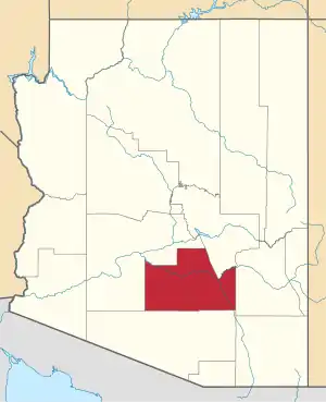
 Location of Vaiva Vo in Pinal County, Arizona. | |
 Vaiva Vo, Arizona Location in the United States | |
| Coordinates: 32°42′0″N 111°55′37″W | |
| Country | United States |
| State | Arizona |
| County | Pinal |
| Area | |
| • Total | 0.46 sq mi (1.19 km2) |
| • Land | 0.46 sq mi (1.19 km2) |
| • Water | 0.00 sq mi (0.00 km2) |
| Population (2010) | |
| • Total | 558 |
| • Estimate (2016)[2] | N/A |
| Time zone | UTC-7 (MST (no DST)) |
| FIPS code | 04-78680 |
Population
The population was 128 at the 2010 census.[4] As of 2019, the population has risen to 142.[5]
Primary coordinates
The primary coordinate point for Vaiva Vo is located at latitude 32.7178 and longitude -111.9265 in Pinal County.[6]
Climate
Vaivo Vo has a nice summertime climate and is best visited during the months of February to November. This is when the weather is most pleasant with hot temperatures and limited rainfall. The highest average temperature in Vaiva Vo is 39 °C in June and the lowest is 17 °C in December.[7]
References
- "2016 U.S. Gazetteer Files". United States Census Bureau. Retrieved Jul 18, 2017.
- "Population and Housing Unit Estimates". Retrieved June 9, 2017.
- U.S. Geological Survey Geographic Names Information System: Vaiva Vo, Arizona
- "2010 Census Gazetteer Files - Places: New Mexico". U.S. Census Bureau. Retrieved February 26, 2017.
- "Vaiva Vo, AZ Profile: Facts & Data". arizona.hometownlocator.com. Retrieved 2020-02-19.
- "Vaiva Vo, AZ Profile: Facts & Data". arizona.hometownlocator.com. Retrieved 2020-02-19.
- "Climate Vaiva Vo – Temperature • Best time to visit • Weather". Besttimetovisit.co.za. Retrieved 2020-02-19.
This article is issued from Wikipedia. The text is licensed under Creative Commons - Attribution - Sharealike. Additional terms may apply for the media files.
