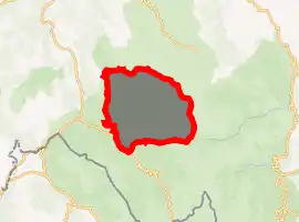
Ussita
Ùssita is a comune (municipality) in the Province of Macerata in the Italian region Marche, located about 80 kilometres (50 mi) southwest of Ancona and about 45 kilometres (28 mi) southwest of Macerata.
Ussita | |
|---|---|
| Comune di Ussita | |
Location of Ussita 
| |
 Ussita Location of Ussita in Italy  Ussita Ussita (Marche) | |
| Coordinates: 42°57′N 13°8′E | |
| Country | Italy |
| Region | Marche |
| Province | Macerata (MC) |
| Frazioni | Calcara, Capovallazza, Casali, Castel Fantellino, Cuore di Sorbo, Fluminata, Frontignano, Pian dell'Arco, Pieve, Sammerlano, San Placido, Sant'Eusebio, Sasso, Sorbo, Tempori, Vallazza, Vallestretta |
| Government | |
| • Mayor | Vincenzo Marini Marini |
| Area | |
| • Total | 55.3 km2 (21.4 sq mi) |
| Elevation | 744 m (2,441 ft) |
| Population (30 November 2016)[2] | |
| • Total | 446 |
| • Density | 8.1/km2 (21/sq mi) |
| Demonym(s) | Ussitani |
| Time zone | UTC+1 (CET) |
| • Summer (DST) | UTC+2 (CEST) |
| Postal code | 62039 |
| Dialing code | 0737 |
| Website | Official website |
The communal seat is in the frazione of Fluminata.
Main sights
- Castle, now in ruins including a 14th-century tower
- Santa Maria Assunta: 14th century parish church
- Sant'Antonio da Padova
- Sant'Ercolano: 13th century Chiesetta
- Santa Lucia di Sasso: 15th-17th centuries
- Santi Vincenzo e Anastasio: 14th century
- Santa Reparata: 20th century
- San Stefano: 13th century
- Sant'Andrea Apostolo: 15th - 17th centuries
References
- "Superficie di Comuni Province e Regioni italiane al 9 ottobre 2011". Istat. Retrieved 16 March 2019.
- All demographics and other statistics: Italian statistical institute Istat.
This article is issued from Wikipedia. The text is licensed under Creative Commons - Attribution - Sharealike. Additional terms may apply for the media files.