Umm Qais
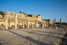
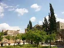
Umm Qais or Qays (Arabic: أم قيس, lit. 'Mother of Qais') is a town in northern Jordan principally known for its proximity to the ruins of the ancient Gadara. It is the largest city in the Bani Kinanah Department and Irbid Governorate in the extreme northwest of the country, near Jordan's borders with Israel and Syria. Today, the site is divided into three main areas: the archaeological site (Gadara), the traditional village (Umm Qais), and the modern town of Umm Qais.[1]
Umm Qais
أم قيس Gadara | |
|---|---|
Town | |
 Umm Qais from north | |
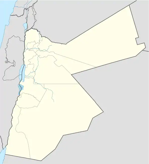
 Umm Qais Location in Jordan | |
| Coordinates: 32°39′15″N 35°41′15″E | |
| Grid position | 213/228 |
| Country | |
| Governorate | Irbid |
| Department | Bani Kinanah |
| Elevation | 1,240 ft (378 m) |
| Time zone | UTC+2 (UTC+2) |
| • Summer (DST) | UTC+3 (UTC+3) |
| Area code(s) | +(962)2 |
Location
Umm Qais is located 28 km north of Irbid and 110 km north of Amman. It expanded from the ruins of ancient Gadara, which are located on a ridge 378 metres (1,240 ft) above sea level, overlooking the Sea of Tiberias, the Golan Heights, and the Yarmouk River gorge. Strategically central and located close to multiple water sources, Umm Qais has historically attracts a high level of interest.
History

Antiquity
Gadara was a centre of Greek culture in the region during the Hellenistic and Roman periods.[2] The name Gadara may have meant "fortifications" or "the fortified city".[3]
In 63 BCE, Roman general Pompey conquered the region, Gadara was rebuilt and became a member of the semi-autonomous Roman Decapolis.[4][5] 33 years later Augustus attached it to the Jewish kingdom of his ally, Herod. After King Herod's death in 4 BCE, Gadara became part of the Roman province of Syria.[6] After the Christianisation of the Eastern Roman Empire, Gadara retained its important regional status and became for many years the seat of a Christian bishop.[7]
The oldest archaeological evidence at Umm Qais, some pottery shards found in Garada, extends back to the second half of the third century BC. [8]
Early Muslim period
The Battle of Yarmouk in 636 a short distance from Gadara, brought the entire region under Arab-Muslim rule. Around 747 the city was largely destroyed by an earthquake, and was abandoned.
Ottoman period
In 1596 it appeared in the Ottoman tax registers named as Mkis, situated in the nahiya (subdistrict) of Bani Kinana, part of the Sanjak of Hawran. It had 21 households and 15 bachelors; all Muslim, in addition to 3 Christian households. The villagers paid a fixed tax-rate of 25% on agricultural products; including wheat, barley, summer crops, fruit trees, goats and bee-hives. The total tax was 8,500 akçe.[9]
In 1838 Um Keis was reported to be in ruins.[10]
Umm Qais boasts an impressive building from the Late Ottoman period, the Ottoman governor's residence known as Beit Rousan, "Rousan House".
Modern period
In 1961 the population of Umm Qais was 1,196 inhabitants.[11]
Preservation efforts
In 1974 the German Protestant Institute of Archaeology uncovered the ruins of a Byzantine church building in Umm Qais.[12]
Since 2005, the Orient Department of the German Archaeological Institute under the direction of Claudia Bührig has been active at Gadara. The team has uncovered Egyptian and Greek imported pottery, stamped amphorae, and a Seleucid fortress, among other things.[13]
In 2015, the Ambassadors Fund for Cultural Preservation and Yarmouk University collaborated to better preserve the Roman Aqueduct of Gadara in Umm Qais. This project was completed in 2018, strengthening the largest remaining subterranean Roman aqueduct.[14]
Tourism

Many visitors come to Umm Qais on day trips from the capital, Amman, roughly 110 kilometres (68 mi) to the south, to see its extensive ruins and enjoy its panoramic views. The Sea of Galilee and Tiberias, Israel, are visible, and just across the valley of the Yarmouk River is the southern end of the Golan Heights, Syria,[15] under Israeli occupation since the Six-Day War in 1967. Mount Hermon bordering Lebanon is visible in the distance on clear days.
At Beit Rousan, now housing a visitor centre and museum, Greek statues and Christian mosaics discovered during archaeological excavations of ancient Gadara are exhibited.
References
Citations
- Alawneh, Firas (Dec 21, 2018). "INVESTIGATIONS OF HELLENISTIC MORTAR FROM UMM QAIS (GADARA), JORDAN". Arqueología Iberoamericana. 40.
- Rocca, Samuel (2008), Herod's Judea: A Mediterranean State in the Classic World, Eugene: Mohr Siebeck, p. 200, ISBN 978-1-4982-2454-3
- Shatzman, Israel. The Armies of the Hasmonaeans and Herod: From Hellenistic to Roman Frameworks.
- Fitzgerald, John Thomas; Obbink, Dirk D.; Holland, Glenn Stanfield (2004). Philodemus and the New Testament world [electronic resource]. BRILL. pp. 365–366. ISBN 9789004114609.
- Mare, W. Harold (2000), "Decapolis", Eerdmans Dictionary of the Bible, Grand Rapids: Wm. B. Eerdmans Publishing, pp. 333–334, ISBN 0-8028-2400-5.
- Josephus Antiquities, XVII, xi, 4; Josephus, Bellum Judaicum, II, vi, 3.
- Reland, Palestine, 776.
- Alawneh, Firas (Dec 21, 2018). "INVESTIGATIONS OF HELLENISTIC MORTAR FROM UMM QAIS (GADARA), JORDAN". Arqueología Iberoamericana. 40.
- Hütteroth and Abdulfattah, 1977, p. 202
- Smith, in Robinson and Smith, 1841, vol 3, 2nd appendix, p. 163
- Government of Jordan, Department of Statistics, 1964, p. 19
- Almasri, Eyad (December 1, 2017). "An enthroned Tyche statue from Gadara / Umm Qais, Jordan" (PDF). Acta Historiae Artium. 58: 5–20. doi:10.1556/170.2017.58.1.1.
- Rawashdeh, Saeb. "German research continues in ancient city of Gadara". The Jordan Times.
- "Umm Qais aqueduct opens as preservation project concludes". The Jordan Times. The Jordan Times.
- For example:*UN Resolution 242, *Text of Resolution at UN.org (PDF), *"CRS Issue Brief for Congress: Israeli-United States Relations" (PDF). Congressional Research Service. April 5, 2002. Retrieved 2009-06-23.,*"Presidency Statement on Golan Heights". April 1, 2004. Retrieved 2009-06-23.,*"Israel and the Occupied Palestinian Territories". UK Foreign and Commonwealth Office. 11 June 2009. Archived from the original on 20 July 2009. Retrieved 2009-06-23.,*"The Arab Peace Initiative, 2002". Al-Bab. 2002. Archived from the original on 4 June 2009. Retrieved 23 June 2009.
Bibliography
- Government of Jordan, Department of Statistics (1964). First Census of Population and Housing. Volume I: Final Tables; General Characteristics of the Population (PDF).
- Hütteroth, Wolf-Dieter; Abdulfattah, Kamal (1977). Historical Geography of Palestine, Transjordan and Southern Syria in the Late 16th Century. Erlanger Geographische Arbeiten, Sonderband 5. Erlangen, Germany: Vorstand der Fränkischen Geographischen Gesellschaft. ISBN 3-920405-41-2.
- Robinson, E.; Smith, E. (1841). Biblical Researches in Palestine, Mount Sinai and Arabia Petraea: A Journal of Travels in the year 1838. 3. Boston: Crocker & Brewster.
- Weber, Thomas, Umm Qais: Gadara of the Decapolis (1989. Amman: Economic Press Co.)
External links
| Wikimedia Commons has media related to Umm Qais. |
- GCatholic - (titular) bishopric
- Irbid Guide (in Arabic)
- Greater Irbid Municipality (in Arabic)
- Irbid news (in Arabic)
- History and pictures