The Brook, Nelson
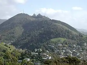
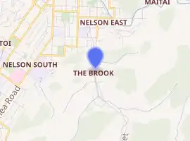
The Brook is one of the suburbs of Nelson, New Zealand. It lies to the south of Nelson and is the location of the Brook Waimarama Sanctuary, a conservation project at the head of the Brook Valley.[2]
The Brook | |
|---|---|
Suburb | |
 Grampians Reserve in The Brook | |

| |
| Coordinates: 41.296°S 173.298°E | |
| Country | |
| Region | Nelson |
| Territorial authority | Nelson |
| Government | |
| • Nelson City Mayor | Rachel Reese |
| • Nelson MP | Rachel Boyack |
| • Te Tai Tonga MP | Rino Tirikatene |
| Area | |
| • Total | 6.90 km2 (2.66 sq mi) |
| • Land | 6.90 km2 (2.66 sq mi) |
| • Water | 0 km2 (0 sq mi) |
| Population (June 2020) | |
| • Total | 2,050[1] |
| Time zone | UTC+12 (NZST) |
| • Summer (DST) | UTC+13 (NZDT) |
| Postcode | 7010 |
| Area code(s) | 03 |
Geography
The Brook covers a land area of 6.90 km².[3]
It has seven public reserves: Andrews Farm Reserve, Betsy Eyre Park, Brook Park, Grampians Reserve, Grove Reserve, Tantragee Reserve and Wards Reserve.[4]
History
The estimated population of The Brook reached 1,700 in 1996.[5]
It reached 1,720 in 2001, 1,660 in 2006, 2,910 in 2013, and 3,000 in 2018.[5]
Demography
The Brook has an estimated population of 2,050, with a population density of 296.90 people per km².[6]
As of the 2018 census, the median age was 45.2, the median income was $31,100, 4.0% of people earned over $100,00, 29.6% had a Bachelor's Degree or higher, and 2.8% of the workforce was unemployed.
Ethnically, the population was 92.2% New Zealand European, 8.4% Māori, 1.7% Pacific peoples, 5.7% Asian, 0.6% Middle Eastern, Latin American, or African, and 0.9% identified with other ethnicities, with many people identifying with multiple ethnic groups; 26.2% were born overseas.
Religiously, the population is 65.2% non-religious and 23.0% Christian.[5]
Economy
In 2018, 7.0% worked in manufacturing, 9.3% worked in construction, 7.0% worked in hospitality, 4.2% worked in transport, 9.6% worked in education, and 14.0% worked in healthcare.[5]
Transport
As of 2018, among those who commute to work, 66.6% drove a car, 3.1% rode in a car, 0.0% use public transport, 10.1% use a bike, and 10.1% walk or run.[5]
References
- "Population estimate tables - NZ.Stat". Statistics New Zealand. Retrieved 22 October 2019.
- Arnold, Naomi (29 April 2013). "Two Sides of the Fence". Stuff.co.nz. Retrieved 2 May 2014.
- "Statistical Area 2 2018 (generalised) GIS" (Data table). stats.govt.nz. Statistics New Zealand.
- "Nelson Parks and Reserves". gdc.govt.nz. Gisborne District Council.
- "Place Summary – The Brook". Stats NZ. Statistics New Zealand.
- "Provisional Statistics". stats.govt.nz. Statistics New Zealand.