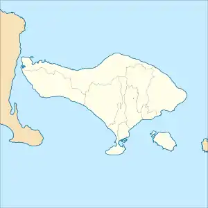
Sungi River
The Sungi River is a river on Bali, Indonesia.[2][3] Its source is located in the mountainous area in the central-northern part of Bali. It flows through the ancient site of Mengwi and enters the sea to the west of Kerobokan Kelod on the southern coast.[4]
| Sungi River Sungai Sungi | |
|---|---|
| Native name | Tukad Sungi |
| Location | |
| Country | Indonesia |
| State | Bali |
| Physical characteristics | |
| Mouth | Yeh Sungi[1] |
• location | Badung Regency |
• elevation | 6 m (20 ft) |

The Sungi River forms most of the eastern boundary of the Tabanan Regency and provides irrigation water for 4,200 ha of sawah (rice paddies) within one regency (kabupaten) alone.
History
The first King of Mengwi, the Lord of Balayu, built a dam over the Sungi River.[5] According to Henk Schulte Nordholt, this dam was very important for the economy along the river bank, providing needed irrigation for the people to prosper.[4]
Geography
The river flows in the middle to the south of Bali with predominantly tropical rainforest climate (designated as Af in the Köppen-Geiger climate classification).[6] The annual average temperature in the area is 24 °C. The warmest month is October, when the average temperature is around 25 °C, and the coldest is July, at 22 °C.[7] The average annual rainfall is 2123 mm. The wettest month is January, with an average of 569 mm rainfall, and the driest is September, with 23 mm rainfall.[8]
| Sungi River | ||||||||||||||||||||||||||||||||||||||||||||||||||||||||||||
|---|---|---|---|---|---|---|---|---|---|---|---|---|---|---|---|---|---|---|---|---|---|---|---|---|---|---|---|---|---|---|---|---|---|---|---|---|---|---|---|---|---|---|---|---|---|---|---|---|---|---|---|---|---|---|---|---|---|---|---|---|
| Climate chart (explanation) | ||||||||||||||||||||||||||||||||||||||||||||||||||||||||||||
| ||||||||||||||||||||||||||||||||||||||||||||||||||||||||||||
| ||||||||||||||||||||||||||||||||||||||||||||||||||||||||||||
See also
References
- Yeh Sungi at Geonames.org (cc-by); Last updated 17 January 2012; Database dump downloaded 27 November 2015
- Rand McNally, The New International Atlas, 1993.
- Tukad Sungi at Geonames.org (cc-by); Last updated 17 January 2012; Database dump downloaded 27 November 2015
- J. Stephen Lansing, Murray P. Cox, Sean S. Downey, Marco A. Janssen and John W. Schoenfelder (2009). "A robust budding model of Balinese water temple networks". World Archaeology. 41: 112–133. doi:10.1080/00438240802668198. S2CID 4821372.CS1 maint: multiple names: authors list (link)
- Nordholt, Henk Schulte (1996). The Spell of Power: A History of Balinese Politics, 1650–1940. KITLV Press. p. 58. ISBN 90-6718-090-4.
- Peel, M C; Finlayson, B L; McMahon, T A (2007). "Updated world map of the Köppen-Geiger climate classification". Hydrology and Earth System Sciences. 11 (5): 1633–1644. doi:10.5194/hess-11-1633-2007.
- "NASA Earth Observations Data Set Index". NASA. 30 January 2016.
- "NASA Earth Observations: Rainfall (1 month – TRMM)". NASA/Tropical Rainfall Monitoring Mission. 30 January 2016.