Summerfield, Maryland
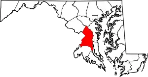
Summerfield is a census-designated place near Landover in Prince George's County, Maryland, United States. The population of the CDP was 10,898 at the 2010 census.[1] It is a suburb of Washington
Summerfield, Maryland | |
|---|---|
 Summerfield Location within the state of Maryland  Summerfield Summerfield (the United States) | |
| Coordinates: 38°54′N 76°52′W | |
| Country | |
| State | |
| County | |
| Area | |
| • Total | 3.6 sq mi (9.4 km2) |
| • Land | 3.6 sq mi (9.4 km2) |
| • Water | 0.0 sq mi (0.0 km2) |
| Elevation | 240 ft (70 m) |
| Population (2010) | |
| • Total | 10,898 |
| • Density | 3,000/sq mi (1,200/km2) |
| Time zone | UTC−5 (Eastern (EST)) |
| • Summer (DST) | UTC−4 (EDT) |
| Area code(s) | 301 |
FedEx Field is located in Summerfield CDP,[2][3] as is the Prince George's County Sports and Learning Complex.[4]
Prior to the 2010 Census, the area was not covered by another census-designated place.[5]
Geography
According to the U.S. Census Bureau, Summerfield has a total area of 3.6 square miles (9.4 km2), of which 0.012 square miles (0.03 km2), or 0.03%, is water.[6] The CDP is bordered to the east by the Capital Beltway (I-495/95) and to the south by Maryland Route 214 (Central Avenue). The CDP of Landover borders Summerfield to the north, the city of Glenarden is to the northeast, Lake Arbor is to the east, Largo is to the southeast, Walker Mill is to the southwest, and Peppermill Village and Seat Pleasant border Summerfield to the west.
Education
Residents are assigned to Prince George's County Public Schools.[2]
Zoned elementary schools include Highland Park, William Paca, and Cora L. Rice.[7] Zoned middle schools include G. James Gholson and Kenmoor.[8] Zoned high schools include Central High School, Fairmont Heights High School, and Charles Herbert Flowers High School.[9]
John Carroll Elementary School was previously located in what is now Summerfield CDP.[10] It was scheduled to close in 2009.[11]
Transportation
Washington Metro operates the Morgan Boulevard station in Summerfield CDP.[2][12]
References
- "Profile of General Population and Housing Characteristics: 2010 Demographic Profile Data (DP-1): Summerfield CDP, Maryland". United States Census Bureau. Retrieved December 23, 2011.
- "2010 CENSUS - CENSUS BLOCK MAP: Summerfield CDP, MD" (PDF). U.S. Census Bureau. Retrieved 2018-09-07.
- "FedExField." State of Maryland Office of Tourism Development. Retrieved on September 7, 2018. "1600 FedEx Way, Landover, MD 20785" - See also parking map from Washington Football Team website
- "Fedexfield Parking and Directions." Washington Redskins. Retrieved on September 7, 2018. "[...]Prince George’s County Sports Complex located at 8001 Sheriff Rd, Hyattsville MD 20785."
- "Prince George's County Census Incorporated Places & Census Designated Places." Maryland Department of Planning. Retrieved on September 8, 2018.
- "Geographic Identifiers: 2010 Demographic Profile Data (G001): Summerfield CDP, Maryland". United States Census Bureau. Retrieved December 16, 2011.
- "NEIGHBORHOOD ELEMENTARY SCHOOLS AND BOUNDARIES SCHOOL YEAR 2018-2019." Prince George's County Public Schools. Retrieved on September 7, 2018.
- "NEIGHBORHOOD MIDDLE SCHOOLS AND BOUNDARIES SCHOOL YEAR 2018-2019." Prince George's County Public Schools. Retrieved on September 7, 2018.
- "NEIGHBORHOOD HIGH SCHOOLS AND BOUNDARIES SCHOOL YEAR 2018-2019." Prince George's County Public Schools. Retrieved on September 7, 2018.
- Home. John Carroll Elementary School. Retrieved on September 8, 2018. "1400 Nalley Terrace Landover, MD 20785"
- Preliminary Subregion 4 Master Plan and Proposed Sectional Map Amendment. Maryland-National Capital Park and Planning Commission. Chapter 9, Public Facilities. p. 261 (PDF p. 3/28). Retrieved on September 7, 2018.
- "Morgan Boulevard." Washington Metro. Retrieved on September 7, 2018. "300 Garrett Morgan Blvd. Landover, MD 20785"
| Wikimedia Commons has media related to Summerfield, Maryland. |
