Subiaco, Western Australia
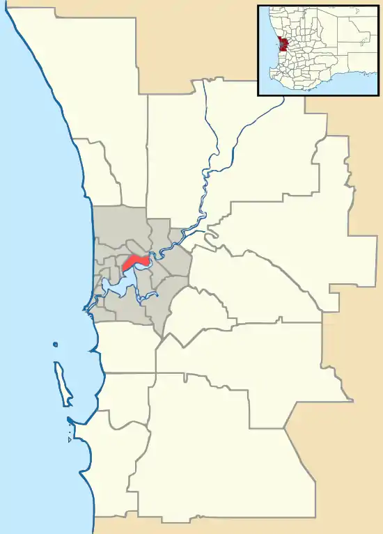
Subiaco (known colloquially as Subi) is an inner western suburb of Perth, Western Australia, north-west of Kings Park. Its local government area is the City of Subiaco.
| Subiaco Perth, Western Australia | |||||||||||||||
|---|---|---|---|---|---|---|---|---|---|---|---|---|---|---|---|
 City of Subiaco council chambers | |||||||||||||||
 Subiaco | |||||||||||||||
| Coordinates | 31.949°S 115.827°E | ||||||||||||||
| Population | 9,202 (2016 census)[1] | ||||||||||||||
| • Density | 2,880/km2 (7,450/sq mi) | ||||||||||||||
| Established | 1851 | ||||||||||||||
| Postcode(s) | 6008 | ||||||||||||||
| Area | 3.2 km2 (1.2 sq mi) | ||||||||||||||
| Location | 4 km (2 mi) W of Perth CBD | ||||||||||||||
| LGA(s) | City of Subiaco | ||||||||||||||
| State electorate(s) | Nedlands | ||||||||||||||
| Federal Division(s) | Curtin | ||||||||||||||
| |||||||||||||||
History
Prior to European settlement the area was home to the Noongar people.[2]
The area was settled in 1851 by Italian Benedictine monks. The monks named the area after Subiaco in Italy, the location where Benedict of Nursia, the founder of the Order of Saint Benedict, had begun his work.[2][3]
Landmarks
Landmarks of suburb include Subiaco Oval, Mueller Park, the Regal Theatre, the Subiaco Hotel, the Victorian terraces on Catherine Street and the Subiaco Arts Centre.

The main street of Subiaco is Rokeby Road, which was named after General Henry Montagu, 6th Baron Rokeby, who was commander of the 1st Infantry Division during the Crimean War. Another important commercial road is Hay Street.
Residential areas include Subi Centro, a modern housing development with the sunken Subiaco railway station on reclaimed industrial land near Wembley, and older heritage properties towards Shenton Park.
Major hospital facilities include St John of God Subiaco Hospital, Princess Margaret Hospital for Children and King Edward Memorial Hospital for Women.
School facilities include Subiaco Primary School[4] and Perth Modern School, the only academically selective school in Western Australia.
On the corner of Rokeby and Hamersley Roads is a clock tower war memorial, built in 1923 to commemorate soldiers from the district who died in World War I. The names of those who died in later conflicts have also been added.[5]
Architecture
Subiaco has a large number of well-preserved high-quality historic homes, many with elaborate leadlight windows.
The City of Subiaco publishes a self-guide walking tour of some of them. From 1989 until 2006 a Festival of Leadlights community event was run biennially by a Subiaco resident.[6] It was restarted in 2018.[7]
Culture
Each year, the City of Subiaco supports a boutique street festival where Rokeby Road is closed off from traffic between Barker Road and Hay Street. It is commonly referred to as the "Subiaco Street Party"[8] and is a free community event that promotes live music, street food, markets and family entertainment.
Subiaco—along with Northbridge, Leederville and Fremantle—is one of Perth's major nightlife hubs.[9] It attracts people from all over the metropolitan region for its pubs, bars and nightclubs. Subiaco's bars and restaurants are largely clustered around Rokeby Road and Hay Street although in recent years several trendy cafes, restaurants and bars have opened up near the southern end of Rokeby Road. Subiaco encompasses small businesses, commercial retail chains, and franchise businesses. Notable business that have operated in Subiaco for over 30 years include the Subiaco Hotel, Farmer Jack Food Market, Coles Supermarkets, the Vic Hotel, Jana Beauty,[10] the Regal Theatre.[11] In addition to this, the Crossways shopping precinct on Rokeby Road was constructed in 1954.[12][13][14]
Subiaco is also known for its Subi Farmer's Market, held every Saturday morning near the primary school on Bagot Road. It is utilised by locals and other shoppers, with fresh and organic produce and a lively market atmosphere.[15]
References
- Australian Bureau of Statistics (27 June 2017). "Subiaco (State Suburb)". 2016 Census QuickStats. Retrieved 19 April 2018.

- "Subiaco History". City of Subiaco. Retrieved 2 September 2009.
- "History of metropolitan suburb names - S". Landgate. Archived from the original on 14 July 2009. Retrieved 2 September 2009.
- "Home - Subiaco Primary School".
- Stephens, John; Seal, Graham (2015). Remembering the Wars: Commemoration in Western Australian Communities. Black Swan Press. pp. 38–39. ISBN 9780987567079.
- "Walking Subiaco : Leadlight" (PDF). City of Subiaco. 2012. Retrieved 15 March 2020.
- Rifici, Victoria (7 December 2018). "Subiaco resident brings back Leadlight Night". Western Suburbs Weekly. Community News Group. Retrieved 15 March 2020.
- "City of Subiaco - Subiaco Street Party 2019".
- Ashworth, Susie; Bain, Carolyn; Smitz, Paul. Lonely Planet Australia. Lonely Planet, 2004. ISBN 1-74059-447-9, p. 847
- https://www.janabeauty.com.au/
- "Regal Theatre".
- Stephenson, Gordon (1955). Plan for the Metropolitan Region, Perth and Fremantle, 1955 Report. Perth: Government Printing Office.
- "City of Subiaco - A-Z Directory". City of Subiaco Website. 11 March 2020.
- "2016 Census: Subiaco Community Profile". Australian Bureau of Statistics. 13 March 2020.
- "Subiaco Farmers Market Perth - Organic & Farm Produce - Fruit, Vegetables, Coffee, Eggs, Milk, Flowers, Meat, Seafood".
Further reading
- Spillman, Ken (1985) Identity Prized: A History of Subiaco Nedlands, University of Western Australia Press. ISBN 0 85564 239 4.
- Stephenson, Gordon; Hepburn, J. A. (John Alastair), 1915-; Stephenson, Gordon, 1908-. Plan for the metropolitan region Perth and Fremantle Western Australia 1955 Atlas; Western Australia. Town Planning Department (1955), Plan for the metropolitan region, Perth and Fremantle, Western Australia, 1955 : a report prepared for the Government of Western Australia, Govt. Printing Office, retrieved 12 March 2020CS1 maint: multiple names: authors list (link)