Stoneywood, Aberdeen
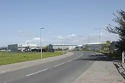
Stoneywood is a village[1] northwest of central Aberdeen, Scotland, located near Aberdeen Airport. There are 2 elementary schools and 1 secondary school within the borders, managed by the Aberdeen School System.[2] The only highway running through town is the A947, a south–north 2 lane road.
Stoneywood | |
|---|---|
 View of the city's agricultural farms. | |
 Stoneywood | |
| Coordinates: 57.1909°N 2.1869822°W | |
| Sovereign State | United Kingdom |
| Country | Scotland |
| Metro | Aberdeen |
References
- "Stoneywood, Aberdeen City - area information, map, walks and more". Ordnance Survey Get Outside. Retrieved 24 January 2018.
- "Map-Postal & Info" https://www.streetcheck.co.uk/postcode/ab219hx Accessed 10 January 2018.
| Wikivoyage has a travel guide for Stoneywood . |
This article is issued from Wikipedia. The text is licensed under Creative Commons - Attribution - Sharealike. Additional terms may apply for the media files.
