State Road 11 (Serbia)
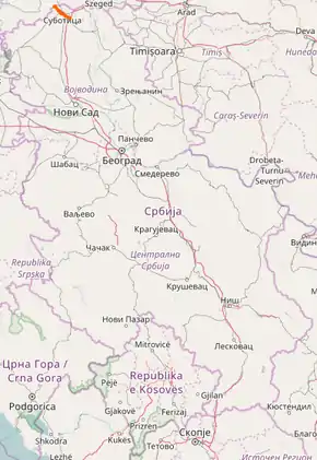
State Road 11, is an IB-class road in northern Serbia, connecting Hungary at Kelebija with Subotica. It is located in Vojvodina.[1]
| ||||
|---|---|---|---|---|
| ||||
 | ||||
| Route information | ||||
| Maintained by JP "Putevi Srbije" | ||||
| Length | 20.077 km (12.475 mi) 24.060 km (14.950 mi) planned | |||
| Major junctions | ||||
| From | Hungary – Serbia border at Kelebija | |||
| To | Subotica | |||
| Location | ||||
| Districts | North Bačka | |||
| Highway system | ||||
IB-Class Highways in Serbia
| ||||
The existing route is an expressway. Although construction of the road, which encircles the city, has not yet started, a small temporary section is in operation. According to the Space Plan of Republic of Serbia, there are no plans to upgrade the road to a motorway, and it is expected to be maintained in its current state.[2]
Sections
| Section number | Length | Distance | Section name |
|---|---|---|---|
| 01101 | 13.200 km (8.202 mi) | 13.200 km (8.202 mi) | Hungary – Serbia border (Kelebija) – Subotica (Sombor) (unconstructed) |
| 01102 | 4.920 km (3.057 mi) | 18.120 km (11.259 mi) | Subotica (Sombor) – Subotica (Bačka Topola) |
| 01103 | 5.940 km (3.691 mi) | 24.060 km (14.950 mi) | Subotica (Bačka Topola) – Subotica-south interchange (unconstructed) |
| 01100 | 11.125 km (6.913 mi) | 11.125 km (6.913 mi) | Hungary – Serbia border (Kelebija) – Subotica (Sombor road) |
| 01199 | 4.023 km (2.500 mi) | 15.157 km (9.418 mi) | Subotica (Sombor road) – Subotica (Sombor) |
See also
References
- "Republic of Serbia – national road network" (PDF). Putevi Srbije (in Serbian).
- Space plan of Republic of Serbia from 2010 to 2021
External links
This article is issued from Wikipedia. The text is licensed under Creative Commons - Attribution - Sharealike. Additional terms may apply for the media files.
