Shook, Missouri
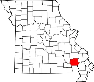
Shook is an unincorporated community in Wayne County, Missouri, United States. The community is located on the West Fork Lost Creek arm of Lake Wappapello along Missouri Route D,[2] approximately sixteen miles north of Poplar Bluff.
Shook | |
|---|---|
 Shook Location within the state of Missouri | |
| Coordinates: 37°02′34″N 90°18′32″W | |
| Country | United States |
| State | Missouri |
| County | Wayne |
| Elevation | 400 ft (100 m) |
| Time zone | UTC-6 (Central (CST)) |
| • Summer (DST) | UTC-5 (CDT) |
| GNIS feature ID | 752136[1] |
The Shook post office was in operation from 1904 to 1999.[3] The community has the name of George Shook, an early settler.[4]
References
- "Shook, Missouri". Geographic Names Information System. United States Geological Survey.
- Shook, Missouri, 7.5 Minute Topographic Quadrangle, USGS, 1966 (1985 rev.)
- "Post Offices". Jim Forte Postal History. Retrieved 1 January 2017.
- "Wayne County Place Names, 1928–1945". The State Historical Society of Missouri. Archived from the original on June 24, 2016. Retrieved January 1, 2017.
This article is issued from Wikipedia. The text is licensed under Creative Commons - Attribution - Sharealike. Additional terms may apply for the media files.
