Shillelogher (barony)
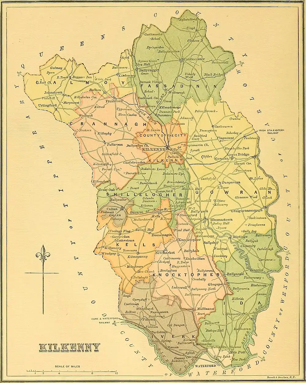
The barony of Shillelogher (Irish: Síol Fhaolchair, meaning "territory of the Descendants of Fáelchar") is a barony in the west of County Kilkenny, Ireland.[1][7][8] The barony is 36,684 acres (148.45 km2) in size.[6] It is one of 12 baronies in County Kilkenny.[9] There are 19 civil parishes in Shillelogher, made up of 109 townlands.[1] The chief town is Bennettsbridge.[10] Shillelogher lies at the centre of the county, with the baronies of Crannagh and Kilkenny to the north (whose chief towns is are Freshford and Kilkenny, and the barony of Gowran to the east (whose chief towns is Gowran). It is borders County Tipperary to the west. The N76 road bisects the barony. The river Nore flows through the barony.[11] Danesfort Church is located in Shillelogher.[12]
Shillelogher[1]
| |
|---|---|
| Etymology: territory of the Descendants of Fáelchar | |
 Shillelogher[1] Location in Ireland | |
| Coordinates: 52.5719025°N 7.3351341°W | |
| Country | Ireland |
| Province | Leinster |
| County | County Kilkenny |
| Barony of Shillelogher | By 1672[3] |
| Civil parishes[4] | List
|
| Government | |
| • Type | County Council |
| • Body | Kilkenny County Council |
| Area | |
| • Total | 14,845 ha (36,684 acres) |
Shillelogher was an early medieval cantred within the shire of Kilkenny,[13] and part of the historic kingdom of Osraige (Ossory).[14] Today it is part of the Roman Catholic Church diocese of Ossory and the Church of Ireland diocese of Cashel and Ossory. Shillelogher is currently administered by Kilkenny County Council.[5]
Etymology
There have been many variations of the name, but all are anglicized variations form the old Irish name, 'Síol Fhaolchair', which means – territory of the Descendants of Fáelchar. The 'f' would be silent and 'l' easily commuted with 'r'.[15] So the name appears under many forms in ancient records, such as 'Stilyker' (1333),[16] 'Sillr',[7] Silelogher, Shillekyr, Shyllekyr, Sylerekyll (1450), Sylerker (1480), in the Red Book of Ossory,[17][7] Sillelogher (1303), 'Sileyrthir',[18] 'shillegher' or 'shilleligher' in 1587, 'Shillekyr' and 'Shillecher' in 1608; 'Shelogher' in 1657; and 'Sleewloger', 'Shellelogher' and 'Shilliliger'.[7]
History

Named as, Descendants of Fáelchar territory. Fáelchar ua Máele Ódrain was a king of Osraige, descended from Óengus Osrithe.[7] The Norman family of Wall was based there.[19]
In 1358 it appears as the 'cantred of Silyrthir' and perhaps included the barony of Crannagh as well as the barony of Shillelogher.[15] Shillelogher was recorded in the Down Survey (1656),[20] the 1842 Ordnance Survey map,[21] and on Griffith's Valuation (1864).[22]
It was established by 1672 and depicted in Hiberniae Delineatio, "Perry's Atlas",[3] engraved in 1671-2 by William Petty from the data of the Down Survey.[23]
Geography

The river Nore flows through the barony.[11] Shillelogher contains the towns of Bennettsbridge and the settlements of Stonyford, Danesfort, and Grange.[10] Danesfort Church is in Shillelogher.[12]
There are 19 civil parishes in Shillelogher.[4] These include; Ballybur, Burnchurch, Castleinch, Danesfort, Earlstown, Ennisnag, Grange, Grangekilree, Kells, Kilferagh, Killaloe, Outrath, St. Canice, St. John's, St. Patrick's, Stonecarthy, Treadingstown, Tullaghanbrogue, and Tullamaine.[4] Parts of the barony were in the Poor law unions of Callan, Kilkenny, and Thomastown.[6]
References
Notes
- (Fiontar 2008, Síol Fhaolchair/Shillelogher)
- (Government 2003)
- Petty, Sir William (1685). Hiberniae Delineatio: Atlas of Ireland. Frank Graham. ISBN 9780900409301.
- (Fiontar 2008, Shillelogher Civil Parishes)
- Kilkenny County County. "Website". kilkennycoco.ie.
- (Parliament 1862, p. 979, Shillelogher Barony)
- (Carrigan 1905, p. 24, Existing Civil Divisions or Baronies)
- (Tighe 1802, p. 4, Baronies)
- (Fiontar 2008, County Kilkenny Baronies)
- (Fiontar 2008, Bennettsbridge) and (Fiontar 2008, Shillelogher population centres)
- (Fiontar 2008, River Nore)
- (Fiontar 2008, Danesfort Church)
- Walsh, Dennis. "Barony of Shillelogher". ancestry.com.
- (Ó hUidhrín 1851, p. 8, PDF)
- (Orpen 1920, pp. 96)
- Brooks, Eric St John (1950). Knights' Fees in Counties Wexford, Carlow and Kilkenny, 13th-15 Century: With Commentary. Stationery Office: Government of Ireland. p. 267.
- Liber Rubrus Diocecis Ossoriensis, the "Red Book of the Diocese of Ossory", containing transcripts of documents relating to the Diocese of Ossory and also relating to the government of Ireland and other matters, 13th - 16th c. 1885. pp. 19f, 3c, 41a/b, 53, 36e.
- Patent Roll 32 Edward III. Castledermot. 1358. pp. RCH 74/64.
- Walsh, Dennis. "The Baronies of Ireland". ancestry.com. and Walsh, Dennis. "Barony Map of the Leinster Region". ancestry.com.
- Down Survey Project. "Shillelogher Map". downsurvey.tcd.ie. The Down Survey Project.
- (Ordnance Survey Ireland 2016, Online Map) Historic Ordnance Survey Map, Survayed 1839 and published 1842. Sheets (KK018, KK019, KK020, KK022, KK023, KK024, KK026, KK027, KK028, and KK031)
- (Griffith 1864, Shillelogher Search)
- Down Survey Project. "County Kilkenny Map". downsurvey.tcd.ie.
Bibliography
- Carrigan, William (1905). The History and Antiquities of the Diocese of Ossory. Middle Abbey Street, Dublin: Sealy, Bryers & Walker. ISBN 9785879206463.CS1 maint: ref=harv (link)
- Fiontar (2008). "Placenames Database of Ireland". logainm.ie. Department of Arts, Heritage, Regional Rural and Gaeltacht Affairs of the Government of Ireland.CS1 maint: ref=harv (link)
- Government (2003). Placenames (Co. Kilkenny) Order 2003 (PDF). Dublin: Government of Ireland.CS1 maint: ref=harv (link)
- Griffith, Richard (1864). "Griffith's Valuation". www.askaboutireland.ie.CS1 maint: ref=harv (link)
- Lewis, Samuel (1837). A Topographical Dictionary of Ireland. Lewis.CS1 maint: ref=harv (link)
- Ó hUidhrín, Giolla na Naomh (1851). O'Donovan, John (ed.). The tribes and territories of ancient Ossory; comprising the portions of O'Heerin's and O'Dugan's topographical poems which relate to the families of that district. Dublin: J. O'Daly. ISBN 978-1143947490.CS1 maint: ref=harv (link)
- Orpen, Goddard Henry (1920). Ireland Under The Normans 1216-1333 Vol. III. III. Oxford: Clarendon Press London.CS1 maint: ref=harv (link)
- Ordnance Survey Ireland (2016). "Ordnance Survey, first edition (6 inch)". osi.ie.CS1 maint: ref=harv (link)
- Parliament (1862). General alphabetical index to townlands and towns, parishes and baronies of Ireland.CS1 maint: ref=harv (link)
- Tighe, William (1802). Statistical observations relative to the county of Kilkenny: made in the years 1800 & 1801. Printed by Graisberry and Campbell.CS1 maint: ref=harv (link)
External links
- Walsh, Dennis. "Barony of Shillelogher". ancestry.com.
- Fiontar (2008). "Barony of Shillelogher". logainm.ie. Department of Community, Rural and Gaeltacht Affairs of the Government of Ireland.CS1 maint: ref=harv (link)
- "Barony of Shillelogher, Co. Kilkenny". townlands.ie.

