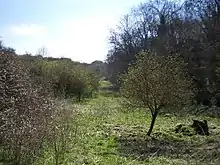
Sharp's Hill Formation
The Sharp's Hill Formation is a Bathonian geologic formation in the United Kingdom, dating to around 167 million years ago. Dinosaur remains diagnostic to the genus level are among the fossils that have been recovered from the formation.[1] It is the lateral equivalent of the Rutland Formation and the Fuller's Earth Formation.[2]
| Sharp's Hill Formation Stratigraphic range: Bathonian | |
|---|---|
 | |
| Type | Geological formation |
| Unit of | Great Oolite Group |
| Underlies | Taynton Limestone Formation |
| Overlies | Chipping Norton Limestone, Horsehay Sand Formation |
| Thickness | up to 5 m |
| Lithology | |
| Primary | Mudstone Marl Limestone |
| Location | |
| Region | England |
| Country | |
| Type section | |
| Named for | Sharp's Hill Quarry |
The type locality is the Sharp's Hill Quarry.[3]
Paleofauna
- Megalosaurus bucklandii[4]
- Cetiosaurus sp. (sauropod indet)
- "Eoplophysis" (Omosaurus) vetustus (stegosaurid indet)
See also
- List of dinosaur-bearing rock formations
Footnotes
- Weishampel, et al. (2004). "Dinosaur distribution." Pp. 517-607.
- British Geological Survey. "Sharp's Hill Formation". BGS Lexicon of Named Rock Units. Retrieved 2 June 2019.
- "Sharp's Hill Quarry citation" (PDF). Sites of Special Scientific Interest. Natural England. Retrieved 3 June 2020.
- Benson, R. B. J. (2010). A description of Megalosaurus bucklandii (Dinosauria: Theropoda) from the Bathonian of the UK and the relationships of Middle Jurassic theropods. Zoological Journal of the Linnean Society 158 (4): 882–935. doi:10.1111/j.1096-3642.2009.00569.x.
References
- Weishampel, David B.; Dodson, Peter; and Osmólska, Halszka (eds.): The Dinosauria, 2nd, Berkeley: University of California Press. 861 pp. ISBN 0-520-24209-2.
This article is issued from Wikipedia. The text is licensed under Creative Commons - Attribution - Sharealike. Additional terms may apply for the media files.