San Policarpo, Eastern Samar
San Policarpo, officially the Municipality of San Policarpo (Waray: Bungto han San Policarpo; Tagalog: Bayan ng San Policarpo), is a 5th class municipality in the province of Eastern Samar, Philippines. According to the 2015 census, it has a population of 14,687 people. [3]
San Policarpo | |
|---|---|
| Municipality of San Policarpo | |
 Map of Eastern Samar with San Policarpo highlighted | |
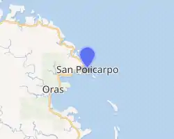
OpenStreetMap 
| |
.svg.png.webp) San Policarpo Location within the Philippines | |
| Coordinates: 12°10′45″N 125°30′26″E | |
| Country | |
| Region | Eastern Visayas (Region VIII) |
| Province | Eastern Samar |
| District | Lone District |
| Barangays | 17 (see Barangays) |
| Government | |
| • Type | Sangguniang Bayan |
| • Mayor | Thelma U. Nicart |
| • Vice Mayor | Paz Nicart |
| • Representative | Maria Fe R. Abunda |
| • Councilors | List
|
| • Electorate | 12,080 voters (2019) |
| Area | |
| • Total | 78 km2 (30 sq mi) |
| Elevation | 6.0 m (19.7 ft) |
| Population | |
| • Total | 14,687 |
| • Density | 190/km2 (490/sq mi) |
| • Households | 3,263 |
| Economy | |
| • Income class | 5th municipal income class |
| • Poverty incidence | 48.57% (2015)[4] |
| • Revenue | ₱54,580,093.77 (2016) |
| Time zone | UTC+8 (PST) |
| ZIP code | 6821 |
| PSGC | |
| IDD : area code | +63 (0)55 |
| Climate type | tropical rainforest climate |
| Native languages | Waray Tagalog |
| Website | www |
In the north-west, it is bounded by Arteche, in the north-east by the vast Pacific Ocean and in the south by Oras.
History
San Policarpo was established as a barrio in 1837. The Municipality of San Policarpo was created from the barrios of San Policarpo, Bahay, Alugan, Pangpang, Japonan, Tabo, Binogawan and Cajagwayan of the municipality of Oras in 1948 under Republic Act No. 281 and inaugurated on February 5, 1949.[5] In 1952, the barrio of Santa Monica was transferred from Oras to San Policarpo.
The town was formerly named "Bunga", derived from the plant called bunga which was very abundant in the present site of the town. "Bunga" means fruit, thus the name indicates the fruit of the toils of its founders.
Demographics
| Year | Pop. | ±% p.a. |
|---|---|---|
| 1948 | 4,779 | — |
| 1960 | 8,051 | +4.44% |
| 1970 | 9,140 | +1.28% |
| 1975 | 9,280 | +0.31% |
| 1980 | 12,258 | +5.72% |
| 1990 | 9,970 | −2.05% |
| 1995 | 11,565 | +2.82% |
| 2000 | 12,403 | +1.51% |
| 2007 | 13,689 | +1.37% |
| 2010 | 13,836 | +0.39% |
| 2015 | 14,687 | +1.14% |
| Source: Philippine Statistics Authority [3] [6] [7][8] | ||
The population of San Policarpo, Eastern Samar, in the 2015 census was 14,687 people, [3] with a density of 190 inhabitants per square kilometre or 490 inhabitants per square mile.
Climate
| Climate data for San Policarpo, Eastern Samar | |||||||||||||
|---|---|---|---|---|---|---|---|---|---|---|---|---|---|
| Month | Jan | Feb | Mar | Apr | May | Jun | Jul | Aug | Sep | Oct | Nov | Dec | Year |
| Average high °C (°F) | 27 (81) |
27 (81) |
28 (82) |
29 (84) |
30 (86) |
30 (86) |
30 (86) |
30 (86) |
29 (84) |
29 (84) |
28 (82) |
27 (81) |
29 (84) |
| Average low °C (°F) | 23 (73) |
22 (72) |
22 (72) |
23 (73) |
24 (75) |
24 (75) |
24 (75) |
24 (75) |
24 (75) |
24 (75) |
24 (75) |
23 (73) |
23 (74) |
| Average precipitation mm (inches) | 105 (4.1) |
67 (2.6) |
65 (2.6) |
53 (2.1) |
86 (3.4) |
129 (5.1) |
135 (5.3) |
113 (4.4) |
131 (5.2) |
163 (6.4) |
167 (6.6) |
162 (6.4) |
1,376 (54.2) |
| Average rainy days | 17.6 | 13.2 | 15.5 | 14.9 | 19.6 | 24.3 | 26.6 | 25.4 | 24.9 | 25.4 | 22.9 | 20.9 | 251.2 |
| Source: Meteoblue [9] | |||||||||||||
Economy
The local economy of San Policarpio, one of the country's poorest towns, is dependent on fishing and farming.[10]
References
- Municipality of San Policarpo | (DILG)
- "Province: Eastern Samar". PSGC Interactive. Quezon City, Philippines: Philippine Statistics Authority. Retrieved 12 November 2016.
- Census of Population (2015). "Region VIII (Eastern Visayas)". Total Population by Province, City, Municipality and Barangay. PSA. Retrieved 20 June 2016.
- "PSA releases the 2015 Municipal and City Level Poverty Estimates". Quezon City, Philippines. Retrieved 12 October 2019.
- "An act creating the municipality of San Policarpo in the province of Samar". LawPH.com. Retrieved 2011-04-08.
- Census of Population and Housing (2010). "Region VIII (Eastern Visayas)". Total Population by Province, City, Municipality and Barangay. NSO. Retrieved 29 June 2016.
- Censuses of Population (1903–2007). "Region VIII (Eastern Visayas)". Table 1. Population Enumerated in Various Censuses by Province/Highly Urbanized City: 1903 to 2007. NSO.
- "Province of Eastern Samar". Municipality Population Data. Local Water Utilities Administration Research Division. Retrieved 17 December 2016.
- "San Policarpo, Eastern Samar: Average Temperatures and Rainfall". Meteoblue. Retrieved 31 December 2018.
- Ricky Bautista (July 28, 2014). "Eastern Samar town has 2 mayors". The Philippine Star. Retrieved 28 July 2016.