Saint-Étienne-du-Vigan
Saint-Étienne-du-Vigan is a commune in the Haute-Loire department in south-central France.
Saint-Étienne-du-Vigan | |
|---|---|
Commune | |
Location of Saint-Étienne-du-Vigan 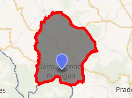
| |
 Saint-Étienne-du-Vigan  Saint-Étienne-du-Vigan | |
| Coordinates: 44°46′51″N 3°50′10″E | |
| Country | France |
| Region | Auvergne-Rhône-Alpes |
| Department | Haute-Loire |
| Arrondissement | Le Puy-en-Velay |
| Canton | Velay volcanique |
| Intercommunality | Pays de Cayres et de Pradelles |
| Government | |
| • Mayor (2014–2020) | Didier Saby |
| Area 1 | 9.43 km2 (3.64 sq mi) |
| Population (2017-01-01)[1] | 100 |
| • Density | 11/km2 (27/sq mi) |
| Time zone | UTC+01:00 (CET) |
| • Summer (DST) | UTC+02:00 (CEST) |
| INSEE/Postal code | 43180 /43420 |
| Elevation | 872–1,164 m (2,861–3,819 ft) (avg. 935 m or 3,068 ft) |
| 1 French Land Register data, which excludes lakes, ponds, glaciers > 1 km2 (0.386 sq mi or 247 acres) and river estuaries. | |
Population
| Year | Pop. | ±% |
|---|---|---|
| 1793 | 200 | — |
| 1806 | 510 | +155.0% |
| 1821 | 420 | −17.6% |
| 1831 | 451 | +7.4% |
| 1841 | 425 | −5.8% |
| 1851 | 436 | +2.6% |
| 1861 | 390 | −10.6% |
| 1872 | 396 | +1.5% |
| 1881 | 469 | +18.4% |
| 1891 | 461 | −1.7% |
| 1901 | 515 | +11.7% |
| 1911 | 506 | −1.7% |
| 1921 | 450 | −11.1% |
| 1931 | 422 | −6.2% |
| 1946 | 333 | −21.1% |
| 1954 | 253 | −24.0% |
| 1962 | 235 | −7.1% |
| 1968 | 228 | −3.0% |
| 1975 | 194 | −14.9% |
| 1982 | 134 | −30.9% |
| 1990 | 110 | −17.9% |
| 1999 | 110 | +0.0% |
| 2009 | 113 | +2.7% |
| 2017 | 100 | −11.5% |
References
- "Populations légales 2017". INSEE. Retrieved 6 January 2020.
| Wikimedia Commons has media related to Saint-Étienne-du-Vigan. |
| Authority control |
|---|
This article is issued from Wikipedia. The text is licensed under Creative Commons - Attribution - Sharealike. Additional terms may apply for the media files.