Rousies
Rousies is a commune in the Nord department in northern France.
Rousies | |
|---|---|
.JPG.webp) A view within Rousies | |
.svg.png.webp) Coat of arms | |
Location of Rousies 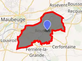
| |
 Rousies  Rousies | |
| Coordinates: 50°16′20″N 4°00′24″E | |
| Country | France |
| Region | Hauts-de-France |
| Department | Nord |
| Arrondissement | Avesnes-sur-Helpe |
| Canton | Fourmies |
| Intercommunality | Communauté d'agglomération Maubeuge Val de Sambre |
| Government | |
| • Mayor (2014-2020) | Josiane Suleck |
| Area 1 | 5.79 km2 (2.24 sq mi) |
| Population (2017-01-01)[1] | 4,016 |
| • Density | 690/km2 (1,800/sq mi) |
| Time zone | UTC+01:00 (CET) |
| • Summer (DST) | UTC+02:00 (CEST) |
| INSEE/Postal code | 59514 /59131 |
| Elevation | 122–167 m (400–548 ft) |
| 1 French Land Register data, which excludes lakes, ponds, glaciers > 1 km2 (0.386 sq mi or 247 acres) and river estuaries. | |
It is located south of Maubeuge.
Heraldry
Arms of Rousies |
The arms of Rousies are blazoned : Quarterly 1&4: Argent, 3 fesses gules; 2&3: Argent, 3 wagoner's axes top 2 addorsed gules. [2](Bermerain, Étrœungt, Féron, Ferrière-la-Grande, Lez-Fontaine, Rousies, Solre-le-Château and Solrinnes use the same arms.) |
See also
References
- "Populations légales 2017". INSEE. Retrieved 6 January 2020.
- Arms of the families of Croÿ-Solre and Croÿ-Renty quartered
External links
| Wikimedia Commons has media related to Rousies. |
- Rousies on the site of the national geographical Institute
- Localization of Rousies on a map of France and communes bordering
| Authority control |
|---|
This article is issued from Wikipedia. The text is licensed under Creative Commons - Attribution - Sharealike. Additional terms may apply for the media files.