Richmond Road (Staten Island)
Richmond Road is a major north-south artery along the East Shore of the New York City borough of Staten Island. It is approximately 4.93 miles (7.93 km) long, and runs through the neighborhoods of Concord, Grymes Hill, Emerson Hill, Grasmere, Old Town, Dongan Hills, Grant City, Todt Hill, New Dorp, Egbertville, Lighthouse Hill, and Richmondtown.
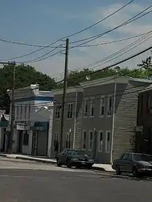
 Richmond Road near Targee Street | |
| Owner | City of New York |
|---|---|
| Maintained by | NYCDOT |
| Length | 4.93 mi[1] (7.93 km) |
| Location | Staten Island, New York |
| Coordinates | 40°35′5.85″N 74°6′23.02″W |
| South end | Arthur Kill Road in Richmondtown |
| Major junctions | |
| North end | Vanderbilt Avenue in Park Hill |
Route description
Parts of Richmond Road along with all of Vanderbilt Avenue and all of Amboy Road form Staten Island's colonial-era eastern corridor that predates the newer, straighter, and wider Hylan Boulevard. The three roads that make up the corridor share a common numbering system, i.e. Richmond Road's numbers start where Vanderbilt Avenue's leave off and Amboy Road's numbers start where Amboy Road forks away from Richmond Road. This numbering system includes the numerically highest of street addresses in New York City.[2]
Other roads that fork off of the Richmond Road corridor are St. Paul's Avenue, Van Duzer Street, Targee Street, Rockland Avenue, Bloomingdale Road, Pleasant Plains Avenue, and Richmond Valley Road.
Transportation
Richmond Road is served by the S74, S84, S76 and S86 local buses, as well as the SIM15 express bus. The S54 and S57 local buses also cover a portion of the route.
History
Richmond Road dates back to the early 1700s, laid out as part of the "Public Common General Road", and was likely a Native American footpath prior to that.[3][4]
Major intersections
The entire route is in the New York City borough of Staten Island.
| Location | mi[1] | km | Destinations | Notes | |
|---|---|---|---|---|---|
| Richmondtown | 0.00 | 0.00 | Arthur Kill Road south / Richmond Hill Road west | ||
| New Dorp | 1.45 | 2.33 | Amboy Road south | ||
| Todt Hill | 3.86 | 6.21 | Targee Street | Southern terminus of one-way segment | |
| Concord–Park Hill line | 4.59 | 7.39 | Exit 13A on I-278; access via Narrows Road | ||
| Park Hill | 4.93 | 7.93 | Van Duzer Street / Vanderbilt Avenue | ||
| 1.000 mi = 1.609 km; 1.000 km = 0.621 mi | |||||
References
- "Richmond County Inventory Listing" (CSV). New York State Department of Transportation. August 7, 2015. Retrieved January 20, 2020.
- "End of the Line". Forgotten New York. Archived from the original on October 17, 2010. Retrieved February 7, 2015.
- (18 October 2008). "Our Staten Island Streets:" Richmond Road, Staten Island Advance (reprint of article which originally appeared in same publication in 1997)
- Morris's Memorial History of Staten Island, New York, Volume 2, p. 448 (1900)