Pejibaye District, Jiménez
Pejibaye is a district of the Jiménez canton, in the Cartago province of Costa Rica.[1][2]
Pejibaye | |
|---|---|
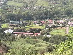
 The town of Pejibaye from the mountains. | |

Pejibaye district | |
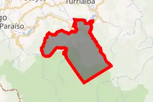
 Pejibaye Pejibaye district location in Costa Rica | |
| Coordinates: 9.773988°N 83.6993734°W | |
| Country | |
| Province | Cartago |
| Canton | Jiménez |
| Creation | 26 May 1967 |
| Area | |
| • Total | 173.85 km2 (67.12 sq mi) |
| Elevation | 643 m (2,110 ft) |
| Population (2011) | |
| • Total | 3,245 |
| • Density | 19/km2 (48/sq mi) |
| Time zone | UTC−06:00 |
| Postal code | 30403 |
Roughly one hour South of Turrialba and two hours East of Cartago, Pejibaye is an emerging ecotourism site in Costa Rica. The Pejibaye town lies in a valley between the La Marta Wildlife Refuge and the Tapantí National Park.[3][4]
History
Pejibaye was created on 26 May 1967 by Ley 3887. Segregated from Tucurrique.[2]
Demographics
| Historical population | |||
|---|---|---|---|
| Census | Pop. | %± | |
| 1973 | 2,820 | — | |
| 1984 | 3,175 | 12.6% | |
| 2000 | 3,375 | 6.3% | |
| 2011 | 3,245 | −3.9% | |
|
Instituto Nacional de Estadística y Censos[6] |
|||
For the 2011 census, Pejibaye had a population of 3,245 inhabitants. [8]
Settlements
Pejibaye, Costa Rica is an ecological community located in the Canton of Jiménez in the Provence of Cartago. Pejibaye is separated into many neighborhoods, including El Humo, Plaza Vieja, San Joaquin, Los Tigres, Oriente, El Oso, La Veinte (20), y Veinte Seis (26). Pejibaye is situated about 65 km from San Jose, 42 miles east of Cartago, 25 km south of Turrialba, 15 km south of Tucurrique, and 10 km west of La Suiza. Buses travel six times a day to and from Cartago and Turrialba. The roads are preserved in their original pristine condition.
Government
The municipal government is seated in Juan Viñas, and oversees Juan Viñas, Tuccurique, and Pejibaye. Recently, a voting referendum to allow Pejibaye to have its own municipal government failed with 1,841 votes against and 1,649 votes in favor (Rodríguez y Brenez, La Nación, 2008).[9]
Transportation
Road transportation
The district is covered by the following road routes:
Economy
Agriculture

Pejibaye was originally designed as one large farm that was later subdivided by owners Don Jesus and Don Ricardo among the 70 families that worked the land. The agricultural history of the town is indicated in the neighborhood names La Veinte (20) and Veintiseis (26). Plaza Vieja is the oldest neighborhood in Pejibaye formed in the 1940s just after the Costa Rican Civil War. Over the last 70 years, the population of Pejibaye worked in the successful production of coffee and sugar cane. In the last 20 years with the decline in price of both sugar and coffee, Pejibaye has moved away from traditional agricultural production towards greater tourism.
Tourism

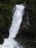
Pejibaye has a growing tourist industry. A small group of bed and breakfasts have sprung up to serve local tourists from neighboring towns who regularly come to Pejibaye for rafting on the Pejibaye river. The river itself has class 2 and 3 rapids, and the town has recently been the site of the Costa Rica National Rafting Competition. Nearby, Pacuare river also has class 4 and 5 rafting for more experienced adventure tourists. The surrounding area is home to six different waterfalls, as well as La Marta Wildlife Refuge and Tapantí National Park, which are home to several Costa Rican species of large cats. Regular hiking, bicycle, and horse back riding tours of the cloud forest can be found in Pejibaye as well.
Education

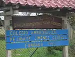
Pejibaye is known for having one of the first Environmental (or Ambiental) High Schools in Costa Rica called Colegio Ambientalista Pejibaye. Newly founded in 1999, this High School has a grand gymnasium, soccer field, air conditioned computer lab, and open air classrooms, with just under 300 students enrolled in grades 7 through 11. Students take classes to learn three languages (English, Spanish, and French) along with the basic core curriculum set forth by the Ministerio de Educación Pública (MEP) of Math, Science, Religion, Social Studies, among others, and a special course in Environmental Studies (also called Ambiental).[10] Nearly 50% of students complete their course work in this High School and go on to study in Universities throughout Costa Rica. In addition to the Environmental High School, there are 3 nearby Grade Schools in El Humo, Plaza Vieja and Pejibaye central with students in grades six and under.
References
- "Declara oficial para efectos administrativos, la aprobación de la División Territorial Administrativa de la República N°41548-MGP". Sistema Costarricense de Información Jurídica (in Spanish). 19 March 2019. Retrieved 26 September 2020.
- División Territorial Administrativa de la República de Costa Rica (PDF) (in Spanish). Editorial Digital de la Imprenta Nacional. 8 March 2017. ISBN 978-9977-58-477-5.
- La Marta Wildlife Refuge Costa Rica
- Tapantí National Park
- "Área en kilómetros cuadrados, según provincia, cantón y distrito administrativo". Instituto Nacional de Estadística y Censos (in Spanish). Retrieved 26 September 2020.
- "Instituto Nacional de Estadística y Censos" (in Spanish).
- "Sistema de Consulta de a Bases de Datos Estadísticas". Centro Centroamericano de Población (in Spanish).
- "Censo. 2011. Población total por zona y sexo, según provincia, cantón y distrito". Instituto Nacional de Estadística y Censos (in Spanish). Retrieved 26 September 2020.
- Ramiro, Rodriguez; Harold Brenes Z (Jan 7, 2008). "Pejibaye pierde lucha por su propio gobierno local". La Nación.
- "Ministerio de Educación Pública (MEP)". Archived from the original on 2014-02-14. Retrieved 2014-02-06.
