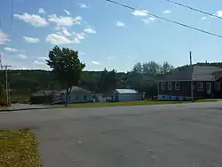
Padoue, Quebec
Padoue | |
|---|---|
 | |
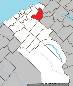
 Location within La Mitis RCM | |
 Padoue Location in eastern Quebec | |
| Coordinates: 48.58°N 67.98°W[1] | |
| Country | |
| Province | |
| Region | Bas-Saint-Laurent |
| RCM | La Mitis |
| Constituted | January 31, 1911 |
| Government | |
| • Mayor | Gilles Laflamme |
| • Federal riding | Haute-Gaspésie—La Mitis—Matane—Matapédia |
| • Prov. riding | Matane-Matapédia |
| Area | |
| • Total | 67.40 km2 (26.02 sq mi) |
| • Land | 67.06 km2 (25.89 sq mi) |
| Population | |
| • Total | 273 |
| • Density | 4.1/km2 (11/sq mi) |
| • Pop 2006-2011 | |
| • Dwellings | 124 |
| Time zone | UTC−5 (EST) |
| • Summer (DST) | UTC−4 (EDT) |
| Postal code(s) | G0J 1X0 |
| Area code(s) | 418 and 581 |
| Highways | No major routes |
| Website | www.municipalite. padoue.qc.ca |
Padoue is a municipality in Quebec, Canada.
Demographics
In the 2011 Census, Statistics Canada originally reported that Padoue had a population of 411 living in 178 of its 183 total dwellings, a 45.2% change from its 2006 population of 283.[5] Statistics Canada subsequently amended the 2011 census results to a population of 273 living in 120 of its 124 total dwellings, a -3.5% change from 2006.[4] With a land area of 67.06 km2 (25.89 sq mi), it had a population density of 4.071/km2 (10.544/sq mi) in 2011.[4][5]
See also
References
- Reference number 135528 of the Commission de toponymie du Québec (in French)
- Geographic code 09040 in the official Répertoire des municipalités (in French)
- "(Code 2409040) Census Profile". 2011 census. Statistics Canada. 2012.
- "Corrections and updates". Statistics Canada. 2012-09-19. Retrieved 2012-10-13.
- "Population and dwelling counts, for Canada, provinces and territories, and census subdivisions (municipalities), 2011 and 2006 censuses (Quebec)". Statistics Canada. 2012-02-08. Retrieved 2012-10-13.
This article is issued from Wikipedia. The text is licensed under Creative Commons - Attribution - Sharealike. Additional terms may apply for the media files.