Pašman
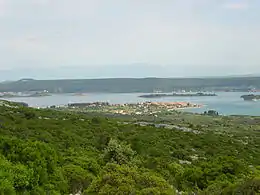
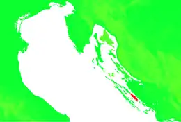
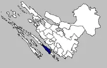
Pašman (pronounced [pǎʃman]) is an island off the coast of the Adriatic Sea in Croatia with an area of 60.11 km2,[2] located to the south of Zadar, surrounded by the islands Ugljan, Iž, Dugi otok and Kornati. The island is inhabited by 2,845 people (2011).
 | |
 | |
| Geography | |
|---|---|
| Location | Adriatic Sea |
| Coordinates | 43°57′N 15°23′E |
| Area | 60.11 km2 (23.21 sq mi) |
| Highest elevation | 272 m (892 ft) |
| Highest point | Bokolj |
| Administration | |
Croatia | |
| County | Zadar |
| Largest settlement | Pašman |
| Demographics | |
| Population | 2,845 (2011)[1] |
| Pop. density | 33.34/km2 (86.35/sq mi) |
There are 11 villages on Pašman, from SE to NW: Tkon, Ugrinić, Kraj, Pašman, Mali Pašman, Barotul, Mrljane, Neviđane, Dobropoljana, Banj, Ždrelac.


Among all islands in Croatian archipelago it is Pašman that has the biggest green surface considering its total area. And it is the 12th island in Croatian archipelago in land area. It is also known to have the cleanest water in the Adriatic due to the current constantly changing.
Summits

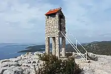
The majority of Pašman's summits offers great panoramas, especially towards the south, on Kornati islands. Along the island's main ridge a mountain road goes, by which we can reach just below or on the peaks also by bike.
- Veliki Bokolj, 274 m,
- Oštro, 254 m,
- Semica, 199 m,
- Straža, 180 m,
- Jakovljev vrh, 178 m,
- Mali Bokolj, 164 m,
- Cudonjin, 146 m,
- Martinjak, 139 m,
- Pustograd, 108 m,
References
- Ostroški, Ljiljana, ed. (December 2015). Statistički ljetopis Republike Hrvatske 2015 [Statistical Yearbook of the Republic of Croatia 2015] (PDF). Statistical Yearbook of the Republic of Croatia (in Croatian and English). 47. Zagreb: Croatian Bureau of Statistics. p. 47. ISSN 1333-3305. Retrieved 27 December 2015.
- Duplančić Leder, Tea; Ujević, Tin; Čala, Mendi (June 2004). "Coastline lengths and areas of islands in the Croatian part of the Adriatic Sea determined from the topographic maps at the scale of 1 : 25 000" (PDF). Geoadria. Zadar. 9 (1): 5–32. doi:10.15291/geoadria.127. Retrieved 2019-12-26.
Further reading
- Pašman at enciklopedija.hr (in Croatian)
- Magaš, Damir (June 1984). "Geografski položaj i osnovna prirodno-geografska obilježja otoka Pašmana" [The geographical situation and physical characteristics of the island Pašman] (PDF). Hrvatski geografski glasnik (in Croatian). 46 (1): 53–71. Retrieved 13 April 2017.
External links
| Wikimedia Commons has media related to Pašman. |
| Wikivoyage has a travel guide for Pašman. |
- Tourist board of the municipality of Pašman (in Croatian, English, German, Italian, and French)
