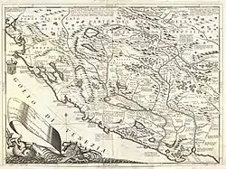
Old Montenegro
Old Montenegro (Serbian: Стара Црна Гора),[1][2][3] also known as Montenegro proper (Serbian: Права Црна Гора),[4][5] or True Montenegro (Serbian: Истинска Црна Гора),[6][7] is a term used for the embryonic part of modern Montenegro. In historical context, the term designates the original territory of the Principality of Montenegro, before the territorial expansion, ratified by the Congress of Berlin in 1878, or even more precisely - the territory of the Prince-Bishopric of Montenegro prior to its unification with the region of Brda in the first half of the 19th century.[8][4]

.png.webp)


During the Ottoman period, from the 16th up to the 18th century, the original (proper) Montenegro was made up of the Montenegrin tribes (Serbian: црногорска племена), traditionally divided into four territorial units, or nahije: Katun, Rijeka, Lješanska nahija and Crmnica. Their inhabitants were known under the regional demonym Montenegrins (Serbian: Црногорци), as opposed to the inhabitants of neighboring regions (Brđani, Hercegovci and Primorci). Since the end of the 18th century, Montenegro started to expand, incorporating the region of Brda in the first half of the 19th century, the region of Old Herzegovina and part of Primorje in 1878, and finally upper and central Polimlje and northern Metohija in 1912.[9]
Tribes
Tribes, divided by nahija. historically, there are four nahijas in the Old Montenegro region, further divided by local tribes (clans);
See also
References
- Ердељановић 1926.
- Радусиновић 1985a.
- Радусиновић 1985b.
- Banac 1992, p. 271.
- Fleming 2002, p. 56.
- Brown 1954, p. 101.
- Bećković 2005, p. 53.
- Denton 1877, p. 52.
- Ćirković 2004.
Sources
- Banac, Ivo (1992) [1984]. The National Question in Yugoslavia: Origins, History, Politics (2. printing of the 2. ed.). Ithaca, N.Y: Cornell University Press.
- Bataković, Dušan T., ed. (2005). Histoire du peuple serbe [History of the Serbian People] (in French). Lausanne: L’Age d’Homme.
- Bećković, Matija (2005). A Stone Between Two Worlds. Toronto: Serbian Literary Company.
- Brown, Alec (1954). Yugoslav Life and Landscape. London: Elek Books.
- Ćirković, Sima (2004). The Serbs. Malden: Blackwell Publishing.
- Denton, William (1877). Montenegro, its people and their history. London: Daldy, Isbister & Company.
- Ердељановић, Јован (1926). Стара Црна Гора: Етничка прошлост и формирање црногорских племена. Српски етнографски зборник. 39. Београд: Српска краљевска академија.
- Fine, John Van Antwerp Jr. (1994) [1987]. The Late Medieval Balkans: A Critical Survey from the Late Twelfth Century to the Ottoman Conquest. Ann Arbor, Michigan: University of Michigan Press.
- Fleming, Thomas (2002). Montenegro: The Divided Land. Rockford, Illinois: Chronicles Press.
- Jelavich, Barbara (1983a). History of the Balkans: Eighteenth and Nineteenth Centuries. 1. Cambridge University Press.
- Jelavich, Barbara (1983b). History of the Balkans: Twentieth Century. 2. Cambridge University Press.
- Радусиновић, Павле С. (1985a). Насеља Старе Црне Горе: Општи дио. 1. Београд: Српска академија наука и уметности.
- Радусиновић, Павле С. (1985b). Насеља Старе Црне Горе: Посебни дио. 2. Београд: Српска академија наука и уметности.
- Stefanović-Karadžić, Vuk (1837). Montenegro und die Montenegriner: Ein Beitrag zur Kenntniss der europäischen Türkei und des serbischen Volkes. Stuttgart und Tübingen: Verlag der J. G. Cotta'schen Buchhandlung.
- L'examen des dialectes du Vieux Monténegro (Stara Crna Gora) en tenant compte des parles voisins, Bulletin international de l' Académie polonaise des sciences et des letters N 1—3 (janvier-mars), 1—13, Cracovie 1932.